
Erode District is one of the 38 districts in the state of Tamil Nadu in India. It was the largest district by area in the state before the formation of Tirupur District in 2009. The headquarters of the district is Erode. It is divided into two revenue divisions, Erode and Gobichettipalayam, and is further subdivided into 10 taluks. Erode District was a part of Coimbatore District before its division into two on 17 September 1979. It covers an area of 5,722 square kilometres (2,209 sq mi), and as of 2011, had a population of 2,251,744.

Omalur is a panchayat town and headquarters of Omalur taluk in the Salem District in the Indian state of Tamil Nadu. It is situated on the National Highway 7 between 11° 73333" latitude and 78° 06667" longitude. It has a population of about 13,600. Agriculture, leather and handloom textiles are the major businesses.
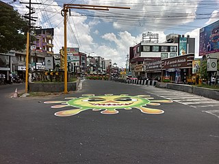
Sathyamangalam is a town and municipality in Erode district in the Indian state of Tamil Nadu. 8 th century Town. It lies on the banks of the River Bhavani, a tributary of the River Cauvery in the foothills of the Western Ghats. It is about 65 km from Erode, 58 km from Tiruppur and 70 km from Coimbatore. As of 2011, the town had a population of 37,816.

Erode is a city in the Indian state of Tamil Nadu. Erode is the seventh largest urban agglomeration in the state, after Chennai, Coimbatore, Madurai, Tiruchirapalli, Tiruppur and Salem. It is also the administrative headquarters of the Erode district. Administered by a city municipal corporation since 2008, Erode is a part of Erode Lok Sabha constituency that elects its member of parliament. Located on the banks of River Kaveri, it is situated centrally on South Indian Peninsula, about 400 kilometres (249 mi) southwest of its state capital Chennai, 250 kilometres (155 mi) south of Bengaluru, 100 kilometres (62 mi) east of Coimbatore and 275 kilometres (171 mi) east of Kochi. Erode is an agricultural, textile and a BPO hub and among the largest producers of turmeric, hand-loom and knitwear, and food products.

Mettur is an industrial and tourist town located in the Salem district in the state of Tamil Nadu, India. It is best known for the Mettur Dam which is the largest dam in south India.

Bhavani is an Indian river which flows through Indian states of Kerala and Tamil Nadu, India. It originates from the Western Ghats of Kerala and is one among the three rivers of Kerala which flows in eastward direction.

Bhavani is a Municipality in Erode District, Tamil Nadu, India. It is located at the northern periphery of Erode City Municipal Corporation and is around 105 km (65 mi) from Coimbatore and 60 km (37 mi) from Tiruppur and Salem. Bhavani is also known as "Carpet City" as it is known for its carpet industry; blankets and carpets manufactured in the town are known as Bhavani Jamakkalam. As of 2011, the town covers an area of 2.17 square kilometres (0.84 sq mi) and has a population of 39,225. It is a grade II municipality.

Dharmapuri is a special grade town in the north western part of Tamil Nadu, India. It serves as the administrative headquarters of Dharmapuri district which is the first district created in Tamil Nadu after the independence of India by splitting it from then Salem district on 2 October 1965. The city is located at 50 km from Krishnagiri, 69 km from Salem, 90 km from Hosur, 117 km from Thiruvannamalai, 126 km from Bangalore and Erode, 181 km from Tiruppur, 200 km from Coimbatore and Tiruchirappalli, 300 km from Madurai and the state capital Chennai. It is located between latitudes N 11 47’ and 12 33’ and longitudes E 77 02’ and 78 40’. It is one of the leading major cultivator and producer of mango in the state along with Krishnagiri often referred as Mango Capital of India.

Coimbatore district is one of the 38 districts in the state of Tamil Nadu in India. Coimbatore is the administrative headquarters of the district. It is one of the most industrialized districts and a major textile, industrial, commercial, educational, information technology, healthcare and manufacturing hub of Tamil Nadu. The region is bounded by Tiruppur district in the east, Nilgiris district in the north, Erode district in the north-east, Palakkad district, Idukki district and small parts of Thrissur district and Ernakulam district of neighboring state of Kerala in the west and south respectively. As of 2011, Coimbatore district had a population of 3,458,045 with a sex-ratio of 1,000 and literacy rate of 84%.

Salem District is one of the 38 districts of Tamil Nadu state in southern India. The district is now divided into Dharmapuri, Krishnagiri, Namakkal as individual districts. Salem is the district headquarters and other major towns in the district include Mettur, Thammampatti, Attur, Omalur, Sangagiri and Edappadi. That Salem dates to at least two thousand years ago is evident from the discovery of silver coins from the Roman Emperor Nero Claudius Caesar Augustus Germanicus found by Koneripatti of Salem in 1987. It was ruled by Mazhavar King Kolli Mazhavan and kings Adhiyaman and Valvil Ori of Sangam age. It is part of Mazhanadu, a vast region that dates to the second century BCE. Salem was the largest district of Tamil Nadu. It was bifurcated into Salem and Dharmapuri districts in 1965 and Namakkal district in 1997. Now Salem has been developed a lot by building many bridges and is considered to be the smart city. Salem is famous for cultivating mangoes.
Rasipuram is a town in the Indian state of Tamil Nadu. It is the headquarters for the Rasipuram taluk. As of 2015, the town had a population of 88,584 and an area of 24 km2 (9.3 sq mi). It has 27 wards and steps have been taken to increase the wards to 33. Rasipuram is known for ghee and tapioca sago.
Paramathi Velur, a town in Paramathi-Velur taluk, Namakkal District, Tamil Nadu, India is situated just off the Srinagar - Kanyakumari National Highway 44 (India). This town is also called as Paramathi Velur, with STD Code 04268 & Postal code 638182.

Vijayamangalam is a census town in Erode district in the Indian state of Tamil Nadu. It is located on National Highway 47 (NH-47) between Perundurai and Perumanallur.

Tamil Nadu is the second largest state economy in India. It is also the most industrialised state in the country. More than 60% of the state is urbanized, accounting over 10.6% of the urban population in the country which is 6% of India's total population. Services contributes to 55% of the economic activity in the state, followed by manufacturing at 34% and agriculture at 11%. Government is the major investor in the state, with 52% of total investments, followed by private Indian investors at 29.9% and foreign private investors at 14.9%. It has been ranked as the most economically free state in India by the Economic Freedom Rankings for the States of India.
Goundampalayam is a village under the panchayat town Chennimalai in Erode district in the state of Tamil Nadu, India.
Kavundampalayam is a village in the Erode district of Tamil Nadu, South India. The village belongs to Chennimalai panchayat town.
Komarapalayam is a textile town situated on the bank of the Cauvery river, Bhavani River of South India, and is a taluk of Namakkal District, Tamil Nadu, India. Komarapalayam is also called as Kumarapalayam. Komarapalayam and Bhavani are twin cities separated by the Cauvery river. However, Bhavani belongs to Erode district. Komarapalayam is famous for its textile industries; also Kumarapalayam is famous for traditional leather chappals. As of 2011, the town had a population of 71,594. Some of the native people call it as Guberapuri due to high industrial production.
Erode city being the headquarters of Erode district, in Tamil Nadu, India, has an extensive road and rail transport network in all radial directions, as it lies landlocked.
The Mettur Thermal Power Station is a coal-fired electric power station located in [Thoppur-Mettur Dam-Bhavani-Erode Rd, Mettur, Tamil Nadu 636406] Salem district of Tamil Nadu. It is operated by Tamil Nadu Generation and Distribution Corporation Limited. The power station was commissioned during various periods from 1987 and this is the first inland thermal Power Station of TANGEDCO.The coal from Mahanadi Coalfields Limited and Eastern Coalfields Limited are transported to the load ports of Paradip (Orissa), Vizag and Haldia. Thereafter the coal is transported to the discharge ports of Ennore and Tuticorin by ships. From Ennore Port the coal is transported again through rail to Ennore Thermal Power Station and Mettur Thermal Power Station.
Tiruppur or Tirupur is a city in the Indian state of Tamil Nadu. Tiruppur is the administrative headquarters of Tiruppur district and the fifth largest city as well as an urban agglomeration in Tamil Nadu. Located on the banks of Noyyal River, it has been ruled at different times, by the Early Pandyas, Medieval Cholas, Later Cholas, Mysore Kingdom and the British. It is about 450 kilometres (280 mi) southwest of the state capital Chennai about 50 kilometres (31 mi) east of Coimbatore 50 kilometres (31 mi) south of Erode and 50 kilometres (31 mi) north of Dharapuram.


