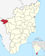
Mulligoor is a village in the Kundah taluk of Nilgiris District of Tamil Nadu State, India. It is situated 10 kilometers away from sub-district headquarters Kundah and 30 kilometers from district headquarters Ooty. The main cultivation in Mulligoor is tea growing. This area surrounding Mulligoor is also very rich in wildlife.
The nearest railway station to Mulligoor is Lovedale which is located in and around 14.8km distance.
Balacola ( 10km ), Melur ( 10km ), Nanjanad ( 11km ), Kuruthukuli ( 14km ), Lovedale ( 17km ) are the nearby major villages to Mulligoor.Mulligoor is surrounded by Udhagamandalam Taluk towards North, Coonoor Taluk towards East, Attappadi Taluk towards South, Gudalur Taluk towards North.
Languages
Badaga is the main language for in this village, which is spoken by about 135,000 Badagas in around 200 villages in the Nilgiris.
Religion
Badagas worship several Hindu deities, including Shiva. But their main deity is "Hethai" and they celebrate "Hethai Habba" in a grand fashion which spreads over a month during December–January every year, and the festival is celebrated all over the district. Lakshabba is the major festival of Mulligoor people.
Demographics
The total geographical area of village is 17005.08 hectares.
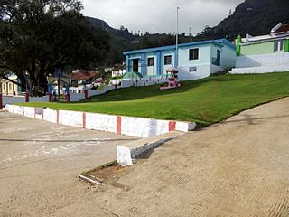
Facilities
A Government Elementary school, Post Office, Gym & Sports Ground is present within the village itself.
Accessibility
Mulligoor is accessible only by road. It has very good and dedicated bus connectivity from Ooty, Coonoor, Mettupalayam and also Coimbatore. There are two routes to Ooty. One route is via M.Palada - Ithalar - Emerald. The other route is via Manjoor - Manihatty. The Coonoor route is via Selas - Adhikaratty Junction. The Mettuplayam Bus also passes through the Coonoor route. The Coimbatore Bus uses the Karamadai - Mulli - Manjoor route. This route is the fastest way to reach Coimbatore from Mulligoor.
Neelakurinji (Kurinji)
Strobilanthes kunthiana, kurinji or neelakurinji, blooms in the forests of Mulligoor. Nilgiri Hills, which literally means the blue mountains, got their name from the purplish blue flowers of Neelakurinji that blossoms only once in 12 years.
Ooty, abbreviated as Udagai) is a town and municipality in the Nilgiris district of the Indian state of Tamil Nadu. It is located 86 km (53 mi) northwest of Coimbatore, and is the headquarters of Nilgiris district. Situated in the Nilgiri hills, it is known by the epithet "Queen of Hill Stations", and is a popular tourist destination.
The Nilgiris district is one of the 38 districts in the southern Indian state of Tamil Nadu. Nilgiri is the name given to a range of mountains spread across the borders among the states of Tamil Nadu, Karnataka and Kerala. The Nilgiri Hills are part of a larger mountain chain known as the Western Ghats. Their highest point is the mountain of Doddabetta, height 2,637 m. The district is contained mainly within the Nilgiri Mountains range. The administrative headquarters is located at Ooty. The district is bounded by Coimbatore to the south, Erode to the east, and Chamarajnagar district of Karnataka and Wayanad district of Kerala to the north. As it is located at the junction of three states, namely, Tamil Nadu, Kerala, and Karnataka, significant Malayali and Kannadiga populations reside in the district. Nilgiris district is known for natural mines of Gold, which is also seen in the other parts of Nilgiri Biosphere Reserve extended in the neighbouring states of Karnataka and Kerala too.
Coonoor, is a taluk and a town of the Nilgiris district in the Indian state of Tamil Nadu. As of 2011, the town had a population of 45,494.
Nilambur is a major town, a municipality and a Taluk in the Malappuram district of the Indian state of Kerala. It is located close to the Nilgiris range of the Western Ghats on the banks of the Chaliyar River. This place is also known as 'Teak Town' because of the abundance of Nilambur teaks, which is a variety of a large, deciduous tree that occurs in mixed hardwood forests. Unlike many Municipalities of India; Nilambur is covered with large amounts of vegetation, making it very scenic.
The Nilgiri Mountain Railway (NMR) is a 1,000 mmmetre gauge railway in Nilgiris district, Tamil Nadu, India, built by the British in 1908. The railway is operated by the Southern Railway and is the only rack railway in India.
Wellington is a town in the Nilgiris District of the Indian state of Tamil Nadu, located at three kilometres to the north of Coonoor on the NH-181. The town includes a Wellington Bazaar, and the Wellington Cantonment. The Wellington Cantonment is home to The Madras Regimental Centre (MRC) and The Defence Services Staff College (DSSC). The Nilgiri passenger train passes through Wellington, which also has a railway station.
Mettupalayam is a municipality town and Taluk headquarters of Mettupalayam Taluk in the Coimbatore district of the Indian state of Tamil Nadu. It is the second largest town in the Coimbatore district after Pollachi. It is located to the north of Coimbatore city on the way to Ooty, in the foothills of Nilgiri hills. As of 2011, the town had a population of 69,213. Mettupalayam railway station is the starting point of Nilgiri Mountain Railway and it operates the only rack railway in India connecting Ooty and Mettupalayam.
O' Valley or Ouchterlony Valley is a Town Panchayat in the Gudalur Taluk of The Nilgiris district in the Indian state of Tamil Nadu. The name is a contraction of an older name after a James Ouchterlony, who established coffee plantations in the area. This panchayat area is located between Mudumalai National Park and New Amarambalam Reserved Forest and has several valleys, streams and water falls.
Ketti also called Ketti Valley is a small town nestled in a large valley of the same name. It is located in The Nilgiris District of Tamil Nadu State, South India and is a Revenue Village of Coonoor Taluk. Upper Ketti is another village called Yellanahalli, which is located on the main Coonoor to Ooty road.
Manihatty, also known as B.Manihatty, is a village in the Nilgiris District of Tamil Nadu, India. Manihatty is 16 km to the south west of Ooty, the district capital of the Nilgiris. The residents of the village are predominantly part of the Badaga people, an ethnolinguistic community in the Nilgiris district.
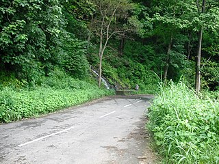
Many Ghat Roads can be found in the Nilgiris District of Tamil Nadu, Southern India. Nearly all of the district is located in the Nilgiri Hills, part of the Western Ghats mountains. This area borders the states of Karnataka and Kerala. The hills consequently can be reached by road from three states. Most of these Ghat Roads go through heavily forested mountains and contain a number of sharp hair-pin bends.
Vandicholai is a Panchayat village in Coonoor Taluk of The Nilgiris District, Tamil Nadu, India. The settlement takes its name from a nearby Shola. The Chinna Vandicholai is a settlement adjoining Wellington Cantonment. The village gets its name from the conjunction of two Badaga words [bandu+so:le; 'moth+woods'].
Yedapalli is a Panchayat village in Coonoor Taluk of The Nilgiris District, Tamil Nadu, India.
Lovedale is a village situated in the Nilgiri Hills in the state of Tamil Nadu in India. It is one of the highest places above mean sea level in the Nilgiris. Today, it is notable for tourism.
The Nilgiri Express is a night express train service operating between Chennai Central and Mettupalayam, Coimbatore in Tamil Nadu, India. It is operated by Indian Railways.
Kundah taluk is a taluk of Nilgiris district of the Indian state of Tamil Nadu. The headquarters of the taluk is the town of Kundah and consists of seven revenue villages. Being Balacola, Kil Kundah, Mulligoor, Bikkatty, Kinnakorai, Ithalar and Mel Kundah.
St. Joseph's Higher Secondary School is a boys' school located in the scenic hill station town Ooty, which is part of The Nilgiris district in Tamil Nadu, India. The school was started by Christian missionaries in 1820.
Achanakal is a Badaga village in the Nilgiris district in the Indian state of Tamil Nadu. The village is located adjacent to the Coonoor-Ooty highway in the Ketti valley. The name is believed to be derived from asinikol meaning bamboo sticks in Badaga language which formed the place before the village came into existence. Ketti valley is also considered the second steepest valley in the world. Achanakal is the largest village among the other 13 villages which are located in the valley. The village is just 3 Kilometres away from Ketti and the Lovedale railway stations.
Halatty Manthalatty is a village in the Indian state of Tamil Nadu, under the Nilgiris District. Halatty Manthalatty is also the name given to a range of mountains spread across the states of Tamil Nadu as well as Karnataka and Kerala. It is one of the small villages in Udhagamandalam Taluk in The Nilgiris District under Kadanad Panchayat. Around 100 families and Around 400 people are living in this village.
Mysore-Ooty Road or Mysore-Udhagamandalam Road is a tourist trail of South India starting from Mysore in Karnataka state and ending in Udhagamandalam in Nilgiri district of Tamil Nadu state, India. Both routes pass through Bandipur National park in Gundlupet, Karnataka and Mudumalai National Park in Tamil Nadu.
This page is based on this Wikipedia article Text is available under the CC BY-SA 4.0 license; additional terms may apply. Images, videos and audio are available under their respective licenses.