Ooty, abbreviated as Udhagai) is a town and municipality in the Nilgiris district of the Indian state of Tamil Nadu. It is located 86 km (53 mi) northwest of Coimbatore, and is the headquarters of Nilgiris district. Situated in the Nilgiri hills, it is known by the epithet "Queen of Hill Stations", and is a popular tourist destination.

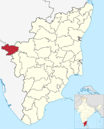
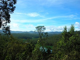
The Nilgiris district is one of the 38 districts in the southern Indian state of Tamil Nadu. Nilgiri is the name given to a range of mountains spread across the borders among the states of Tamil Nadu, Karnataka and Kerala. The Nilgiri Hills are part of a larger mountain chain known as the Western Ghats. Their highest point is the mountain of Doddabetta, height 2,637 m. The district is contained mainly within the Nilgiri Mountains range. The administrative headquarters is located at Ooty. The district is bounded by Coimbatore to the south, Erode to the east, and Chamarajnagar district of Karnataka and Wayanad district of Kerala to the north. As it is located at the junction of three states, namely, Tamil Nadu, Kerala, and Karnataka, significant Malayali and Kannadiga populations reside in the district. Nilgiris district is known for natural mines of Gold, which is also seen in the other parts of Nilgiri Biosphere Reserve extended in the neighbouring states of Karnataka and Kerala too.

Coonoor, is a taluk and a town of the Nilgiris district in the Indian state of Tamil Nadu. As of 2011, the town had a population of 45,494.
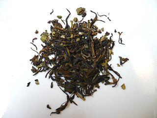
Nilgiri tea is a drink made by infusing leaves of Camellia sinensis that is grown and processed in the Nilgiris district in Tamil Nadu, India. The leaves are processed as black tea, though some estates have expanded their product offerings to include leaves suitable for making green, white and oolong teas. It is generally described as being a brisk, fragrant and full-bodied tea. The region produces both rolled and crush, tear, curl tea and it is predominantly used for blending. Nilgiri tea is also used for making iced tea and instant tea.

Chaliyar River is the fourth longest river in Kerala at 169 km in length. The Chaliyar is also known as Chulika River, Nilambur River or Beypore River as it is near the sea. Pothukal, Chungathara, Nilambur, Mampad, Edavanna, Kavanoor, Perakamanna, Areekode, Kizhuparamba, Elamaram, Cheekkode, Vazhakkad, Vazhayur, Cheruvadi, Edavannappara, Mavoor, Peruvayal, Feroke and Beypore are some of the towns/villages situated along the banks of the Chaliyar. It mainly flows through Malappuram district. Its tributaries flow through both the districts of Malappuram and Kozhikode. The bank of river Chaliyar in the Nilambur region is also known for its natural Gold fields. Explorations done at the valley of the river Chaliyar in Nilambur have shown reserves of the order of 2.5 million cubic meters of placers with 0.1 gram per cubic meter of gold. It originates at the Ilambaleri hills of Nilgiri Mountains in Nilgiris district, which is also near Wayanad-Malappuram district border. It flows mainly through the erstwhile region of Eranad, and finally empties into the Arabian Sea at Beypore port, opposite to Chaliyam harbour.
Thekkady is a town near Periyar National Park, an important tourist attraction in the Kerala state of India. The name Thekkady is derived from the word "thekku" which means teak. Temperatures are lowest in the months of December–January and highest in the months of April–May.

The Anamala or Anaimalai, also known as the Elephant Mountains, are a range of mountains in the southern Western Ghats of central Kerala and span the border of western Tamil Nadu in Southern India. The name anamala is derived from the Malayalam word aana and the Tamil word yaanai, meaning elephant, or from tribal languages. Mala or Malai means 'mountain', and thus literally translatable as 'Elephant mountain'.

Aruvankadu is a big village located in The Nilgiris District, Tamil Nadu, India. It is located between Coonoor and Ooty on the NH 67, 6 km from Coonoor town and 12 km from Ooty. It is connected by frequent bus services from various towns and cities. Aruvankadu is also connected via the Nigiri Mountain Railway (NMR).
Athigaratty is a hamlet located in the Nilgiri Hills in the state of Tamil Nadu. One of the largest villages in the Nilgirs South India with over 800 households.
Nelliyalam is a panchayat town in The Nilgiris district in the Indian state of Tamil Nadu. As of 2011, the town had a population of 44,590.
Nilagiri is a town and a Notified Area Council in Balasore district in the Indian state of Odisha.
O' Valley or Ouchterlony Valley is a Town Panchayat in the Gudalur Taluk of The Nilgiris district in the Indian state of Tamil Nadu. The name is a contraction of an older name after a James Ouchterlony, who established coffee plantations in the area. This panchayat area is located between Mudumalai National Park and New Amarambalam Reserved Forest and has several valleys, streams and water falls.

Ketti also called Ketti Valley is a small town nestled in a large valley of the same name. It is located in The Nilgiris District of Tamil Nadu State, South India and is a Revenue Village of Coonoor Taluk. Upper Ketti is another village called Yellanahalli, which is located on the main Coonoor to Ooty road.
Manihatty, also known as B.Manihatty, is a village in the Nilgiris District of Tamil Nadu, India. Manihatty is 16 km to the south west of Ooty, the district capital of the Nilgiris. The residents of the village are predominantly part of the Badaga people, an ethnolinguistic community in the Nilgiris district.
The Nilgiri Mountains form a part of the Western Ghats in northwestern Tamil Nadu, southern Karnataka and eastern Kerala in South India. They are located at the trijunction of the three states and connect the Western Ghats to the Eastern Ghats. At least 24 of the Nilgiri Mountains' peaks are above 2,000 m (6,600 ft), with the highest peak being Doddabetta at 2,637 m (8,652 ft).
Vandicholai is a Panchayat village in Coonoor Taluk of The Nilgiris District, Tamil Nadu, India. The settlement takes its name from a nearby Shola. The Chinna Vandicholai is a settlement adjoining Wellington Cantonment. The village gets its name from the conjunction of two Badaga words [bandu+so:le; 'moth+woods'].

Yedapalli is a Panchayat village in Coonoor Taluk of The Nilgiris District, Tamil Nadu, India.

Kalakkad Mundanthurai Tiger Reserve (KMTR) located in the South Western Ghats montane rain forests in Tirunelveli district and Kanyakumari district in the South Indian state of Tamil Nadu, is the second-largest protected area in Tamil Nadu. It is part of the Agasthyamala Biosphere Reserve.
Chembakolli is a village in the south of India, in the Nilgiris district, Tamil Nadu. It is located in the Nilgiri Hills. Chembakolli's closest town is Gudalur and its closest city is Mysore and Coimbatore to south of Nilgiris district.

Mango Orange, officially spelt ‘mangorange’, is a small village in the Nilgiris district of Tamil Nadu, India. The village is dominated by tea estates. Most of the population is employed in the tea estates and there are a few schools, churches and mosques dotted around the undulating terrain.