Ooty, officially known as Udhagamandalam ; abbreviated as Udhagai), is a town and a municipality in the Nilgiris district of the Indian state of Tamil Nadu. It is located 86 km (53 mi) north west of Coimbatore and is the headquarters of the Nilgiris district. Located in the Nilgiri Hills, it is known as the "Queen of Hill Stations" and is a popular tourist destination.

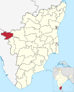
The Nilgiris district is one of the 38 districts in the southern Indian state of Tamil Nadu. Nilgiri is the name given to a range of mountains spread across the borders among the states of Tamil Nadu, Karnataka and Kerala. The Nilgiri Hills are part of a larger mountain chain known as the Western Ghats. Their highest point is the mountain of Doddabetta, height 2,637 m. The district is contained mainly within the Nilgiri Mountains range. The administrative headquarters is located at Ooty. The district is bounded by Coimbatore to the south, Erode to the east, and Chamarajnagar district of Karnataka and Wayanad district of Kerala to the north. As it is located at the junction of three states, namely, Tamil Nadu, Kerala, and Karnataka, significant Malayali and Kannadiga populations reside in the district. Nilgiris district is known for natural mines of Gold, which is also seen in the other parts of Nilgiri Biosphere Reserve extended in the neighbouring states of Karnataka and Kerala too.

Hebron School is a co-educational independent boarding school in the hill station known as Ooty, in Tamil Nadu, southern India. The school is operated by a Protestant Christian trust with the aim of providing education to the children of Christian workers and other families living in India, and other parts of Asia.

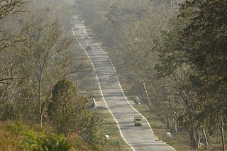
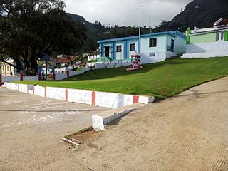
Aruvankadu is a big village located in The Nilgiris District, Tamil Nadu, India. It is located between Coonoor and Ooty on the NH 67, 6 km from Coonoor town and 12 km from Ooty. It is connected by frequent bus services from various towns and cities. Aruvankadu is also connected via the Nigiri Mountain Railway (NMR).
Gundlupet is a municipal town situated in the Chamarajanagar district of Karnataka, India. It is also known as "The flower pot of India". It is situated on NH 766, 60 km away from Mysuru and approximately 200 km from the state administrative capital, Bengaluru. Gundlupet is the last town in Karnataka on the National Highway 766 which goes through Mysore, Ooty, Wayanad, and Kozhikode. It is situated very close to the Tamil Nadu and Kerala state borders. NH 181 begins from Gundlupet and ends in Nagapattinam in Tamil Nadu via Ooty and Coimbatore.
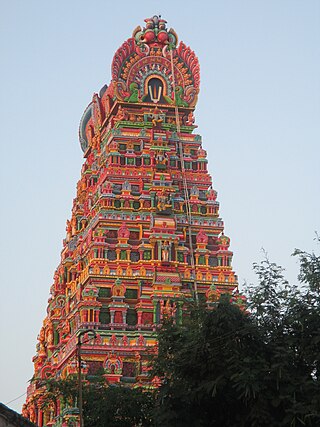
Karamadai is a town located near Mettupalayam, in the Indian state of Tamil Nadu. It is located on Coimbatore - Ooty NH 67. Nearby places are Teachers colony, Press Colony, Jodhipuram and Periyanaickenpalayam. The Ranganathaswamy temple and Nanjundeswarar temple are the most prominent landmarks in the town. The place of Karamadai came into limelight due to the presence of ex-steel giant Sri Ramakrishna Steel Industries.
Mettupalayam is a municipality town and taluk headquarters of Mettupalayam Taluk in the Coimbatore district of the Indian state of Tamil Nadu, a suburb of Coimbatore. It is the third largest town in the Coimbatore district after Coimbatore and Pollachi. It's located to the North of the Coimbatore city on the way to Ooty in the foothills of Nilgiri hills. As of 2011, the town had a population of 66,595. Mettupalayam railway station is the starting point of Nilgiri Mountain Railway and it operates the only rack railway in India connecting Ooty and Mettupalayam.

Holy Trinity Church is located in Ooty (Ootacamund), in the state of Tamil Nadu. It is one of the oldest landmarks in Ooty. The building was initially used by Indian Christians as a place of worship on Sundays and used as a school during weekdays. It became a dedicated church from 1858.

Pykara is a river 19 kilometres (12 mi) from Ooty in the Indian State of Tamil Nadu with a village by the same name nearby. The Pykara River is considered very sacred by the Todas. It rises at Mukurthi peak, flows northwards, and then turns to the west after reaching the edge of the plateau. The river flows through Mukurthi, Pykara and Glenmorgan dams, and forms part of an important hydro-electric power project.

The Kamaraj Sagar Dam is in the Nilgiris district of Tamil Nadu state in India. It is located at a distance of 10 km from the Ooty bus stand. It is a picnic spot and a film shooting spot on the slopes of the Wenlock Downs. The dam's storage capacity is 26.6 million cubic meters(MCM) or 0.94 tmc ft.
Gudalur division is a revenue division in the Nilgiris district of Tamil Nadu, India. It is one of the three revenue divisions of Nilgiris District, and includes two talukas, Gudalur and Pandhalur. According to the 2011 census Gudalur Revenue division had an estimated population of 2,32,213.
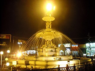
Adam's fountain is a public display fountain in Charring cross, Ooty. It was built in 1886 as a memorial to a Governor of Ooty, who was very famous in the region during his tenure. The total cost of finishing the fountain was between Rs. 13,000 to Rs. 14000, which was funded through public funding.

Kalhatti Falls also called as Bird Watcher's Falls is a tourist spot near Ooty, The Nilgiris, Tamil Nadu. These falls are about 13 km from Ooty, on the Ooty to Mysore Road or Sigur Ghat Road, It is situated at an average height of around 400 feet in the Sigur Plateau.This Place is rich in wild life like Bison, Bear, Deer, and also various type of birds. From the Kalhatti village one has to continue for 2 miles to reach the falls and the falls is connected in the same Kalhatti village road.

Western Catchment is an area of The Nilgiris, Tamil Nadu, situated about 20 km from Ooty. The Western Catchment area is protected by the Forest Department, and tourists are not allowed in without permission. Earlier some regional movies were filmed here, but due to environmental protection permission is no longer given.

Jegathala is a village in Nilgiris, located at an altitude of 1,850 m (6,070 ft) above sea level. It is 5 km from Coonoor and 13 km from Ooty.

The Mayar River is one of the tributaries of the Bhavani in Tamil Nadu, South India. The Mayar river originates from a small town called Mayar off the Masinagudi–Ooty road. This is a natural line of separation between the state of Karnataka and Tamil Nadu and a separation between the forest of Bandipur National Park and the Mudumalai sanctuary to the south. The Mayar River Gorge is 20 kilometres (12 mi) long and is also called the Mayar Canyon. The river flows into the gorge below Theppakadu in a roaring waterfall called Mayar Falls. This river is checked by Bhavanisagar Dam on the plains near Satyamangalam, along with the Bhavani River.

Meppadi is a village in the Indian state of Kerala. It is an extremely scenic hill station on the State Highway between Kozhikode and Ooty. The nearest city is Kalpetta, which is the headquarters of the Wayanad revenue district.
Achanakal is a Badaga village in the Nilgiris district in the Indian state of Tamil Nadu. The village is located adjacent to the Coonoor-Ooty highway in the Ketti valley. The name is believed to be derived from asinikol meaning bamboo sticks in Badaga language which formed the place before the village came into existence. Ketti valley is also considered the second steepest valley in the world. Achanakal is the largest village among the other 13 villages which are located in the valley. The village is just 3 Kilometres away from Ketti and the Lovedale railway stations.
Halatty Manthalatty is a village in the Indian state of Tamil Nadu, under the Nilgiris District. Halatty Manthalatty is also the name given to a range of mountains spread across the states of Tamil Nadu as well as Karnataka and Kerala. It is one of the small villages in Udhagamandalam Taluk in The Nilgiris District under Kadanad Panchayat. Around 100 families and Around 400 people are living in this village.
Mulligoor is a village in the Kundah taluk of Nilgiris District of Tamil Nadu State, India. It is situated 10 kilometers away from sub-district headquarters Kundah and 30 kilometers from district headquarters Ooty. The main cultivation in Mulligoor is tea growing. This area surrounding Mulligoor is also very rich in wildlife.