Harur | |
|---|---|
Municipality | |
| Nickname: Ariyur, | |
 Harur Location in Tamil Nadu, India | |
| Coordinates: 12°03′13″N78°28′53″E / 12.0536°N 78.4814°E | |
| Country | |
| State | Tamil Nadu |
| Region | Kongu Nadu |
| District | Dharmapuri |
| • Rank | municipality |
| Elevation | 350 m (1,150 ft) |
| Population (2025) | |
• Total | 37,203 |
| Languages | |
| • Official | Tamil |
| Time zone | UTC+5:30 (IST) |
| PIN | 636903 |
| Telephone code | 04346 |
| Vehicle registration | TN 29Z |
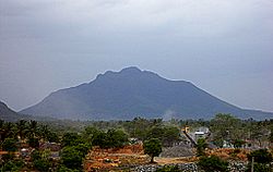
Harur is a municipality and Taluk in the Dharmapuri district of Tamil Nadu, India. It is one of two revenue blocks in the district.