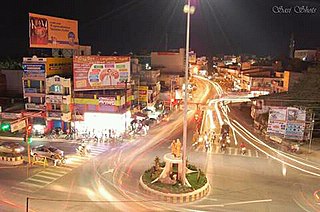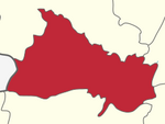
Chamarajanagar is the southernmost district in the state of Karnataka, India. It was carved out of the original larger Mysore District in the year 1998. Chamarajanagar town is the headquarters of this district.

Dharmapuri, is a City in the western part of Tamil Nadu, India. The town is located at 50 km from Krishnagiri, 64 km from Salem, 126 km from Bangalore, 200 km from Coimbatore, and 300 km from the state capital Chennai. It is located between latitudes N 11 47’ and 12 33’ and longitudes E 77 02’ and 78 40’. It is one of top leading Mango cultivator and producer of state.

Madurai district is one of the 38 districts of the state of Tamil Nadu in southeastern India. The city of Madurai serves as the district headquarters. It houses the famous Sri Meenakshi Sundareshwarar temple and is situated on the banks of the river Vaigai and the oldest Islamic mosque in Madurai, The Kazimar Big Mosque, situated on the banks of Kiruthumal river. Thiruparankundram is one of the major tourist place in the district. As of 2011, the district had a population of 3,038,252 with a sex-ratio of 990 females for every 1,000 males. Aside from the city of Madurai, the larger towns are Melur, vadipatti, Peraiyur, and Usilampatti. It is an important hub for various film shootings. Alanganallur is an important town in Madurai.

Dharmapuri is one of the 38 districts of Tamil Nadu, in India. It is the first district created in Tamil Nadu after the independence of India by splitting it from then-Salem district on 2 October 1965. The other major towns in the district are Harur, Palacode, Karimangalam, Nallampalli, Pennagaram and Pappireddipatti. Dharmapuri District is one of the major producers of mango in the state, fine quality granite is found in the district. It is also one of the main sericulture belts in the state. Around 30 percent of the district's area is under forest cover. Kaveri enters Tamil Nadu through this district.

Harur is a Town Panchayat in the Dharmapuri district of Tamil Nadu, India. It is one of two revenue blocks in the district.

Kadathur is a panchayat town in Dharmapuri district in the Indian state of Tamil Nadu. Kadathur is situated 20 kilometres (12 mi) southeast of Dharmapuri. It is in the southern region of the district.

Kambainallur is a panchayat town in karimangalam taluk of Dharmapuri district in the Indian state of Tamil Nadu. It also serves as a main source of transport, food, health and education for many villages situated around the Kambainallur.

Karimangalam is a town and taluk headquarters in Dharmapuri district in the Kongunadu region of Tamil Nadu. It is located at 20km from Dharmapuri and 70km from Salem.

Papparapatti is a panchayat town in Dharmapuri district in the Indian state of Tamil Nadu. The original name of this town was Pallur Pettai, later it was officially renamed as Papparapatti by the local government. The name Papparapatti was derived from Parpanar petai, which means the place where Brahmin community people lives.

Periyar University is a university in Salem, Tamil Nadu, India. It was established by the Government of Tamil Nadu in 1997. It is named after social reformer Thanthai Periyar E. V. Ramasamy. The University Grants Commissions, New Delhi bestowed 2f status in 1998 and 12(B) status in 2005 to the university. It is accredited by NAAC with 'A' grade. It has been awarded a cumulative grade point average (CGPA) of 3.15 points.

Dharmapuri is a Lok Sabha constituency in Tamil Nadu, India.
Harur is the state legislative assembly constituency in Dharmapuri district, Tamil Nadu, India, which includes the city of Harur. The seat is reserved for candidates from the Scheduled Castes. It is part of the Dharmapuri constituency for national elections to the Parliament of India.
Harur taluk is a taluk in the Dharmapuri district of the Indian state of Tamil Nadu. The headquarters of the taluk is the town of Harur.
Harur block is a revenue block in the Dharmapuri district of Tamil Nadu, India. It has a total of 34 panchayat villages.

Aandiyur Uthangarai is a village in Uthangarai taluk, Krishnagiri district, Tamil Nadu, India.
Chellampatti may refer to several places in the state of Tamil Nadu, India:

Soriyampatti is a village in Harur Taluk, in Dharmapuri District, in the Tamil Nadu State of India.
Karimangalam taluk is a taluk in the Dharmapuri district of the Indian state of Tamil Nadu. On 10 February 2016, Karimangalam taluk was formed by merging parts of Palacode and Harur taluks of Dharmapuri district. The headquarters of the taluk is the town of Kariamangalam. This taluk contains a total of 52 panchayat villages.
Kammalampatty village is located in Harur Taluk of Dharmapuri district in Tamil Nadu, India. It is situated 5 km away from sub-district headquarter Harur and 46 km away from district headquarter Dharmapuri. As per 2009 stats, Ellapudayampatty is the gram panchayat of Kammalampatty village.

Tirupathur is a town and also the headquarter of Tirupattur district, India, one of the oldest places in Tamil Nadu. It is known for its reservoir of fine sandal wood in the trailing mountains around it. It is located about 89 km from Vellore, 85 km from Hosur and Thiruvannamalai, 210 km from Chennai, and 125 km from Bangalore.


