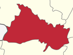
Pappireddipatti

Last updated

Pappireddipatti
India Tamil Nadu location map.svg
Red pog.svg
Pappireddipatti
Location in Tamil Nadu, India
India location map 3.png
Red pog.svg
Pappireddipatti
Pappireddipatti (India)
Coordinates: 11°54′43″N78°21′58″E / 11.911933°N 78.366004°E / 11.911933; 78.366004
CountryFlag of India.svg  India
State Tamil Nadu
District Dharmapuri
Government
  TypeMLA Constituency
  BodyMLA
Population
 (2011)
  Total19,369
Languages
  Official Tamil
Time zone UTC+5:30 (IST)
PIN
636905
Telephone code+91-4346
Vehicle registration TN-29
Climate Warm and Dry (Köppen)
Avg. summer temperature38 °C (100 °F)
Avg. winter temperature17 °C (63 °F)
Website https://www.townpanchayat.in/pappireddipatti

Pappireddipatti is a Town Panchayat of Dharmapuri district in the Indian state of Tamil Nadu and also a revenue Taluk of Dharmapuri district.

Contents

Pappireddipatti is the business center for villages surrounding it and for the people living in villages of Shevaroy Hills.

Geography

It is almost surrounded by hills in all directions; mainly Kalrayan Hills in the East and Shevaroy Hills in the west.

Vaniyar Dam, one of the big dams in Dharmapuri district is located at 5 km from Pappireddipatti, built in the foothills of Shevaroy Hills across the Vaniyar river a major tributary of Ponnaiyar River. The Dam has a capacity to hold 418 mcft water with a depth of 65 ft [1] and connected to the lakes of Venkatasamuthram, Aalapuram, Onthiampatti, Thenkaraikottai and Parayapatti via channels. There is small park and officer's quarters available near the dam. The dam is scenic and people can reach Yercaud by a long walk through the Shrevarayan forest.

The dam receives water from its catchment area in Shevaroy Hills. Water will be flowing to the dam only during Monsoon season and remains dry if monsoon fails. During 29 November 2010, water level of the dam reached 64.29 ft against its full depth of 65 feet. [2]

Climate

Pappireddipatti has a Warm and Dry climate (Köppen), with monsoonal influences typical of India. The town's yearly rainfall average stands at 857 millimetres (33.7 in). [3] A maximum rainfall of 1,640.9 millimetres (64.60 in) was recorded in the rainfall station situated at Chitteri during 1991. Pappireddipatti area is drained by Vaniyar river system by its tributaries like Kallar, Veppadi aaru and Krukkampatti aaru.

Geology

Pappireddipatti area is covered by hard Crystalline rock. Ground water level ranges from 4.41 metres (14.5 ft) to 19.07 metres (62.6 ft) during winter and 2.94 metres (9.6 ft) to 9.47 metres (31.1 ft) during summer. Hydrological soil group 'D' with slow rate of infiltration covers more than half of this area. [3]

Quartz is available at Peddampatti Village of Pappireddipatti. [4]

Demographics

As of 2011 census of India, [5] Pappireddipatti had a population of 9,369. Males and females constitute roughly 50:50 of the population. Pappireddipatti has a literacy rate of 73%, on par with the national average but lesser than the state literacy rate of 80.1%. [6] Male literacy is 79%, and female literacy is 67%. In Pappireddipatti, 8% of the population is under 6 years of age.

Festival

While Kaanum Pongal, the fourth day of Pongal festival, people visit Vaniyar Dam to spend their time with family, relatives and friends.

Transport

Pappireddipatti is well connected by roads to the nearby city Salem and district headquarters Dharmapuri. The nearest railway station is at Bommidi, 16.4 km from Pappireddipatti. The nearest airport is at Salem, 42 km.

Industries

Related Research Articles

<span class="mw-page-title-main">Yercaud</span> Hill Station in Tamil Nadu, India

Yercaud, also spelt Erkad, is a Hill station in Salem District, in Tamil Nadu, India.

<span class="mw-page-title-main">Mettur</span> Town in Tamil Nadu, India

Mettur is an industrial and tourist town located in the Salem district in the state of Tamil Nadu, India. It is best known for the Mettur Dam which is the largest dam in south India.

<span class="mw-page-title-main">Dharmapuri</span> City in Tamil Nadu, India

Dharmapuri is a city in the north western part of Tamil Nadu, India. It serves as the administrative headquarters of Dharmapuri district which is the first district created in Tamil Nadu after the independence of India by splitting it from then Salem district on 2 October 1965. The city is located 50 km from Krishnagiri, 69 km from Salem, 90 km from Hosur, 117 km from Thiruvannamalai, 126 km from Bangalore and Erode, 181 km from Tiruppur, 200 km from Coimbatore and Tiruchirappalli, 300 km from Madurai and the state capital Chennai. It is located between latitudes N 11 47’ and 12 33’ and longitudes E 77 02’ and 78 40’. It is one of the major leading cultivators and producers of mangoes in the state along with Krishnagiri, and is often referred as Mango Capital of India.

<span class="mw-page-title-main">Dharmapuri district</span> Place in India

Dharmapuri is one of the 38 districts in the state of Tamil-Nadu, India. It is the first district created in Tamil Nadu after the independence of India by splitting it from then-Salem district on 2 October 1965. Dharmapuri District is one of the major producers of mango in the state, fine quality granite is found in the district. It is also one of the main sericulture belts in the state. Around 30 percent of the district's area is under forest cover. Kaveri enters Tamil Nadu through this district. Dharmapuri district had the lowest literacy rate of 74.23% in Tamilnadu during the 2011 census.

Harur is a third grade municipality in the Dharmapuri district of Tamil Nadu, India. It is one of two revenue blocks in the district.

Hosanagara is a panchayat town in Shimoga district in the Indian state of Karnataka. It is nested in western ghats of India. The World Cattle Conference with main emphasis on cow was held in month of April 2007 in Hosanagar. The different uses of cow were exhibited. Near Hosanagar there is a mutt named Sri Ramachandrapura Math, 6 km from the town.

Hukkeri is a Town Municipal Council and taluka in Belgavi district in the Indian state of Karnataka.

Kadathur is a panchayat town in Dharmapuri district in the Indian state of Tamil Nadu. Kadathur is situated 20 kilometres (12 mi) southeast of Dharmapuri. It is in the southern region of the district.

Kurpania is a census town in the Bermo CD block in the Bermo subdivision of the Bokaro district in the Indian state of Jharkhand.

<span class="mw-page-title-main">Srinivaspur</span> Place in Karnataka, India

Srinivaspur is a town located in the Kolar district of Karnataka state, India. The latitude 13.33 and longitude 78.22 are the geocoordinate of the Srinivaspur. Bengaluru is the nearby state capital for Srinivaspur town. It is located around 106 km away from Bengaluru and 80 km from BIAL. The other surrounding state capitals are Chennai 225.9 km., Pondicherry 233.2 km., Hyderabad 453.4 km.,

Thammampatti is a Town Panchayat in the Gangavalli taluk of Salem District of Tamil Nadu, India. The town is located between Pachamalai and the Kolli Hills on the banks of the River Swetha bordering Tiruchirappalli district, and is known mainly for its fine wood carvings.

<span class="mw-page-title-main">Krishnagiri</span> City in Tamil Nadu, India

Krishnagiri is a city in the state of Tamil Nadu, India, and it serves as the administrative headquarters of Krishnagiri District formed in 2004. It is located at the bottom of Krishnadevaraya Hills, and the town is fully surrounded by hill rocks. It is located 250 km from Chennai, 45 km from Dharmapuri, and 90 km from Bengaluru. Krishnagiri is known as "Mango Capital of India" as mangoes are cultivated as the main crop, and the land here is extremely fertile with rich access to fresh water making it amenable to growing crops. Krishnagiri is the site of significant business and residential development. The Krishnagiri Dam was built in 1967.

Jena is a census town in the Jaridih CD block in the Bermo subdivision of the Bokaro district in the Indian state of Jharkhand.

<span class="mw-page-title-main">Mayurakshi River</span> Major river in Jharkhand and West Bengal, India

The Mayurakshi is a major river in Jharkhand and West Bengal, India, with a long history of devastating floods.

Gomia is a census town in the Gomia CD block in the Bermo subdivision of the Bokaro district in the Indian state of Jharkhand. The modern name is a transformation of Gumia over the years. Though, today, it is still listed as Gumia by the South Eastern Railway (India).

Bommidi is a panchayat town which is located in Pappireddipatti taluka of Dharmapuri district in Tamil Nadu, India. It is also known as B. Mallapuram. Bommidi's name is used for the railway station, the police station situated at Nadur, the post office, and bus transportation, while the name "B. Mallapuram" is used for schools, hospitals, and government officials.

<span class="mw-page-title-main">Vellar River (Northern Tamil Nadu)</span> River in Tamil Nadu, India

The Vellar River is a river in the Indian state of Tamil Nadu. It originates in the Kalrayan Hills, and flows generally eastward through Salem, Perambalur, and Cuddalore districts, before flowing into the Bay of Bengal near Parangipettai. The river has a total length of 150 kilometres (93 mi), and its drainage basin covers an area of 7,504.346 square kilometres (2,897.444 sq mi) in Cuddalore, Perambalur, Salem, Kallakurichi, Ariyalur, Namakkal, Tiruchirappalli, and Dharmapuri districts.

<span class="mw-page-title-main">Kallakurichi district</span> District of Tamil Nadu in India

Kallakurichi is one of the 38 districts in the state of Tamil Nadu in India. The district headquarter is Kallakurichi. Kallakurichi District was announced on 8 January 2019 and it came into existence on 26 November 2019.

<span class="mw-page-title-main">Tirupattur</span> Town in Tamil Nadu, India

Tirupathur or Tirupattur is the headquarters of Tirupathur district in the state of Tamil Nadu in India and is one of the oldest inhabited places in the state, with a history of over 1,600 years. The town is known for an abundance of sandalwood in the surrounding hills. It is located about 89 km (55 mi) from Vellore, 85 km (53 mi) from Hosur, 60 km (37 mi) from Dharmapuri, 50 km (31 mi) from Krishnagiri, 50 km (31 mi) from Thiruvannamalai, 210 km (130 mi) from Chennai, and 125 km (78 mi) from Bangalore.

Kethureddipatti is a Village Panchayat in Dharmapuri district of Tamil Nadu, India. It is located at 30 km (19 mi) from Dharmapuri town. It comes under Pappireddipatti taluk and Kadathur Block. It belongs to Pappireddipatti State Legislative Assembly Constituency and Dharmapuri Loksabha Constituency. It consists of nine panchayat wards. As per the 2011 Census, the total population of this village is 4,808.

References

  1. "Water released from Vaniyar Dam". The Hindu . Chennai, India. 31 March 2009. Archived from the original on 15 March 2013.
  2. "Vaniyar Dam full to the brim". The Hindu . Chennai, India. 30 November 2010. Archived from the original on 3 December 2010.
  3. 1 2 "Planning Commission Study Report" (PDF).
  4. "Minerals of Dharmapuri District". www.dharmapuri.tn.nic.in.
  5. "Census of India 2011".
  6. "Census of India 2011: Highlights - Literates and Literacy Rate" (PDF).