Kambainallur | |
---|---|
Panchayat Town | |
Coordinates: 12°12′25″N78°19′08″E / 12.207°N 78.319°E | |
Country | ![]() |
State | Tamil Nadu |
Region | Kongu Nadu |
District | Dharmapuri |
Taluk | Karimangalam |
Area | |
• Total | 7.2 km2 (2.8 sq mi) |
Elevation | 412 m (1,352 ft) |
Population (2011) | |
• Total | 12,194 |
• Density | 1,700/km2 (4,400/sq mi) |
Languages | |
• Official | Tamil |
Time zone | UTC+5:30 (IST) |
Vehicle registration | TN 29Z(Harur) |
Kambainallur is a panchayat town in karimangalam taluk of Dharmapuri district in the Indian state of Tamil Nadu.
As of 2011 [update] Indian census figures, [1] Kambainallur had a population of 12,194. Males constitute 52% of the population and females 48%. Kambainallur has an average literacy rate of 70.69%, lower than the national average of 80.09%: male literacy is 78.28%, and female literacy is 62.77%. In Kambainallur, 13% of the population is under 6 years of age.[ citation needed ]l
Azizpur is a census town in Agra district in the state of Uttar Pradesh, India.
Dhampur is a city and a municipal board in Bijnor district in the state of Uttar Pradesh, India. It is located at 29.51°N 78.50°E, and lies in Northern India.
Dhanuha is a census town in Jaunpur district in the state of Uttar Pradesh, India.
Dhanauli is a census town in Agra district in the Indian state of Uttar Pradesh, India.
Injambakkam is a locality in the south of Chennai in the Indian state of Tamil Nadu. Being a part of the Walajabad block of the district, its panchayat is part of Walajabad panchayat union. Injambakkam is located along the ECR.
Kanjikuzhi is a census town in Kottayam district in the Indian state of Kerala. It is a suburb of Kottayam City. It lies on the Kottayam - Kumily state highway.
Khetia is a town and a nagar panchayat in the Barwani district in the Indian central western state of Madhya Pradesh. The town shares its border with the state of Maharashtra and connectivity for the state of Gujarat.
Kiraoli is a town and a nagar panchayat in Agra district in the Indian state of Uttar Pradesh.
Kumbhkot is a census town in Kota district in the Indian state of Rajasthan.
Lal Gopalganj Nindaura is a town and a nagar panchayat in Prayagraj district in Indian state of Uttar Pradesh.
Nainana Jat is a census town in Agra district in the Indian state of Uttar Pradesh.
Nallur (Nalloor) is a panchayat town in Kanniyakumari district in the Indian state of Tamil Nadu.
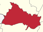
Narath is a census town in Kannur district in the Indian state of Kerala.
Pinahat is a town and a nagar panchayat in Agra district in the Indian state of Uttar Pradesh and situated on the Bank of Chambal River. It is about 55 km from Agra. The distance between Pinahat and Chambal is only 2 km.
Sarai Mir is a town and a nagar panchayat in Azamgarh district in the Indian state of Uttar Pradesh.
Shahganj is a town and a municipal board in Jaunpur district in the Indian state of Uttar Pradesh.
Shamsabad is a city and a municipal Corporation in Agra district in the Indian state of Uttar Pradesh.
Thevaram is a town in Theni district in the Indian state of Tamil Nadu. Thevaram is located in Tamil Nadu near the border of Kerala at the Eastern side foot-hill of the Western Ghats. It is connected with State Highway SH100.
Jafarabad is a town and nagar panchayat in Jaunpur district in the Indian state of Uttar Pradesh.
Shahpur is a town and a notified area in Bhojpur district in the Indian state of Bihar.