Dharmapuri is a city in the north western part of Tamil Nadu, India. It serves as the administrative headquarters of Dharmapuri district which is the first district created in Tamil Nadu after the independence of India by splitting it from then Salem district on 2 October 1965. The city is located at 50 km from Krishnagiri, 69 km from Salem, 90 km from Hosur, 117 km from Thiruvannamalai, 126 km from Bangalore and Erode, 181 km from Tiruppur, 200 km from Coimbatore and Tiruchirappalli, 300 km from Madurai and the state capital Chennai. It is located between latitudes N 11 47’ and 12 33’ and longitudes E 77 02’ and 78 40’. It is one of the leading major cultivator and producer of mango in the state along with Krishnagiri often referred as Mango Capital of India.

Dharmapuri is one of the 38 districts in the state of Tamil Nadu in India. It is the first district created in Tamil Nadu after the independence of India by splitting it from then-Salem district on 2 October 1965. Dharmapuri District is one of the major producers of mango in the state, fine quality granite is found in the district. It is also one of the main sericulture belts in the state. Around 30 percent of the district's area is under forest cover. Kaveri enters Tamil Nadu through this district. Dharmapuri district had the lowest literacy rate of 74.23% in Tamilnadu during the 2011 census.
Chengam or Chengamma as on British records, is an important market town and a taluk headquarter in the Foot hills of Eastern ghats in Tiruvannamalai district of Tamil Nadu, India. Chengam is the gateway to the Chengam pass in the Eastern ghats between Javvadhu hills to the north and Chennakesava hills to the south. The town is also the center for various industrial activities which includes Sathanur dam hydro-electric project, Aavin milk processing plant and Periya Kolappadi SIDCO estate.
Harur is a third grade municipality in the Dharmapuri district of Tamil Nadu, India. It is one of two revenue blocks in the district.
Kadathur is a panchayat town in Dharmapuri district in the Indian state of Tamil Nadu. Kadathur is situated 20 kilometres (12 mi) southeast of Dharmapuri. It is in the southern region of the district.
Kambainallur is a panchayat town in karimangalam taluk of Dharmapuri district in the Indian state of Tamil Nadu. It also serves as a main source of transport, food, health and education for many villages situated around the Kambainallur.
Karimangalam is a town and taluk headquarters in Dharmapuri district in the Kongunadu region of Tamil Nadu. It is located at 20 km from Dharmapuri and 70 km from Salem.
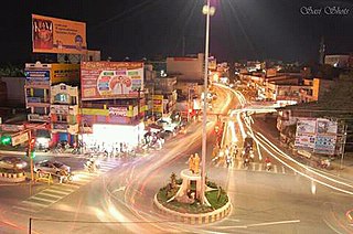
Kaveripattinam is a town in Krishnagiri district in the northern part of Tamil Nadu.It is a revenue block in the Krishnagiri district of Tamil Nadu, India. It has a total of 36 panchayat villages.
Koothappar is a panchayat town in Tiruchirappalli district in the Indian state of Tamil Nadu. It is located 16 km from Tiruchirappalli.
Mulanur is a panchayat town under in Dharapuram taluk in Tirupur District in the Indian state of Tamil Nadu.
Palacode is a panchayat town in Dharmapuri district in the Indian state of Tamil Nadu.
Papparapatti is a panchayat town in Dharmapuri district in the Indian state of Tamil Nadu. The original name of this town was Pallur Pettai, later it was officially renamed as Papparapatti by the local government. The name Papparapatti was derived from Parpanar petai, which means the place where Brahmin community people lives.
Pappireddipatti is a Town Panchayat of Dharmapuri district in the Indian state of Tamil Nadu and also a revenue Taluk of Dharmapuri district.
Pennagaram is a town in Dharmapuri district in the Indian state of Tamil Nadu. It is the headquarters of Pennagaram taluk (sub-district).
Sundarapandiapuram is a panchayat town in Tenkasi district, in the Indian state of Tamil Nadu. It is known for its ancient temples and scenic beauty. It is a popular setting for many Tamil films and regional sitcoms.
Thazhakudy is a panchayat town in Kanniyakumari district in the Indian state of Tamil Nadu. This village is situated between 2 rivers "Puthanaar" and "Palaiyaar". There are also few temples in and around Thazhakudy. Avvaiyar Amman temple is one among them which is 2 km towards East from Thazhakudy.
Kombai is a panchayat town in Theni District in the Indian state of Tamil Nadu, located in the beautiful foot hills of Western Ghats, blessed by mother nature with all pancha boota - Land, Water, Fire, Air and Ether. The town is known for its splendid nature, culture, diversity and ethnicity, history, landmarks and flourishing transformation.

Thiruppuvanam is a town in Manamadurai Constituency and also Manamadurai division in the Indian state of Tamil Nadu.

Sendamangalam also known as Senthamangalam is a town panchayat in the Indian state of Tamil Nadu is situated in Namakkal District.
Palacode taluk is a taluk in the Dharmapuri district of the Indian state of Tamil Nadu. The headquarters of the taluk is the town of Palacode. Part of Cauvery North Wildlife Sanctuary is located in this taluk.

