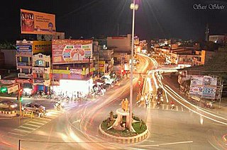
Dharmapuri, is a City in the western part of Tamil Nadu, India. The town is located at 50 km from Krishnagiri, 64 km from Salem, 126 km from Bangalore, 200 km from Coimbatore, and 300 km from the state capital Chennai. It is located between latitudes N 11 47’ and 12 33’ and longitudes E 77 02’ and 78 40’. It is one of top leading Mango cultivator and producer of state.

Dharmapuri is one of the 38 districts of Tamil Nadu, in India. It is the first district created in Tamil Nadu after the independence of India by splitting it from then-Salem district on 2 October 1965. The other major towns in the district are Harur, Palacode, Karimangalam, Nallampalli, Pennagaram and Pappireddipatti. Dharmapuri District is one of the major producers of mango in the state, fine quality granite is found in the district. It is also one of the main sericulture belts in the state. Around 30 percent of the district's area is under forest cover. Kaveri enters Tamil Nadu through this district.

Harur is a Town Panchayat in the Dharmapuri district of Tamil Nadu, India. It is one of two revenue blocks in the district.
Kadathur is a panchayat town in Dharmapuri district in the Indian state of Tamil Nadu. Kadathur is situated 20 kilometres (12 mi) southeast of Dharmapuri. It is in the southern region of the district.
Kambainallur is a panchayat town in karimangalam taluk of Dharmapuri district in the Indian state of Tamil Nadu. It also serves as a main source of transport, food, health and education for many villages situated around the Kambainallur.
Singarapettai is a town in uthangarai taluk in Krishnagiri district

Dharmapuri is a Lok Sabha constituency in Tamil Nadu, India.
Harur is the state legislative assembly constituency in Dharmapuri district, Tamil Nadu, India, which includes the city of Harur. The seat is reserved for candidates from the Scheduled Castes. It is part of the Dharmapuri constituency for national elections to the Parliament of India.
nick name :Cleanest city of indiaMorappur is a Railway junction in Dharmapuri district in Tamil Nadu. It comes under Harur taluk in Dharmapuri district.
Pennagaram is a state assembly constituency in Dharmapuri district in Tamil Nadu, India. It comprises Pennagaram taluk and a portion of Palacode taluk. It is a part of Dharmapuri constituency for national elections to the Parliament of India.
Dharmapuri taluk is a taluk in the Dharmapuri district of the Indian state of Tamil Nadu. The headquarters of the taluk is the town of Dharmapuri.
Palacode taluk is a taluk in the Dharmapuri district of the Indian state of Tamil Nadu. The headquarters of the taluk is the town of Palacode. Part of Cauvery North Wildlife Sanctuary is located in this taluk.
Harur taluk is a taluk in the Dharmapuri district of the Indian state of Tamil Nadu. The headquarters of the taluk is the town of Harur.
Harur block is a revenue block in the Dharmapuri district of Tamil Nadu, India. It has a total of 34 panchayat villages.
Chellampatti is a village of Harur taluk, Dharmapuri district, Tamil Nadu, India.
Chellampatti may refer to several places in the state of Tamil Nadu, India:
Karimangalam taluk is a taluk in the Dharmapuri district of the Indian state of Tamil Nadu. On 10 February 2016, Karimangalam taluk was formed by merging parts of Palacode and Harur taluks of Dharmapuri district. The headquarters of the taluk is the town of Kariamangalam. This taluk contains a total of 52 panchayat villages.
Nallampalli taluk is a taluk in the Dharmapuri district of the Indian state of Tamil Nadu. On 11 February 2016, Nallampalli taluk was formed from parts of Dharmapuri taluk. The headquarters of the taluk is the town of Nallampalli. This taluk contains a total of 31 panchayat villages.
Kammalampatty village is located in Harur Taluk of Dharmapuri district in Tamil Nadu, India. It is situated 5 km away from sub-district headquarter Harur and 46 km away from district headquarter Dharmapuri. As per 2009 stats, Ellapudayampatty is the gram panchayat of Kammalampatty village.


