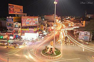
Dharmapuri is a city in the north western part of Tamil Nadu, India. It serves as the administrative headquarters of Dharmapuri district which is the first district created in Tamil Nadu after the independence of India by splitting it from then Salem district on 2 October 1965. The city is located at 50 km from Krishnagiri, 69 km from Salem, 90 km from Hosur, 117 km from Thiruvannamalai, 126 km from Bangalore and Erode, 181 km from Tiruppur, 200 km from Coimbatore and Tiruchirappalli, 300 km from Madurai and the state capital Chennai. It is located between latitudes N 11 47’ and 12 33’ and longitudes E 77 02’ and 78 40’. It is one of the leading major cultivator and producer of mango in the state along with Krishnagiri often referred as Mango Capital of India.

Dharmapuri is one of the 38 districts in the state of Tamil Nadu in India. It is the first district created in Tamil Nadu after the independence of India by splitting it from then-Salem district on 2 October 1965. Dharmapuri District is one of the major producers of mango in the state, fine quality granite is found in the district. It is also one of the main sericulture belts in the state. Around 30 percent of the district's area is under forest cover. Kaveri enters Tamil Nadu through this district. Dharmapuri district had the lowest literacy rate of 74.23% in Tamilnadu during the 2011 census.
Dharmapuri is a village and the mandal headquarters of Dharmapuri mandal in Jagtial district of Telangana, India.
Kadathur is a panchayat town in Dharmapuri district in the Indian state of Tamil Nadu. Kadathur is situated 20 kilometres (12 mi) southeast of Dharmapuri. It is in the southern region of the district.
Pappireddipatti is a Town Panchayat of Dharmapuri district in the Indian state of Tamil Nadu and also a revenue Taluk of Dharmapuri district.
Dharmapuri block is a revenue block in the Dharmapuri district of Tamil Nadu, India. It has a total of 28 panchayat villages.
Karimangalam block is a revenue block in the Dharmapuri district of Tamil Nadu, India. It has a total of 30 panchayat villages.
Harur block is a revenue block in the Dharmapuri district of Tamil Nadu, India. It has a total of 34 panchayat villages.
Morappur block is a revenue block in the Dharmapuri district of Tamil Nadu, India. It has a total of 43 panchayat villages. It includes the railway station which is an important link between the east of Chennai and west of Salem and Coimbatore, and in Dharmapuri district. Morappur is also famous for the Singara Velan temple. Morappur has a government hospital and good agricultural development.
Nallampalli block is a revenue block in the Dharmapuri district of Tamil Nadu, India. It has a total of 32 panchayat villages. The Powergrid corporation in Dharmapuri district is situated in this block area along Hogenakkal-Dharmapuri State Highway
Palacode block is a revenue block in the Dharmapuri district of Tamil Nadu, India. It has a total of 32 panchayat villages.
Pappireddipatti block is a revenue block in the Dharmapuri district of Tamil Nadu, India. It has a total of 19 panchayat villages.
Pennagaram block is a revenue block in the Dharmapuri district of Tamil Nadu, India. It has a total of 33 panchayat villages.
Bandahalli is a village in Nallampalli Taluk, Dharmapuri district, Tamil Nadu, India. Bandahalli is 18.5 km from the Taluk's main town, Nallampalli, 23.2 km from the district's administrative headquarters, Dharmapuri, and 272 km (169 mi) from the state capital, Chennai.

Gettupatti is a village in Dharmapuri District of Tamil Nadu State, India.
It comes under Dokkubothanahalli Panchayath and its south regions is covered by thoppur forest.
It is located 20 km towards South from Dharmapuri and 308 km from State capital Chennai.
Kalvarayan Hills taluk or Kalvarayanmalai taluk is one of the six taluks of Kallakurichi district in the Indian state of Tamil Nadu.
Kovilur is a small Village in Nallampalli Block in Dharmapuri District of Tamil Nadu State, India. It comes under Nallampalli Panchayath. It is located 10 km towards South from District headquarters Dharmapuri. 4 km from Nallampalli.
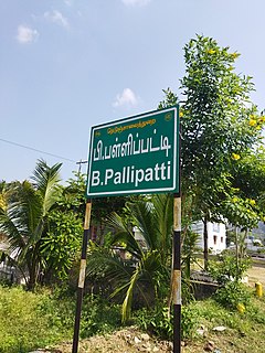
B. Pallipatti is a village in the Dharmapuri district of the Indian state of Tamil Nadu. The village code is 643526, and it is under the jurisdiction of B. Pallipatti Grama panchayath.
Kethureddipatti is a Village Panchayat in Dharmapuri district of Tamil Nadu, India. It is located at 30 km (19 mi) from Dharmapuri town. It comes under Pappireddipatti taluk and Kadathur Block. It belongs to Pappireddipatti State Legislative Assembly Constituency and Dharmapuri Loksabha Constituency. It consists of nine panchayat wards. As per the 2011 Census, the total population of this village is 4,808.
Eriyur block is one of the 10 revenue blocks in Dharmapuri district of Tamil Nadu, India. It has a total of 10 panchayat villages carved out from Pennagaram block.


