This article relies largely or entirely on a single source .(October 2021) |
Thalakkulathur | |
|---|---|
village | |
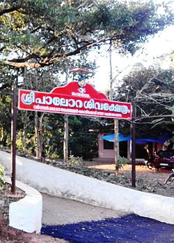 Palora Shiva Temple, Purakkattiri | |
 Thalakkulathur Location in Kerala, India  Thalakkulathur Thalakkulathur (India) | |
| Coordinates: 11°21′10″N75°45′40″E / 11.35278°N 75.76111°E | |
| Country | |
| State | Kerala |
| District | Kozhikode |
| Population (2011) | |
• Total | 29,388 |
| Languages | |
| • Official | Malayalam, English |
| Time zone | UTC+5:30 (IST) |
| PIN | 673317 |
| Vehicle registration | KL-76 |
| Website | https://www.facebook.com/palorasivakshethram/ |
Thalakkulathur is a small village near Kozhikode city, along the road to Atholi, in the state of Kerala. [1]
![Thalakulathur Mathilakam Narayanaperumal Temple tlkkullttuu[?] ksseetrN, koolllikkoott (1900).jpg](http://upload.wikimedia.org/wikipedia/commons/thumb/9/95/Thalakulathur_Mathilakam_Narayanaperumal_Temple_%E0%B4%A4%E0%B4%B2%E0%B4%95%E0%B5%8D%E0%B4%95%E0%B5%81%E0%B4%B3%E0%B4%A4%E0%B5%8D%E0%B4%A4%E0%B5%82%E0%B5%BC_%E0%B4%95%E0%B5%8D%E0%B4%B7%E0%B5%87%E0%B4%A4%E0%B5%8D%E0%B4%B0%E0%B4%82%2C_%E0%B4%95%E0%B5%8B%E0%B4%B4%E0%B4%BF%E0%B4%95%E0%B5%8D%E0%B4%95%E0%B5%8B%E0%B4%9F%E0%B5%8D_%281900%29.jpg/120px-Thalakulathur_Mathilakam_Narayanaperumal_Temple_%E0%B4%A4%E0%B4%B2%E0%B4%95%E0%B5%8D%E0%B4%95%E0%B5%81%E0%B4%B3%E0%B4%A4%E0%B5%8D%E0%B4%A4%E0%B5%82%E0%B5%BC_%E0%B4%95%E0%B5%8D%E0%B4%B7%E0%B5%87%E0%B4%A4%E0%B5%8D%E0%B4%B0%E0%B4%82%2C_%E0%B4%95%E0%B5%8B%E0%B4%B4%E0%B4%BF%E0%B4%95%E0%B5%8D%E0%B4%95%E0%B5%8B%E0%B4%9F%E0%B5%8D_%281900%29.jpg)