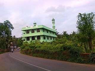
Cherukulamba is a village in Malappuram district of Kerala state, south India. It is 9 km from Malappuram town. It is surrounded by Chattipparamba and Padapparamba. two fast growing towns in Malappuram district. This town has somewhat big population when compared to other small towns surrounding it. This town is a Muslim-dominated towns which has as many as 6 Mosques, i.e. the place of worship for Muslims.

Pudiyangadi is a town near Tirur in Kerala, India. This town was the part of the Kingdom of Tanur (Vettattnad) in medieval times.
Pachattiri is a small village located near Tirur in Kerala, India. It lies on the banks of the Tirur River. A temple devoted to Krishna is located here, as is a temple devoted to Shiva.This was a part of the Kingdom of Tanur (Vettattnad) kingdom in medieval times.
Ananthavoor is a village in Tirur Thaluk Malappuram District of the state of Kerala, India.
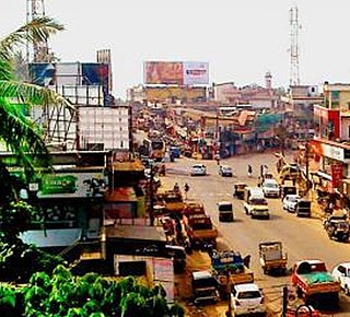
Athavanad is a village and Gram Panchayath in the Tirur Taluk, in the Malappuram District of the state of Kerala, India. The town lies on the National Highway 17, between Puthanathani and Valanchery. Puthanathani is the main town of the Athavanad village and the village office is located in Athavanad Para & Kurumbathoor. Nearby towns include Valanchery, Tavanur, Tirunavaya, Kuttippuram, Irimbiliyam, and Edayur.

Marakkara is a grama panchayath in Kuttippuram Block Panchayat, Tirur Taluk, Malappuram district in the state of Kerala, India.
Niramaruthur is a sandy coastal village and also a Gram panchayat in Tirur Taluk, Malappuram district in the state of Kerala, India. Tanur and Tirur are nearby municipal towns.
Ozhur is a village in the Malappuram district of the state of Kerala, India. The village was a part of the Kingdom of Tanur (Vettattnad) in medieval times.

Parappur is a village and townland two kilometers north of Kottakkal in Malappuram district in the state of Kerala, India.
Ponmundam is a census town in the Malappuram district of Kerala state in India. The Malappuram-Tirur state highway passes through this area. This was a part of the Kingdom of Tanur (Vettathunad) in medieval times.

Purathur is a sandy coastal village and a Grama Panchayat in Tirur Taluk, Malappuram district in the state of Kerala, India. Bharathappuzha river and Tirur River merges together in Purathur and join with the Arabian Sea at Padinjarekara Azhimukham, which is also the southernmost tip of Purathur Gram panchayat. Opposite to Padinjarekara Azhimukham is Ponnani port. The village is located at the southernmost tip of Tirur Taluk and is bordered by historically important Ponnani port in Ponnani Municipality of Ponnani taluk to south.
Thalakkad is a census town in Malappuram district in the state of Kerala, India.
Thennala is a Grama panchayat in Malappuram district in the Indian state of Kerala. Thennala is known for its cultured population and localities. National Highway (NH-17) passes through the pookkipparamb. Parapanangadi is the nearest railway station (12 km) and Calicut International airport is the nearest airport (23 km).
Veliyankode is a beautiful sandy coastal village and a Gram panchayat in Ponnani taluk, Malappuram district in the state of Kerala, India. It is located on the middle of Malabar Coast, between Ponnani and Perumbadappu.

Vettom is a local body of the Kerala government and village in Tirur Taluk, Malappuram district, India. It is the coastal suburb of Tirur Municipality. It was part of the Kingdom of Tanur (Vettathnad) in medieval times. Vettom gram panjayath is surrounded by water on all borders. Those are Tirur River and canoli canal.
Ittilakkal is a small village in Ponmundam panchayath, Tanur Block Panchayth Malappuram district, Kerala, India. The Puthanathani - Vattathani road passes through this area. The village was a part of the Kingdom of Tanur (Vettathunad) in medieval times.
Puthantheru is a small town on the coastline between Tirur and Tanur Malappuram district of Kerala state, South India. Previously it was called Theru, but as the town developed its name became Puthantheru. It comes under Tanalur Gram panchayat.
Kavapura is a small village/hamlet in Tirur Taluk in Malappuram District of Kerala State, India. It comes under Ozhur Panchayath. It belongs to North Kerala Division. It is located 20 km towards west from District headquarters Malappuram. 6 km from Tanur. 349 km from State capital Thiruvananthapuram.
Karingapara is a small village/hamlet in Tirur Taluk in Malappuram District of Kerala State, India that comes under Ozhur Panchayath.
Athavanad is a village and Grama Panchayat in the Malappuram district, the Indian state of Kerala.


