Tourist attractions in Wayanad

Last updated

Forest Road in Wayanad Waynad Bamboo Road.jpg
Forest Road in Wayanad

The Wayanad District of Kerala, India has a wide variety of tourist attractions ranging from religious sites to natural and historical sites. [1] This district is divided into three towns: Kalpetta, Sultan Bathery and Mananthavady. All Major Tourism destinations in the district are maintained by the District Tourism Promotion Council (Department of Tourism, Government of Kerala).

Contents

Religious sites

  1. Saint Mary Orthodox Cathedral is a declared "Pilgrim Centre of Saint Mary" and tourist attraction in Wayanad affiliated with the Malankara Orthodox Syrian Church. Pilgrims to the church can be blessed by the holy relics of three saints. The church is also the seat of the around 50 Malankara Orthodox Churches in all of Wayanad, with the current bishop being His Grace Geevarghese Mar Barnabas. [2] [3]
  2. Thirunelli Temple is an ancient temple dedicated to Lord Maha Vishnu. It is situated on the side of Brahmagiri hill in Kerala, which is about 30 kilometers away from Mananthavady (Wayanad district). The name Thirunelli derived from the nelli, the Tamil/Malayalam and Kannada word for Indian gooseberry of the Amla tree. According to tradition, Lord Brahma was traveling round the Universe on his hamsa, when he became attracted by the beauty of the area now known as Brahmagiri Hill. Descending on that spot, Brahma noticed an idol, set in an Amla tree. Brahma recognized the idol as Lord Vishnu Himself and the place as Vaikuntha (Vishnuloka) itself. With the help of the Devas, Brahma installed the idol and called it Sahyamalak Kshetra. At Brahma’s request Vishnu promised that the waters of the area would wash away all sins. (Thus, the spring and river near the temple is called Papanasini: "washes away all sins"). Even today the head priest of the temple leaves a portion of the worship materials in the belief that Lord Brahma Himself will come and perform pooja rites deep in the holy hours of morning. The famous incarnation of Lord Vishnu Parasurama is reputed to have visited Thirunelli and performed last rites of his father sage Jamadagni. He also took immersion in the Papanasini to wipe away sins committed in killing Kshatriyas.
  3. Puliyarmala Jain Temple dates back to the 13th century. The temple includes a Dravidian style architecture, beams and pillars carved out of stones, a stone slab roof, and engravings on the doors and walls throughout the temple. The temple is believed to be used as the ammunitions store of Tipu Sultan, the ruler of Mysore. [4] Dedicated to Jain Tirthankar, the temple is also named Ananthantha Swami Temple. Now, this serene place is under the supervision of the local archaeological department. They have maintained it properly with grass walkways and surrounding gardens.
  4. The three Edakkal Caves are located at a height of 1000 m on Ambukuthi Mala, near Sultan Bathery. The new stone age pictorial writings on the walls of these natural caves at Edakkal, shed light on the ancient civilizations that existed within the regions. The caves can be accessed only by a kilometer long trekking trail from the nearest parking area.
  5. Kayakkunn Ancient Stone Temple – 16.6 km

Nature sites

  1. Bandipur National Park in southern Karnataka is an 874-km2 forested reserve and is known for its small population of tigers. Once the private hunting ground of the Maharajas of Mysore, the park is also home to Indian elephants, spotted deer, bison (gaurs), antelope and numerous other native species and endangered wildlife. The 14th-century Himavad Gopalaswamy temple offers views from the park's highest peak. Most visitors arrive Dec–Jan, and Apr-May when the weather is mostly dry as the monsoon season runs Jun-Oct. The climate is tropical and hot year-round.
  2. Wayanad Wildlife Sanctuary at Muthanga is contiguous to the protected area network, with Nagarhole and Bandipur of Karnataka to the north-east and Muthumala of Tamil Nadu to the south-east. Rich in Biodiversity, the sanctuary is an integral part of the Nilgiri Biosphere Reserve, which has been established with the specific objective of conserving the biological heritage of the region. The sanctuary is rich in flora and fauna. The management lays emphasis on scientific conservation with due consideration for the general lifestyles of tribals and others who live in and around the forest. The vegetation is predominantly moist deciduous forest with small stretches of swamp, teak, bamboo and tall grass. Amidst such fertile and varied flora, this region hosts several rare herbs and medicinal plants. Due to the decent amount of watering holes in the area, Muthanga has a large population of pachyderms and has been declared a Project Elephant site. Some other animals that can be found there are jungle cat, panthers, civet cat, monkeys, wild dogs, spotted deer, bison, gaur, cheetah, sloth bear, peacock, owls, jungle fowls, woodpeckers, babblers, and cuckoos. The reserve is also home to a small population of tigers.
  3. Banasura Sagar Dam – 24 km – considered the largest earthen dam in India.
  4. Kayakkunn Ancient Stone Temple – is a small city near Nadavayal, Mananthavady, in the Wayanad District, Kerala, India. The city belongs to Panamaram Panchayath, and the assembly constituency is Mananthavady (North Wayanad). 22.1 km
  5. Soochipara Falls, also known as Sentinel Rock Falls – 20 km
  6. Lakkidi View Point
  7. Karalad Lake – 16 km
  8. Philately and Numismatics Museum – adjacent to Banasura Sagar dam
  9. Meenmutty Falls – 25 km – 2 km jungle hike to spectacular waterfall
  10. Kanthanpara Falls – 22 km
  11. Kurumbalakotta - is a hill 15 kilometres (9.3 mi) west of Kalpetta in Wayanad district, Kerala. It is a monolith hillock in Kerala. It rises to 980 metres (3,220 ft) above sea level. It is situated in the centre of Wayanad and also a part of Deccan plateau and the confluence of Western Ghats
  12. Chembra Peak – At a height of 2100 metres, the towering Chembra Peak is located near Meppadi in the southern part of Wayanad. It is the tallest of peaks in the region and climbing this peak would test one's physical prowess. Climbing up the Chembra Peak is an exhilarating experience, as each stage in the climb unfolds great expanses of Wayanad and the view gets wider as one goes up to its summit. Going up and coming down the peak would take a full day. Those who would like to camp at the top are assured of an unforgettable experience.
  13. Neelimala View Point -near Meenmutty Falls – 27 km
  14. Sunrise Valley – a place to watch the rising and setting sunset amid dramatic mountain scenery – 22 km
  15. Mango Orange village near Pandallur has undulating tea estates.
  16. Kolagappara rock – a place for trekking. It is approximately 1900 metres above sea level and is located upon the western ghat of India.
  17. 900 Kandi- off-road adventure spot

Toward Sulthan Bathery Kayakkunn Ancient Stone Temple – 21.9 km Karapuzha Dam – 17 km Edakkal Caves – 28 km Chethalayam Falls – 37 km Muthanga Wildlife Sanctuary – 42 km – 12 km Sulthan Bathery Jain Temple – 24 RARS (Regional Agricultural Research Station) – 25 km Phantom Rock – 26 km

Historical sites

  1. The Wayanad Heritage Museum, located in the Indian village of Ambalavayal is managed by the District Tourism Promotion Council. The Museum displays tribal relics and artifacts. Four sectors of the museum—the Verasmruthi, the Gothrasmruthi, the Devasmruthi, and the Jeevanasmruthi—house different types of items ranging from the Neotholic age to the 17th century, including artifacts from ordinary tribal life, decorated memorial grave stones once used to adorn the graves of heroes, and terracotta figures.
  2. The Mahatma Gandhi Memorial Museum and Library in Kalpetta, is a boarding house near the Jain Temple, where Gandhi took rest during his visit. The museum is located at Puliyarmala, about 4 km from Kalpetta.
  3. The Anantnath Swami Temple at Puliyarmala, is one of the very few present-day Jain temples in Kerala.
  4. Myladippara Trekking Centre.
  5. Myladippara is a cliff located to the east of the Civil Station, adjacent to the new NH bypass road. A trek to the Myladippara offers a charming experience, making it a great destination for tourists.
  6. Thovarimala Ezhuthupara is a destination located 5  km from Sulthan Bathery and 400 m (1,312 ft) of trekking where one can see stone age pictorial writings on a rock.
  7. Pazhassi's Cave, Wentworth Estate, Cherambadi Pazhassi Raja, a ruler of the Kottayam dynasty in Malabar, was renowned for his resistance against British colonial forces. As part of his strategic preparations during the Second Pazhassi War (1797–1805), he utilized the rugged terrain of Cherambadi and its surrounding areas. The region, dense with forests and hills, served as a natural stronghold for guerrilla warfare.

Other sites

Best time to visit

Winter and monsoon seasons are the best time for travelers to explore the spots. Even if there is something special to experience throughout the year. Climate is an important aspect of Wayanad tourism. We can go through the months and what you should experience.

Best Months to visit [5]

Related Research Articles

<span class="mw-page-title-main">Wayanad district</span> District in Kerala, India

Wayanad is a district in the north-east of the Indian state of Kerala, with its administrative headquarters at the municipality of Kalpetta. It is the only plateau in Kerala. The Wayanad Plateau forms a continuation of the Mysore Plateau, the southern portion of the Deccan Plateau. It is set high in the Western Ghats with altitudes ranging from 700 to 2,100 meters. Vellari Mala, a 2,240 m (7,349 ft) high peak situated on the trijunction of Wayanad, Malappuram, and Kozhikode districts, is the highest point in Wayanad district. The district was formed on 1 November 1980 as the 12th district in Kerala, by carving out areas from Kozhikode and Kannur districts. An area of 885.92 km2 in the district is forested. Wayanad has three municipal towns—Kalpetta, Mananthavady and Sulthan Bathery. There are many indigenous tribes in this area. The Kabini River, a tributary of the Kaveri River, originates at Wayanad. Wayanad district, along with the Chaliyar valley in the neighbouring Nilambur in Malappuram district, is known for natural gold fields, which are also seen in other parts of the Nilgiri Biosphere Reserve. The Chaliyar river, which is the fourth longest river of Kerala, originates on the Wayanad plateau. The historically important Edakkal Caves are located in Wayanad district.

<span class="mw-page-title-main">Mananthavady</span> Town in Kerala, India

Mananthavady is a municipality, taluk and town in the Wayanad district of Kerala, India. The municipal boundaries are defined by Tirunelli Panchayat to the north, Kabani River to the east and south, and Thavinhal Panchayat to the west. Mananthavady is the third largest town in Wayanad District, following Sulthan Bathery and Kalpetta. It is situated 35 km northeast of the district headquarters, Kalpetta, 80 km east of Thalassery, and 110 km northeast of Kozhikode.

<span class="mw-page-title-main">Brahmagiri (Karnataka)</span> Mountain range in India

Brahmagiri, is a mountain range in the Western Ghats of south India. It is situated on the border between Kodagu district in Karnataka state in the north and Wayanad district of Kerala state on the south. Brahmagiri Hill, at 1608 m height, near Tirunelli is a scenic tourist attraction. The top of Brahmagiri Hill is well forested and has much wildlife. Talakaveri is located on the northern section of the range, near Bhagamandala in Kodagu district (Coorg), in the South Indian state of Karnataka.

<span class="mw-page-title-main">Kalpetta</span> Town, City in Kerala, India

Kalpetta is the largest and first City, Town and municipality in the Wayanad district of the Indian state of Kerala. Kalpetta is the headquarters of Wayanad district, as well as the headquarters of Vythiri taluk. It is a bustling city, town surrounded by dense coffee and tea plantations and mountains. It lies on the Kozhikode-Mysore National Highway NH 766 at an altitude of about 780 m above sea level. Kalpetta is 72 km from Kozhikode and 140 km from Mysore.
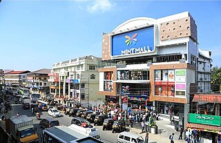
<span class="mw-page-title-main">Sultan Bathery</span> Town in Kerala, India

Sultan Bathery is a town and municipality in the Wayanad district of Kerala, India, near its borders with Tamil Nadu and Karnataka. Once known as a strategic location in the Malabar region, Sultan Bathery is the headquarters of the Sultan Bathery taluk.

<span class="mw-page-title-main">Thirunelli Temple</span> Temple in India

Thirunelli Temple is an ancient temple dedicated to Maha Vishnu on the side of Brahmagiri hill in Kerala, India, near the border with Karnataka state. The temple is classified one among the 108 Abhimana Kshethram of Vaishnavate tradition. The temple is at an altitude of about 900m in north Wayanad in a valley surrounded by mountains and forests. It is 32 km away from Manathavady.

<span class="mw-page-title-main">Pulpally</span> Town in Kerala, India

Pulpally is a mid-sized town in Wayanad District of Kerala, India.Pulpally also known as 'The land of black gold'. Pulpally is also renowned for its pure wild Wayanad honey. The famous Seetha devi temple in Kerala is situated on Pulpally. Geographically a small town in Sultan Bathery Taluk and a "Grama Panchayath" under the local self governance system. It is about 24 km from Sultan Bathery, and is almost surrounded by forest. The main source of income is agriculture.

<span class="mw-page-title-main">Kutta</span> Place in Karnataka, India

Kutta is a small village in Ponnampet taluk of Kodagu, in Karnataka state of India. As per census survey 2011, location code number of Kutta is 618078.

Anjukunnu is a village in Wayanad district in the state of Kerala, India.

<span class="mw-page-title-main">Panamaram</span> Town in Kerala, India

Panamaram is a town, village in Wayanad district in the state of Kerala, India.

<span class="mw-page-title-main">Banasura Hill</span> One of the tallest mountains in Western Ghats, Kerala

Banasura Hill is situated in Padinjarathara and it is one of the tallest mountains in the Western Ghats of the Wayanad district, Kerala, India. The hill is named after Banasura, a mythical character of Indian legends. It is one of the highest peaks exceeding 2,000m between Nilgiris and Himalayas after Chembra Peak.

<span class="mw-page-title-main">National Highway 766 (India)</span> National highway in India

National Highway 766 is a National Highway in Southern India. NH 766 connects Kozhikode in Kerala with Kollegal in Karnataka via Mysore. Of the total distance of 272 km, 117 km is in Kerala and 155 is in Karnataka. At Kollegal, it joins National Highway 948, which connects Bengaluru and Coimbatore. The highway passes through dense forests of Western ghats of India. The NH-766 passes through 19.7 km Bandipur National Park and Wayanad wild life sanctuary.

<span class="mw-page-title-main">Meenangadi</span> Town in Kerala, India

Meenangadi is an old town situated on the highway NH 766 between Kalpetta and Sulthan Bathery in Wayanad District, in Kerala, India. This place is one among the Provinces where the existence of Dolmens provide an historical evidence of earlier civilisation. Coffee bean, Black pepper, Ginger, Rice and Areca are the major crops cultivated in this area. Meenangadi is famous for its Fish Market and Cattle Market. The nearest railway station is at Kozhikode at 87 km and airport is Kannur International Airport with 94 km from Meenangadi. Meenangadi is surrounded by, Ambalavayal Panchayat, Kalpetta Taluk towards west, Gudalur Taluk towards East, Mananthavady Taluk towards west. Kalpetta, Sultan Bathery, Kozhikode are the nearby Cities and towns to Meenangadi.
Kerala's first carbon neutrality project launched in Meenangadi in June 2016. Upon achieving the goals of the project, Meenangadi will be the first village in India to go completely carbon neutral. Meenangadi has a population of 33450 According to 2011 Census with two Villages Purakkadi and (Part)Krishnagiri.

<span class="mw-page-title-main">Transportation in Wayanad</span>

The district capital of Wayanad is Kalpetta town. Kalpetta has very good road connectivity with the rest of Kerala and neighboring South Indian cities. National Highway 766 (India) NH766 connects Kalpetta with Kozhikode and Mysore. State Highways connect Kalpetta with Ooty in Tamil Nadu and Madikeri in Karnataka.

<span class="mw-page-title-main">Kattikkulam</span> Place in Kerala, India

Kattikkulam (Kartikulam) is a small town near Mananthavady in Wayanad district, Kerala, India.The office of the Thirunelly Gramapanchayath is located at Kartikulam.

Educational Organizations are located mainly in Kalpetta and Sultan Battery.

Wayanad district, which is home to Edakkal Caves, has human settlement from prehistoric era. Wayanad is the sole Plateau in Kerala. The tribal dialects of Wayanad like the Ravula language and the Paniya language are closely related to Malayalam.
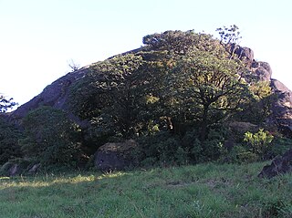
<span class="mw-page-title-main">Pakshipathalam Bird Sanctuary</span> Bird sanctuary in India

Pakshipathalam Bird Sanctuary is a bird sanctuary and a tourist location in Wayanad district of Kerala state, India.

References

  1. "Wayanad and its tourist Attractions | Kerala Tourism | Kerala Tourism". www.keralatourism.org. Retrieved 19 November 2017.
  2. "Sultan Bathery Diocese". moscbatherydiocese.com. Retrieved 17 June 2024.
  3. "Diocese of Sultan Bathery". MOSC.in. MOSC Publications. Retrieved 17 June 2024.
  4. "Puliyarmala Jain Temple, Kalpetta - TripAdvisor". www.tripadvisor.com. Retrieved 14 March 2018.
  5. "Best months to visit Wayanad". Feel Wayanad. 17 May 2021. Retrieved 20 June 2021.