Padiyoor is a small town in Kannur district of Kerala state, India. Padiyoor village is part of Padiyoor-Kalliad Grama Panchayat in Iritty taluk.
Irikkur is a town and grama panchayat in Kannur District of Kerala state, India.

Kalliasseri is a census town in Kannur district in the Indian state of Kerala. Kalliaseri Panchayat comprises two villages: Kalliasseri and Irinave.
Kannapurampronunciation (help·info) is a census town and grama panchayat in Kannur district of North Malabar region in the Indian state of Kerala.

Panniyannur is a census town in Thalassery taluk of Kannur district in the Indian state of Kerala. It is part of Greater Mahé Region.

Pappinisseri is a census town and grama panchayat in Kannur district in the Indian state of Kerala. Pappinissery have consistently won the Swaraj Trophy for best Grama Panchayat from 2017-2018 to 2021. Pappinisseri Panchayat also bagged the third position in the Swaraj Trophy during 2015-2016. Also, Pappinissery has been declared as the best Grama Panchayat in Kerala by Kerala government. Pappinisseri Panchayat comprises two villages viz Pappinisseri and Aroli. Pappinisseri better known for visha chikitsa kendram
Koodali is a census town and grama panchayat in Thalassery taluk of Kannur district in Kerala state, India. Koodali is located 15.5 km (9.6 mi) east of Kannur city on Kannur-Mattanur road.

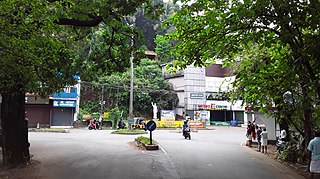
Naduvil is a small town in Kannur district in the Indian State of Kerala. The town is the headquarters of Naduvil Grama panchayat.

Alakode is an emerging town in Kannur district in the Indian state of Kerala. It is located 46 km (29 mi) North of District headquarters Kannur. Alakode is located on Taliparamba-Manakadavu-Coorg Road. Alakode was one of the major centers of Malabar Migration.

Cherukunnu is a census town in Kannur district in the Indian state of Kerala. Cherukunnu town is located on Valapattanam-Pappinisseri-Pazhayangadi main road, situated to the south of the Pazhayangadi in Kannur District of North Malabar region in Kerala.

Kurumathur is a census town in Taliparamba taluk of Kannur district in Kerala state, India. Kurumathur is located 8 km (5.0 mi) east of Taliparamba town in SH 36.

Kuttiyeri is a village of Pariyaram Grama Panchayath near Taliparamba town in Kannur district in the Indian state of Kerala. Mini villages of Vellavu, Mavichery, Thalora & Panangattoor are parts of Kuttiyeri.
Panniyoor is a village in Kannur district in the Indian state of Kerala.
Kariyad is a small town in Talassery taluk of Kannur district in the Indian state of Kerala. It is part of Greater Mahé Region. It is 57.31 km.2 The total population according to the 1991 census is 123,628.
Aroli is a village of Pappinisseri Panchayat in Kannur district in the Indian state of Kerala.

Morazha is a village of Anthoor Municipality in Kannur district in the Indian state of Kerala. Before formation of Anthoor Municipality this village was part of Thaliparamba Municipality. Though part of a Municipal Town, Morazha remains like a village.

Anthoor is a municipality in the Kannur district of the North Malabar region in the Indian state of Kerala. Anthoor is located roughly 15 km from the Kannur City, and 7 km from Taliparamba town.
Koonam is a census village in Taliparamba Taluk in North Kerala Division, Kannur District of Kerala, India. It comes under Kurumathoor and chengalayi Panchayaths. It is located about 9 km (5.6 mi) from Taliparamba and 30 km (19 mi) north of Kannur.

Chapparapadavu is a Grama panchayat in Kannur district in the Indian state of Kerala. Chapparapadavu Panchayat have administration over the villages of Kooveri, Thimiri, and Vellad.
Anchampeedika is a town in the Kannur district of the North Malabar region in the Indian state of Kerala. Anchampeedika is located roughly 13.5 km from the Kannur Corporation, and it is adjacent to the Taliparamba municipality.

