Payyanur railway station

Last updated

Payyanur
Indian Railways Suburban Railway Logo.svg Indian Railways station
Payyanur.jpg
Payyanur Station
General information
Location Payyanur, Kannur, Kerala
India
Coordinates 12°05′28″N75°11′42″E / 12.091°N 75.1951°E / 12.091; 75.1951
Owned by Indian Railways
Operated by Southern Railway zone
Platforms3
Tracks5
Connections Bus stand, Taxicab stand, Auto rickshaw stand
Construction
Structure typeStandard (on ground station)
ParkingYes
Accessible Wheelchair symbol.svg
Other information
StatusFunctioning
Station codePAY
Zone(s) Southern Railway zone
Division(s) Palakkad
ClassificationNSG-4
History
ElectrifiedYes
Route map
km
BSicon CONTg.svg
BSicon SPLa.svg
BSicon vABZgl+l.svg
BSicon SPLeq.svg
BSicon lCONTf@Fq.svg
BSicon lvDST-L.svg
BSicon vSTR2.svg
BSicon ldDST~R.svg
BSicon vSTRc3.svg
4
Padil Bypass Cabin
BSicon vSTRc1.svg
BSicon ldBHF~L.svg
BSicon lvBHF-R.svg
BSicon vSTR+4.svg
2
Mangalore Junction
BSicon vKBHFa.svg
BSicon vSTR.svg
0
Mangalore Central
BSicon vSHI2g+l-.svg
BSicon vSTR.svg
BSicon KDSTaq.svg
BSicon ABZgr+r.svg
BSicon vSTR.svg
2
Bunder Goods Shed
BSicon vSTRlf-.svg
BSicon STRl.R.svg
BSicon vSTRc2.svg
BSicon dABZg2.svg
BSicon dSTRc3.svg
BSicon vSTR3.svg
BSicon STRr.R.svg
BSicon v-STRrf.svg
BSicon dSTRc1.svg
BSicon vSTR+1.svg
BSicon dSTR.svg
BSicon dSTR+4.svg
BSicon vSTRc4.svg
BSicon vDST.svg
3
Nethravathi
BSicon dWASSERq.svg
BSicon vWBRUCKE1.svg
BSicon dWASSERq.svg
Netravati River
BSicon vHST.svg
5
Tokkottu
BSicon vSKRZ-G2u.svg
Ullal overpass
BSicon vHST.svg
7
Ullal
BSicon dWASSERq.svg
BSicon vWBRUCKE1.svg
BSicon dWASSERq.svg
Talapady Rivulet
BSicon vSTR+GRZq.svg
Karnataka
Kerala
Border
BSicon vHST.svg
17
Manjeshwar
BSicon dWASSERq.svg
BSicon vWBRUCKE2.svg
BSicon dWASSERq.svg
BSicon dWASSERq.svg
BSicon vWBRUCKE1.svg
BSicon dWASSERq.svg
Manjeswaram River
BSicon vHST.svg
24
Uppala
BSicon dWASSERq.svg
BSicon vWBRUCKE1.svg
BSicon dWASSERq.svg
Shiriya River
BSicon dWASSERq.svg
BSicon vWBRUCKE2.svg
BSicon dWASSERq.svg
Kumbla River
BSicon vHST.svg
34
Kumbla
BSicon dWASSERq.svg
BSicon vWBRUCKE1.svg
BSicon dWASSERq.svg
Mogral River
BSicon vSKRZ-G2u.svg
Nellikunnu overpass
BSicon vSKRZ-G2u.svg
Thayalangadi overpass
BSicon vBHF.svg
46
Kasaragod BSicon BUS2.svg BSicon PARKING.svg
BSicon dWASSERq.svg
BSicon vWBRUCKE1.svg
BSicon dWASSERq.svg
Chandragiri River
BSicon vHST.svg
49
Kalanad
BSicon vTUNNEL1.svg
Chembirika Tunnel
BSicon dWASSERq.svg
BSicon vWBRUCKE1.svg
BSicon dWASSERq.svg
Kalanad River
BSicon vSKRZ-G2u.svg
BSicon vHST.svg
55
Kotikulam
BSicon dWASSERq.svg
BSicon vWBRUCKE1.svg
BSicon dWASSERq.svg
Bekal River
BSicon vSKRZ-G2u.svg
Pallikere overpass
BSicon vSKRZ-G2u.svg
BSicon vHST.svg
60
Bekal Fort
BSicon dWASSERq.svg
BSicon vWBRUCKE1.svg
BSicon dWASSERq.svg
Chithari River
BSicon vHST.svg
69
Kanhangad BSicon PARKING.svg
BSicon vSKRZ-G2u.svg
BSicon dWASSERq.svg
BSicon vWBRUCKE1.svg
BSicon dWASSERq.svg
Kariangode River
BSicon vSKRZ-G2u.svg
Nileshwaram overpass
BSicon vHST.svg
78
Nileshwar BSicon PARKING.svg
BSicon vSKRZ-G2u.svg
BSicon dWASSERq.svg
BSicon vWBRUCKE1.svg
BSicon dWASSERq.svg
Karyangod River
BSicon vHST.svg
83
Cheruvathur BSicon PARKING.svg
BSicon vSKRZ-G2u.svg
Cheruvathur overpass
BSicon vSKRZ-G2u.svg
Padne Road
BSicon vHST.svg
88
Chandera
BSicon vHST.svg
92
Thrikaripur
BSicon dWASSERq.svg
BSicon vWBRUCKE1.svg
BSicon dWASSERq.svg
Kavvayi River
BSicon vSKRZ-G2u.svg
Payyanur overpass
BSicon vHST.svg
98
Payyanur BSicon BUS2.svg BSicon PARKING.svg
BSicon dWASSERq.svg
BSicon vWBRUCKE1.svg
BSicon dWASSERq.svg
Perumba River
BSicon vHST.svg
101
Ezhimala
BSicon vHST.svg
110
Pazhayangadi BSicon PARKING.svg
BSicon vSKRZ-G2o.svg
Payangadi underpass
BSicon dWASSERq.svg
BSicon vWBRUCKE1.svg
BSicon dWASSERq.svg
Kuppam River
BSicon vSKRZ-G2u.svg
Thavam overpass
BSicon vHST.svg
117
Kannapuram BSicon BUS2.svg BSicon PARKING.svg
BSicon dWASSERq.svg
BSicon vWBRUCKE2.svg
BSicon dWASSERq.svg
Irinave River
BSicon vHST.svg
123
Pappinisseri
BSicon vSKRZ-G2u.svg
Pappinisseri overpass
BSicon dWASSERq.svg
BSicon vWBRUCKE1.svg
BSicon dWASSERq.svg
Valapattanam River
BSicon vSKRZ-G2o.svg
Valapattanam underpass
BSicon vHST.svg
125
Valapattanam
BSicon vSKRZ-G2u.svg
Alavil-Valapattanam Road
BSicon vHST.svg
127
Chirakkal
BSicon vSKRZ-G2o.svg
Manjapalam underpass
BSicon vBHF.svg
132
Kannur BSicon BUS2.svg BSicon PARKING.svg
BSicon vSKRZ-G4o.svg
Thavakkara underpass
BSicon vHST.svg
135
Kannur South
BSicon dWASSERq.svg
BSicon vWBRUCKE2.svg
BSicon dWASSERq.svg
Kanaam River
BSicon vHST.svg
144
Etakkot
BSicon vSKRZ-G2u.svg
BSicon dWASSERq.svg
BSicon vWBRUCKE1.svg
BSicon dWASSERq.svg
Anjarakandi River
BSicon vHST.svg
148
Dharmadam
BSicon vSKRZ-G2u.svg
Dharmadam overpass
BSicon dWASSERq.svg
BSicon vWBRUCKE1.svg
BSicon dWASSERq.svg
Ummanchira River
BSicon dWASSERq.svg
BSicon vWBRUCKE1.svg
BSicon dWASSERq.svg
Kuyyali River
BSicon vBHF.svg
152
Thalassery BSicon BUS2.svg BSicon PARKING.svg
BSicon vSKRZ-G2u.svg
Kodiyeri Road
BSicon vHST.svg
155
Jagannath Temple Gate
BSicon vSTR+GRZq.svg
Kerala
Puducherry
BSicon dWASSERq.svg
BSicon vWBRUCKE1.svg
BSicon dWASSERq.svg
Mahé River
BSicon vHST.svg
162
Mahe BSicon PARKING.svg
BSicon vSTR+GRZq.svg
Puducherry
Kerala
BSicon vSKRZ-G2u.svg
Chombala overpass
BSicon vHST.svg
165
Mukkali
BSicon vHST.svg
169
Nadapuram Road
BSicon vSKRZ-G2u.svg
Kainatty overpass
BSicon vSKRZ-G2u.svg
Thazhe Angadi Road
BSicon vBHF.svg
174
Vadakara BSicon PARKING.svg
BSicon dWASSERq.svg
BSicon vWBRUCKE1.svg
BSicon dWASSERq.svg
Kuttiady River
BSicon vHST.svg
178
Iringal
BSicon vHST.svg
184
Payyoli BSicon BUS2.svg BSicon PARKING.svg
BSicon vHST.svg
187
Tikkotti
BSicon vSKRZ-G2u.svg
BSicon vHST.svg
191
Vellarakkad
BSicon vHST.svg
197
Quilandi BSicon PARKING.svg
BSicon vSKRZ-G2u.svg
BSicon vHST.svg
202
Chemancheri
BSicon vSKRZ-G2u.svg
Vengalam overpass
BSicon dWASSERq.svg
BSicon vWBRUCKE1.svg
BSicon dWASSERq.svg
Akalapuzha River
BSicon vHST.svg
209
Elattur
BSicon vSKRZ-G2u.svg
Vengali overpass
BSicon vHST.svg
216
West Hill
BSicon vHST.svg
219
Vellayil
BSicon vSKRZ-G2u.svg
Vellayil overpass
BSicon vSKRZ-G2u.svg
CH overpass
BSicon vSKRZ-G2u.svg
Old Railway overpass
BSicon vBHF.svg
221
Kozhikode BSicon BUS2.svg BSicon PARKING.svg
BSicon vCONTf.svg
km
Location
India location map.svg
Red pog.svg
Payyanur
Location within India
India Kerala location map.svg
Red pog.svg
Payyanur
Payyanur (Kerala)

Payyanur railway station(Code: PAY) is a railway station serving the town of Payyanur in the Kannur district of Kerala. This is a NSG-4 category railway station. This station is the second largest railway station of Kannur district in terms of area after Kannur railway station.

Contents

Line

It lies in the Shoranur–Mangalore section of the Southern Railways. The station has three platforms and five tracks.

Location

Payyanur Railway station is located 3.6 km from Payyanur New Bus Stand and 2.7 km from Old Bus Stand, Payyanur, and 4.4 km from KSRTC bus stand, Payyanur (on NH-66).

Kannur International Airport is 60 km from the railway station.

Services

No trains originate from the station. Trains halting at the station connect the town to prominent cities in India such as Trivandrum Central, Ernakulam Junction, Mumbai, Chennai Central, Bangalore, Kozhikode, Thrissur, Coimbatore Junction, Kollam, Mangalore, Mysore, Pune, Pondicherry, New Delhi and so forth.

Former Kerala Chief Minister V. S. Achuthanandan waiting for a train at Payyanur station V.S.Achuthanandhan Rly Pnr.jpg
Former Kerala Chief Minister V. S. Achuthanandan waiting for a train at Payyanur station

Importance

The Indian Naval Academy is located approximately 5 km (3.1 mi) from the railway station. CRPF's Recruit Training Centre-3 in Peringome is located approximately 22 km (14 mi) from the railway station.

Related Research Articles

<span class="mw-page-title-main">Taliparamba</span> Municipality in Kerala, India

Taliparamba is a Municipality in Taliparamba taluk of Kannur district, Kerala, India. The municipal town spreads over an area of 18.96 square kilometres (7.32 sq mi) and is inhabited by 44,247 number of people.

<span class="mw-page-title-main">Payyanur</span> Municipality in Kerala, India

Payyanur, is a municipal town and a taluk, a sub-district administrative unit, in the Kannur district of Kerala, India. On 10 March 2018, Kerala Chief Minister Pinarayi Vijayan inaugurated Payyanur as the fifth taluk in the district. Payyanur taluk comprises 22 villages including 16 de-linked from the Taliparamba taluk and six from the Kannur taluk. The town is situated on the banks of the Perumba River.

Pariyaram is a Grama Panchayat consisting of two villages viz. Pariyaram census town and Kuttiyeri village. Pariyaram is a suburb of Taliparamba on National Highway between Taliparamba and Payyanur in Kerala state of India. Mini villages of Thiruvattoor, Koran Peedika, Mukkunnu & Chithappile Poyil are parts of Pariyaram.

<span class="mw-page-title-main">Pazhayangadi</span> Town in Kerala, India

Pazhayangadi, is a small township, approximately 23 km (14 mi) north of district headquarters Kannur, 13.6 km (8.5 mi) south of Payyanur and 13.6 km (8.5 mi) west of Taliparamba in the Indian state of Kerala. In the local language of Malayalam it literally means "Old Market". The town is bounded by the Madayi Hills (Madayippara) on the west and by the Pazhayangadi River on the south. Ezhimala, a range of hills, that is believed to be home to a variety of medical herbs including mrithasanjeevini, and a very ancient recorded history, is situated nearly 8 km west of Pazhayangadi. Pazhayangadi town is spread over Madayi and Ezhome Grama Panchayats. Madayi Hill offers a splendid scene of Ezhimala which means a chain of seven mountains, where the Indian Naval Academy is situated.

<span class="mw-page-title-main">Kavvayi Backwaters</span> Island in India

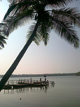
Kavvayi Backwaters located near Payyanur is the third largest backwater in Kerala and the largest one in north Kerala.

<span class="mw-page-title-main">Cheruthazham</span> Census Town in Kerala, India

Cheruthazham is a Census Town and Grama Panchayat in Kannur district in the state of Kerala, India. It is the location of the famous Hanumarambalam, dedicated to Sri Rama and Hanuman.Cherutazham is also the birthplace of Kalamandalam Krishnan Nair who gave a new dimension to the art of Kathakali. There are many artists in Cherutazham who are experts in the traditional musical items like "panchavadyam", "taayambaka", "chenda melam" etc. The new generation of Cherutazham is also getting trained in these art forms.

<span class="mw-page-title-main">Pappinisseri</span> Census Town in Kerala, India

Pappinisseri is a census town and a suburb of Kannur city in Kannur district in the Indian state of Kerala. Pappinissery have consistently won the Swaraj Trophy for best Grama Panchayat from 2017-2018 to 2021. Pappinisseri Panchayat also bagged the third position in the Swaraj Trophy during 2015-2016. Also, Pappinissery has been declared as the best Grama Panchayat in Kerala by Kerala government. Pappinisseri Panchayat comprises two villages viz Pappinisseri and Aroli. Pappinisseri better known for visha chikitsa kendram

<span class="mw-page-title-main">Pulingome</span> Village in Kerala, India


Pulingome is a village in Kannur District of Kerala state, India.

<span class="mw-page-title-main">Cherupuzha, Kannur</span> Town in Kerala, India

Cherupuzha is a town in Kannur district, Kerala, India. It is the headquarters of the Cherupuzha Panchayat which is a special grade panchayat in Kerala.

<span class="mw-page-title-main">Ezhome</span> Census Town in Kerala, India

Ezhome is a census town in Kannur district in the Indian state of Kerala.

<span class="mw-page-title-main">Karivellur</span> Census town in Kerala, India

Karivellur is a census town and Gram Panchayat in Kannur district of Kerala state, India.

<span class="mw-page-title-main">Ramanthali</span> Village in Kerala, India

Ramanthali is a village in Kannur district in the Indian state of Kerala. It boasts the gateway for Indian Naval Academy in Ezhiamala.

<span class="mw-page-title-main">Thirumeni</span> Village in Kerala, India

Thirumeni is a village in Kannur district in the Kerala state of India. It is known for its hill station Chathamangalam Hills. The village has several recently migrated families from various parts of the erstwhile political entity (state) of Travancore who settled here in the famed "Malabar migration period" in the nineteenth century. Most of the inhabitants of the village reside in the valley of three major hills by name Chathamangalam Theruvamala alias Alumbumala, Kottathalachimala and Thevarkunnumala. Thirumeni is a small junction with a few government institutions, religious institutions and small shops in int. and is subdivided into smaller villages like Kokkadave, Prapoyil, Chathamangalam (Kannur), Thabore, Muthuvom, Korali, Chattivayal, Thannichal, Paruthikallu etc.

<span class="mw-page-title-main">Pilathara</span> Town in Kerala, India

Pilathara is a suburb town of Payyannur in the Kannur district of Kerala, India. This region is noted for its cultural, traditional and religious characteristics. The Government Medical College, Kannur aka Pariyaram Medical College is just 4 km away from Pilathara. Pazhayangadi and Mathamangalam are located south and north of Pilathara respectively. It comes under Payyanur taluk and Cheruthazham village. Kannur International Airport is the nearest airport of about 50 km away. The nearby railway station is at Pazhayangadi, just 8 km away from Pilathara town.

<span class="mw-page-title-main">Kannur railway station</span> Railway station in Kerala, India

Kannur Railway Station, also formerly known as Cannanore, is the largest railway station serving the City of Kannur in Kerala. It lies in the Shoranur–Mangalore section of the Southern Railways of the Indian Railways. It is the largest railway station in terms of area and number of tracks in North Malabar region. At 62 crore in financial year 2018–19, it is the fifth largest in terms of passenger revenues in Kerala, and second largest under Palakkad division. Almost all major trains connecting the other parts of Kerala, Tamil Nadu, Andhra Pradesh and North India halt here. Kannur and Kannur South are two different stations which serve Kannur city.

Padiyotchal is a small town in Kannur district in the Indian state of Kerala.

<span class="mw-page-title-main">Olayambadi</span>

Olayambadi is a small village about 21 km from Payyanur town in the Kannur district of Kerala state, South India.

<span class="mw-page-title-main">Transport in Kannur district</span>

Kannur has a good road network connecting to Bangalore, Mangalore, Kodagu and Cochin. The railway station is also well connected to all parts of India. There is new International airport from Kannur opened on 9 December 2018, other nearest airports are at Calicut and Mangalore. Thalassery, Payyanur, Taliparamba and Iritty are the other transport hubs.

The KSR Bengaluru City Junction–Kannur Express is an Express train belonging to South Western Railway zone that runs between KSR Bengaluru and Kannur in India. It is currently being operated with 16511/16512 train numbers on a daily basis.

Kuttur is a village in Payyanur Taluk of Kannur district in the Indian state of Kerala.

References