Ullal

Last updated • 7 min readFrom Wikipedia, The Free Encyclopedia

Ullal
City
Ullal Queen Abbakka Devi.jpg
Ullal Abbakkadevi Circle
Ullal
Ullal in Karnataka
Coordinates: 12°48′54″N74°50′34″E / 12.8149°N 74.8429°E / 12.8149; 74.8429
CountryFlag of India.svg  India
State Seal of Karnataka.svg   Karnataka
District Dakshina Kannada
Government
  TypeCity Municipal Council
  Body Ullal City Municipal Council
  Council PresidentK.Hussain Alias Kunhimonu
Area
  Total11.8 km2 (4.6 sq mi)
Elevation
5 m (16 ft)
Population
 (2011)
  Total53,808
  Density4,600/km2 (12,000/sq mi)
Time zone UTC+5:30 (IST)
PIN
575020
Vehicle registration KA 19
Official language Kannada [1]
Length of Roads268.97 km
Lok Sabha constituency Dakshina Kannada
Vidhan Sabha constituency Mangalore
Literacy92.87%
Website www.ullalcity.mrc.gov.in

Ullal or Uḷḷāla is a City in Dakshina Kannada district of Karnataka state in India. Ullal City Municipal Council along with the Mangalore City Corporation forms the continuous Mangalore urban agglomeration area which is currently the fourth biggest in Karnataka after Bangalore, Mysore and Hubli-Dharwad. [2] There is also a plan to merge Ullal City Municipality & some gram panchayats along with Mangalore City Corporation to form the Greater Mangalore region. Ullal is one of the oldest towns in India. In the 15th century it came under the rule of the Portuguese. Still the remains of its glorious history can be seen in the beaches and other parts of Ullal. [3] . It is very famous for historic locations like Sri Cheerumba Bagavathi Temple, Someshwara Temple, Someshwar Beach, Summer Sands Beach Resort, Queen Abbakka Chowta's Fort at Ranipura, K Pandyarajah Ballal Institutes and college of nursing, St. Sebastian Church Permannur, Fish Meal & Oil Plant, and Queen Abbakka's Jain temple at Melangadi.

Contents

This quaint little sea town on the shore of Arabian Sea was the setting for wide-scale sea-erosion that occurred in the late 1990s and early this millennium. The local authorities, however, have tried to reduce the damage by placing sand bags near the advancing coastline, the benefits of this step are yet to be noted [4] , Ullal is the first "Kerosene Free" city in the state of Karnataka [5] [6] . This town is an important trading centre for fish and fish manure. Fishing and Beedi rolling are main occupations of the residents of this town.

History

The popular Ullal Bridge, Mangalore Ullal Bridge Mangalore.JPG
The popular Ullal Bridge, Mangalore
Ullal - Thokottu Road, Mangalore Ullal - Thokottu Road, Mangalore.jpg
Ullal – Thokottu Road, Mangalore
Ullal highrise buildings, Mangalore Ullal highrise buildings.jpg
Ullal highrise buildings, Mangalore

This town was the subsidiary capital of the Chowta rulers and was ruled by Jain Queen, Abbakka Chowta in the middle of the 16th century.

Abbakka Chowta of Ullal can perhaps be proclaimed the first promoter of women's liberation. A regular firebrand, the people of Ullal look upon her with much pride. A Jain princess of 16th century, she came to the throne on the death of her sister. She was married to the King of Mangalore, but the marriage was not a success. In a few years the couple was estranged with the queen returning to her beloved Ullal. The reason for the grouse was, the queen was averse to the payment of subsidy demanded by the Portuguese. While her husband continued to be subservient to them, the queen was openly rebellious. Relations between the royal couple steadily worsened and finally ended with divorce, with the queen returning all the jewels to her ex-husband. War was declared and the queen was captured while on a sailing expedition on the Nethravathi. Taken prisoner she was presented before her husband. However, on this one occasion the queen thought discretion the better part of valour and with all her womanly charms got the Banga Arasa (King) to set her free and return all her lands to her. The Raja went so far as to avow his eternal friendship to her. But hardly had she reached the precincts of her own kingdom then she vowed to wage war on her husband once more.

For this she sought the help of the powerful Raja of Bednore. The Banga Raja had meanwhile enlisted the help of the Portuguese to subjugate his wife. The Raja of Bednore being an opportunist was only too ready to enter the fray. The Banga-Portuguese alliance was defeated with the Banga Fort razed to the ground. The queen had to part with the fertile tract of land at Berdatte to the Bednore King for his support.

Having successfully defeated her husband, the queen now turned her attention to the Portuguese with whom she maintained her unconciliatory attitude. Several punitive expeditions were sent against her, which she repulsed successfully with the help of the Zamorin of Calicut. Another expedition sent under João Peixoto in 1566 ended in disaster for the Portuguese. The queen along with Chennappa Mogaveera (Gurikara) as commander-in-chief and Mogaveera warriors she surrounded the Portuguese frigate at night. She took them by surprise and inflicted a crushing defeat on them. Incensed by the defeat made all the more insulting at the hands of a woman, the Portuguese sent a veritable armada under the leadership of the Portuguese Governor himself. While the queen met with initial success, she was betrayed, so some say, by her own people for a casket of silver. However, the army of the queen was thoroughly outnumbered. What ensured was a bloody massacre with the queen escaping to the hills, a fugitive. Another version has it that the queen had killed herself rather than give herself up to the enemy which really seems more in keeping with her character.

Pietro Della Valle, a renowned traveller and historian of the 16th century, seems to have been fascinated by her. Her militant nature aroused his interest and he made several attempts to meet her. His efforts finally met with success when he accidentally came across her in the bazaar. His foreign mein and dress elicited her interest and with the aid of an interpreter, courtesies were exchanged and an invitation issued to visit the royal palace.

Della Valle was enamoured of "her perfect dignity, handsome feature and exemplary assiduity. Active and vigorous in actions of war and weighty affairs. Even at night she was not free to take rest but dispensed justice to her people." His description of her is at once romantic and realistic. He puts her age down at 40, dark complexioned and with elegant figure. At another instance, he says she could be mistaken for a common kitchen wench, but for her graceful and judicious speech. Her scanty clothing of only a loincloth may have created this impression. He seems highly impressed with her administrative qualities and doesn't give much credence to the rumours of her having poisoned her elder two sons, who were aspiring to the throne.

One can see the ruins of the fort she built around Somanatheshwara temple. This temple houses few things related to the Abbakka Chowta. There is an old Jain temple (basadi) in the town which belonged to the queen. Ullal was one of the major ports of the western coast in the pre-colonial era. [7]

Civic Administration

Ullal City Municipality is the second biggest Governing body after Mangalore City Corporation in Mangalore Urban Agglomeration. [8]

Ullal was formed as a Nagara Panchayat in 1996. Later Town Municipal Council was formed in 2006. And was then upgraded to City Municipality [9] in 2014.

Geography

Ullal is located at 12°48′N74°51′E / 12.8°N 74.85°E / 12.8; 74.85 . [10] It has an average elevation of 5 metres (16 ft).

Climate

Climate data for Ullal, India
MonthJanFebMarAprMayJunJulAugSepOctNovDecYear
Record high °C (°F)36.3
(97.3)
37.8
(100.0)
38.1
(100.6)
36.6
(97.9)
36.7
(98.1)
34.4
(93.9)
35.5
(95.9)
32.2
(90.0)
34.6
(94.3)
35.0
(95.0)
35.6
(96.1)
35.6
(96.1)
38.1
(100.6)
Mean daily maximum °C (°F)32.8
(91.0)
33.0
(91.4)
33.5
(92.3)
34.0
(93.2)
33.3
(91.9)
29.7
(85.5)
28.2
(82.8)
28.4
(83.1)
29.5
(85.1)
30.9
(87.6)
32.3
(90.1)
32.8
(91.0)
31.5
(88.7)
Mean daily minimum °C (°F)20.8
(69.4)
21.8
(71.2)
23.6
(74.5)
25.0
(77.0)
25.1
(77.2)
23.4
(74.1)
22.9
(73.2)
23.0
(73.4)
23.1
(73.6)
23.1
(73.6)
22.4
(72.3)
21.2
(70.2)
22.9
(73.2)
Record low °C (°F)16.1
(61.0)
17.3
(63.1)
18.8
(65.8)
19.7
(67.5)
20.4
(68.7)
20.5
(68.9)
19.8
(67.6)
19.4
(66.9)
20.2
(68.4)
19.1
(66.4)
15.9
(60.6)
16.1
(61.0)
15.9
(60.6)
Average rainfall mm (inches)1.1
(0.04)
0.2
(0.01)
2.9
(0.11)
24.4
(0.96)
183.2
(7.21)
1,027.2
(40.44)
1,200.4
(47.26)
787.3
(31.00)
292.1
(11.50)
190.8
(7.51)
70.9
(2.79)
16.4
(0.65)
3,796.9
(149.48)
Average rainy days0.200.31.6723.527.424.913.79.13.60.6111.9
Average relative humidity (%)62666871718789888579736575
Mean monthly sunshine hours 313296299292276119941331782262712922,789
Source: Weather of Ullal, India by AccuWeather [11]

Work Profile

Out of total population, 20,979 were engaged in work or business activity. Of this 14,766 were males while 6,213 were females. In census survey, worker is defined as person who does business, job, service, and cultivator and labour activity. Of total 20979 working population, 96.19% were engaged in Main Work while 3.81% of total workers were engaged in Marginal Work.

Demographic

Religion in Ullal City

source:Ullal City Census 2011 data

  Muslim (61.10%)
  Hindu (29.59%)
  Christian (9.34%)
  Sikhs (0.01%)
  Jains (0.01%)
  Buddhist (0.02%)
  Not Stated (0.03%)

According to 2011 Census, Muslims form 61.10%, Hindus form 29.59% and Christians form 9.34% of the Population. [12]

Population of Children with age of 0–6 is 6278 which is 11.68% of total population of Ullal (CMC). In Ullal City Municipal Council, Female Sex Ratio is of 1025 against state average of 973. Moreover, Child Sex Ratio in Ullal is around 944 compared to Karnataka state average of 948. Literacy rate of Ullal city is 92.87% higher than state average of 75.36%. In Ullal, Male literacy is around 96.42% while female literacy rate is 89.45%.

Ullal City Municipal Council has total administration over 9,588 houses to which it supplies basic amenities like water and sewerage. It is also authorize to build roads within City Municipal Council limits and impose taxes on properties coming under its jurisdiction.

Schedule Caste (SC) constitutes 1.67% while Schedule Tribe (ST) were 0.49% of total population in Ullal (CMC).

Media

Ullal based local television channels include Posa Kural News, Abbakka TV, CCN TV, STAR OF KUDLA CCN LIVE, CCN NEWS, DAIL TV etc.

See also

Related Research Articles

<span class="mw-page-title-main">Mangalore</span> City in Karnataka, India

Mangalore, officially known as Mangaluru, is a major industrial port city in the Indian state of Karnataka and on the west coast of India. It is located between the Laccadive Sea and the Western Ghats about 352 km (219 mi) west of Bangalore, the state capital, 14 km north of Karnataka–Kerala border and 297 km south of Goa. Mangalore is the state's only city to have all four modes of transport—air, road, rail and sea. The population of the urban agglomeration was 619,664 according to the 2011 national census of India. It is known for being one of the locations of the Indian strategic petroleum reserves.

<span class="mw-page-title-main">Mandya</span> City in Karnataka, India

Mandya is a city in the state of Karnataka. It is the headquarter of Mandya district and is located 45 kilometres (28 mi) from Mysore and 100 kilometres (62 mi) from Bangalore.

<span class="mw-page-title-main">Dakshina Kannada</span> District of Karnataka in India

Dakshina Kannada district is located in the state of Karnataka in India, with its headquarters in the coastal city of Mangalore. The district covers an area nestled in between the Western Ghats to its east and the Arabian Sea to its west. Dakshina Kannada receives abundant rainfall during the Indian monsoon. It is bordered by Udupi district to the north, Chikmagalur district to the northeast, Hassan district to the east, Kodagu to the southeast and Kasaragod district of Kerala to the south. According to the 2011 census of India, Dakshina Kannada district had a population of 2,083,625. It is the only district in Karnataka state to have all modes of transport like road, rail, water and air due to the presence of a major hub, Mangalore. This financial district is also known as the Cradle of Indian banking.

<span class="mw-page-title-main">Tulu Nadu</span> Region and proposed state in southern India

Tulu Nadu or Tulunad, is a region and proposed state on the southwestern coast of India. The Tulu people, known as 'Tuluva', speakers of Tulu, a Dravidian language, are the preponderant ethnic group of this region. The proposed region, which once existed as the district South Canara, encompasses the undivided territory of the contemporary Dakshina Kannada and Udupi districts of Karnataka and Kasargod of Kerala.
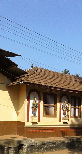
<span class="mw-page-title-main">Bantwal</span> Suburb in Dakshina Kannada, Karnataka, India

Bantwal is a suburb of Mangalore in Dakshina Kannada district, Karnataka, India, and the headquarters of Bantwal taluk. It is located 25 km (16 mi) East of Mangalore city center. BC Road-Kaikamba of Bantwal is one of the fastest developing areas in Dakshina Kannada district of Karnataka.

Talapady is a village near Mangaluru city in Ullal taluk of Dakshina Kannada district of Karnataka state in India. Talapady borders the states of Karnataka and Kerala. National Highway 66 passes through Talapady which is 14 km (9 mi) south of Mangalore city. The Karnataka-Kerala checkpost border is situated at Talapady. Another village Thalapady, Kasargod which is situated near Talapady in Manjeswar crossing Kerala border.
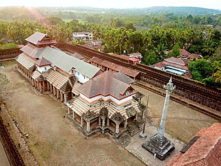
<span class="mw-page-title-main">Moodabidri</span> Town in Karnataka, India

Moodubidire is a town and taluk in Dakshina Kannada district. It lies 34 km northeast of the district headquarters, Mangalore, in Karnataka, India.

Chowta is a surname from coastal Karnataka in India. It is found among Jain Bunt & Hindu Bunt.

The Mariyamma Temple is situated in Boloor, India, dedicated to Goddess Mariyamma, situated approximately 5 km from Mangaladevi Temple in Mangalore city, Karnataka, India. It is believed that Mariyamma and Mangaladevi were sisters.

<span class="mw-page-title-main">Abbakka Chowta</span> Rani of Ullal

Rani Abbakka Chowta was the first Tuluva Queen of Ullal who fought the Portuguese in the latter half of the 16th century. She belonged to the Chowta dynasty, an indigenous Tuluva dynasty who ruled over parts of coastal Karnataka, India. Their capital was Puttige. The port town of Ullal served as their subsidiary capital. The Portuguese made several attempts to capture Ullal as it was strategically placed. But Abbakka repulsed each of their attacks for over four decades. For her bravery, she came to be known as Abhaya Rani. She was also one of the earliest Indians to fight European colonialism and is sometimes regarded as the 'first woman freedom fighter of India'. In the state of Karnataka, she is celebrated along with Rani Kittur Chennamma, Keladi Chennamma, Rani Chennabhairadevi and Onake Obavva, as the foremost women warriors and patriots.

Mangaloreans are a collection of diverse ethnic groups that hail from the historical locales of South Canara (Tulunaad) on the south western coast of Karnataka, India, particularly the residents native to Mangaluru.

<span class="mw-page-title-main">Karkala</span> Town in Karnataka, India

Karkala is a town and the headquarters of eponymous Karkala taluk in the Udupi district of Karnataka state in India. It lies near the foothills of the Western Ghats, Karkala has a number of natural and historical landmarks, and is a major tourist and transit destination due to its strategic location along the way to Hebri, Sringeri, Kalasa, Horanadu, Udupi, Kollur, Subrahmanya and Dharmasthala.

Mangalore taluk is a taluk (subdistrict) in the Dakshina Kannada district, Karnataka on the western coast of India. Mangalore is the administrative headquarters of the taluk. It is made up of Mangalore City Corporation, Ullal City Municipality that govern the Mangalore Urban Agglomeration, Other than these there are forty-nine panchayat villages in Mangalore taluk. It covers an area of 834 square kilometres (322 sq mi). Mangalore, Ullal and Moodabidri are the top 3 highly populated towns.

<span class="mw-page-title-main">Ullal beach</span> Beach in Mangalore, Ullal

Ullal Beach is situated on the southwestern seaboard of the Indian sub-continent, adjacent to Ullal town, 10 km south of the city of Mangalore, Karnataka, India. Attractions are its picturesque stretch of Coconut trees, fishermen's lane, the ruined fort of Abbakka Devi and 16th century Jain temples. A resort is also situated nearby.

<span class="mw-page-title-main">Ullal City Municipal</span>

The Ullal City Municipal is the municipal corporation responsible for looking after the city administration of the city of Ullal in Mangalore, Karnataka, India.
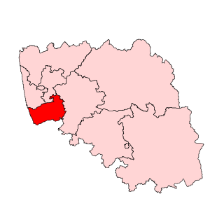
<span class="mw-page-title-main">Mangalore Assembly constituency</span> Constituency of the Karnataka legislative assembly in India

Mangalore Assembly constituency is one of the Karnataka Legislative Assemblies or Vidhan Sabha constituencies in Karnataka, India which belongs to Dakshina Kannada Lok Sabha constituency. Mangalore constituency, along with Mangalore City South and Mangalore City North, represents Mangalore City. The constituency has 45% Muslims population and 6% Christians.

<span class="mw-page-title-main">Tourist attractions in Mangalore</span>

The city of Mangalore is proclaimed as the gateway to Karnataka and lies nestled between the blue waters of the Arabian Sea and the green, towering hills of the Western Ghats. The 184 square km city is spread out over the backwaters of the two rivers, Netravati and Gurpura.

Banga Arasa or Banga Raja is the dynastic title of a medieval ruling family of coastal Karnataka, India. The word Banga is the name of a clan and a surname of the Bunts and the word Arasa or Raja means a ruler in the Tulu language. The dynasty followed the Bunt custom of matrilineal inheritance (Aliyasantana). The Banga Arasas claimed descent from the ancient Alupas and the rulers bore the Alupa royal title Pandyapparasa. The Banga Arasas were said to have been given control of 15 sub-divisions (Magane) of Southern Tulu Nadu by the Hoysala Ballal Emperor, Vira Narasimha. The Banga Arasas ruled from 1224 C.E until the conquest of South Canara by the British in 1799 CE. Descendants of the dynasty survive. However, the family seems to have stopped the coronation ritual after 1889 CE. Since the cessation of the coronation ritual no member of the family has borne the princely title Banga Arasa or Banga Raja instead preferring the aristocratic title Ballal. The dynasty patronized Jainism.They also built Hindu temples as well as shrines to deities of the Buta Kola folk tradition. Ullalthi, a form of the mother goddess worshiped in the Buta Kola tradition was the tutelary deity of the dynasty.

The Chowta dynasty was a Jain dynasty that ruled parts of the Tulu Nadu region during the 12th – 18th centuries.

<span class="mw-page-title-main">Rani Chennabhairadevi</span> Longest ruling queen in Indian history

Rani Chennabhairadevi,, was the 16th-century Jain queen of Nagire province under the Vijayanagara Empire. She was officially known as Mahamandaleshwari Rani Chennabhairadevi. She is regarded as being the longest ruling queen in Indian history, from 1552 to 1606, a period of 54 years. She is also known for her wars against the Portuguese in 1559 and 1570, which she won, which helped to start commercial relationships with the Portuguese.
References

  1. "50th Report of the Commissioner for Linguistic Minorities in India (July 2012 to June 2013)" (PDF). Archived from the original (PDF) on 8 July 2016. Retrieved 14 January 2015.
  2. "Urban Agglomerations and Cities having population 1 lakh and above" (PDF). Provisional Population Totals, Census of India 2011. The Registrar General & Census Commissioner, India. Archived from the original (PDF) on 10 March 2020. Retrieved 10 August 2014.
  3. "Ullal Beach Mangalore, India | Best Time To Visit Ullal Beach".
  4. Raviprasad Kamila (19 August 2015). "Sea erosion: Ullal project gains national focus". The Hindu.
  5. Ullal to be Kerosene Free City soon, as of 2015.
  6. Kerosene free city.
  7. Analysis of the 1931 Census of India
  8. Mangalore Urban Agglomeration Population
  9. Ullal upgraded to City Municipality
  10. Falling Rain Genomics, Inc – Ullal
  11. "Weather of Ullal, India". AccuWeather.
  12. 2011 Census Data