
Kasaragod ([kɑːsɑrɡoːɖɨ̆] formerly Kassergode in English, is a municipal town and administrative headquarters of Kasaragod district in the state of Kerala, India. Established in the year 1966, Kasaragod was the first municipal town in the district. It is the northernmost district of Kerala and is also known as Saptha Bhasha Sangama Bhoomi.
Kanhangad or Kanhangad is a located in the Kasaragod District, state of Kerala, India.

The Kerala backwaters are a network of brackish lagoons and lakes lying parallel to the Arabian Sea coast of Kerala state in southern India, as well as interconnected canals, rivers, and inlets, a labyrinthine system formed by more than 900 kilometres (560 mi) of waterways, and sometimes compared to American bayous. The network includes five large lakes linked by canals, both man made and natural, fed by 38 rivers, and extending virtually half the length of Kerala state. The backwaters were formed by the action of waves and shore currents creating low barrier islands across the mouths of the many rivers flowing down from the Western Ghats range. In the midst of this landscape there are a number of towns and cities, which serve as the starting and end points of backwater cruises. There are 34 backwaters in Kerala. Out of it, 27 are located either closer to Arabian Sea or parallel to the sea. The remaining 7 are inland navigation routes.

Karamana is a river flowing through the city of Thiruvananthapuram in Kerala, India. The river starts near the southern tip of the Western Ghats(Sahyadri Mountains) at Agastyar Koodam. The river flows 66 km westward and merges with the Arabian Sea at Panathura near Kovalam. The river gets its name from Karamana, a suburb of Thiruvananthapuram city, through which it flows.

The Chandragiri River also known as Perumpuzha River is the longest river in Kasaragod district, Kerala, India. It was named after the Mauryan emperor Chandragupta Maurya.

Kallada River/Kulathupuzha " Puzha "means River.Its's the longest river in Kollam District, Kerala, India.The river originates in Kulathupuzha,a part of Western Ghats and flows west reaching Arabian Sea after travelling a distance of 120km.

Kasaragod is one of the 14 districts in the southern Indian state of Kerala. Its northern border Thalappady is located just 10 km south to Ullal, which is the southernmost portion of the major port city Mangalore, on the southwestern Malabar coast of India.

Badiyadka officially known as "Badiadka" is a town and gram panchayat in the Kasaragod district, state of Kerala, India.

Karadka is a village, block panchayat and grama panchayat in Kasaragod district in the state of Kerala, India.

The Perumba River is a 51 km long river which flows through the Kannur and Kasargod districts of the Malabar region in Kerala, India. The town of Payyannur is situated on the banks of this river subsequently the river is locally known as Payyannur River.

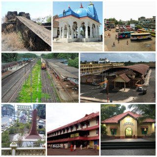
Hosdurg is one of four taluks that constitute the Kasaragod District, Kerala. Others are Kasaragod, Manjeshwaram and Vellarikundu taluks. In the north, it borders Kasaragod taluk; in south, the Kannur District; in the east, Vellarikundu taluk; and in the west, the Arabian sea. With an area of 900.3 km2, it was the smaller of the two taluks. Then Hosdurg bifurcated into Vellarikund and Hosdurg taluks in 2013 for ease of administration. Kanhangad and Nileshwaram are the municipalities within the taluk. Hosdurg is a kilometer south of Kanhangad town, the latter being the taluk headquarters. Other major settlements include Trikarpur, Cheruvathur and Udma. Bekal Fort tourism is situated in the taluk. The name Hosdurg comes from the Kannada word hosa ("new") and Sanskrit word durg ("fort").
Mogral Puthur is a gram panchayat in the Kasaragod District, state of Kerala, India. It is north of the town of Kasaragod, and it consists of two revenue villages. The village of Puthur is the northern portion of the roughly circular panchayat, and Kudlu encompasses the southern half. Mogral Puthur has on its west border the Arabian Sea; on the east is the Madhur panchayat; and on the north is the Mogral River. The total area of this "second-grade" panchayat is 14.23 square kilometers. The major business centers are: Puthur, Chowki, Padinhar and Eriyal.

Pavangad is a suburb included in Kozhikode corporation in the Kozhikode district of Kerala, India. It is located about 6.5 km north of Calicut on the Calicut-Kannur National Highway 66 (India) and is bounded by the Arabian Sea at the west, Canoli Canal at east and Korapuzha River at the north. State Highway 54 (Kerala) starts from Pavangad and ends in Kalpetta. Late Mr. K. T. Muhammed was a resident in Pavangad, popularly known as KT, was a Malayalam playwright and screenwriter. He died on 25 March 2008 at his residence. Pavangad is a fast-growing residential area towards the northern city limits of Kozhikode. Sneha Residence association is one of the major residential associations in this locality which consists of around 237 houses.

Kasaragod North is a suburb of Kasaragod city in north Kerala. It is located at the mouth of a lagoon formed by the Shiriya river. The following townships, suburbs and villages are part of Kasaragod North:

Kasaragod District is the northernmost district in the southwestern Indian coastal state of Kerala. The district has a long history starting from pre-historic times to modern period.
Shiriya River is a river flowing through the states of Karnataka and Kerala.
Uppala River is a river flowing through the states of Karnataka and Kerala.Uppala River is 50 km in long, making it the 26th longest river in Kerala. It originates from the Veerakamba hills in Dakshina Kannada district in Karnataka at an elevation of 150 metres above sea level, flows primarily in a westward direction, and empties into the Arabian sea in the backwaters near the town of Uppala located about 22 km north of Kasaragod town in Kerala. The river has a catchment area of 250 km2 of which 174 km2 is in Karnataka state.
Chittari River is a small river that flows through the village of Chithari near Kanhangad in Kasaragod district of Kerala. Malayalam: ചിത്താരിപ്പുഴ The Chittaripuzha is 25 km long and originates from Iriya Punur. The river, which passes through various encroachments, is now on the verge of destruction. The mangrove forests around the village of Chithari are unique. Leptarma biju, a crab not found anywhere else in the world, was discovered in these forests on September 4, 2020.
Puthur is a census town in Kasaragod district in the Indian state of Kerala. Puthur is a suburb of Kasaragod city.