
Edavanna is a town situated in Eranad Taluk of Malappuram District, Kerala, South India. The town is situated on Calicut–Nilambur–Gudalur state highway and near the banks of the Chaliyar River. The Koyilandy-Edavanna state highway ends here. Edavanna is part of the Eranad Assembly constituency and Wayanad Lok Sabha constituency.

Balussery is a town located about 25 km northeast of Kozhikode city and lies on State Highway 34. It is one of the 12 block Panchayats in Kozhikode district. Balussery is the Northeast side entry of Calicut city.
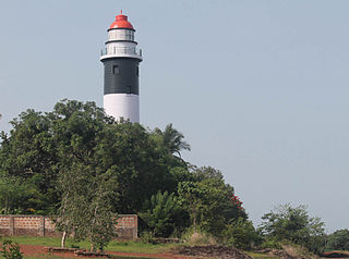
Koyilandy is a major town municipality and a taluk in Kozhikode district, Kerala on the Malabar Coast. The historical town is located right in the middle of the coast of Kozhikode district, between Kozhikode (Calicut) and Kannur, on National Highway 66.
Poonoor is a town in Kozhikode District, Kerala, India. The town is part of the Unnikulam Panchayath, within the Thamarassery Taluk of the Kozhikode District. Poonoor can be found on the banks of the Poonoor River 4.5 km west of Thamarassery and 8.5 km east of Balussery. The town is situated on Koyilandy-Edavanna Road State Highway 34 ]] that starts in Koyilandy and ends in Edavanna.

Mampad is a town in Malappuram district, Kerala, India. located about 08 km east of Nilambur city. Nearby places include Edavanna, Areacode, Manjeri, Wandoor and Pandikkad. It is under the Wandoor Assembly Constituency. Kozhikode-Nilambur-Gudalur SH pass through here. The Mampad town is now developing day to day. Most people are engaged in agriculture and business activities. Hindus, Christians and Muslims co-exist in harmony adding to the diversity in faith and religion. The land is famous for football. The land where Asif Zahir Mampad Rahman played. He contributed a lot to the Malappuram district.
Vattoli Bazaar is a small town situated 2 km east of Balusseri in the Koyilandy -Thamarassery state highway. The location is in Kozhikode district of Kerala state in India.
Kizhuparamba or Keezhuparamba is a village and Panchayath on the northern boundary of Malappuram District In Kerala State of India.

Thiruvangoor (തിരുവങ്ങൂർ) is a small village 16 kilometres (9.9 mi) away from Kozhikode, Kerala, India. It lies to the east of the Arabian Sea (Kappad) and west of Kuniyil Kadavu. Portuguese navigator Vasco de Gama is believed to have landed near Thiruvangoor, at Kappad, during one of his voyages, on 20 May 1498. Thiruvangoor lies on National highway 66.Nearby major towns are Atholi and Koyilandy. The Kuniyil Kadavu Bridge allows for transportation between Thiruvangoor and Atholi town.
Ulliyeri is a village in Kozhikode district in the state of Kerala, India. Ulliyeri is between Koyilandy and Balussery and also between Kuttiyadi and Kozhikode.

Mukkam is a major town in Kozhikode, state of Kerala, India. Mukkam is located about 27 km east of Calicut city on the bank of river Iruvanjippuzha, one of the major tributaries of river Chaliyar.
State Highway 2 is a State Highway in Kerala, India that starts from Thiruvananthapuram Peroorkada and ends near Thenmala Kollam by joining with Kollam-Tirumangalam NH-744. The highway is 73.2 km long. The major towns in this highway are Nedumangad, Palode and Kulathupuzha.
State Highway 6 is a State Highway in Kerala, India that starts in Kayamkulam and ends in Thiruvalla. The highway is 30.8 kilometres (19.1 mi) long.(NH66 to MC road)
State Highway 19 is a State Highway in Kerala that starts from Munnar and ends Kumily. The highway is 106.0 km long.
State Highway 28 is a State Highway in Kerala, India that starts at Valluvambram near Malappuram and ends at the state boundary. The highway is 65 km long.
State Highway 31 is a State Highway in Kerala, India that starts in Cherkala and ends at the state boundary at Adkasthala near Perla. The highway is 28.8 kilometres (17.9 mi) long.
State Highway 47 is a State Highway in Kerala, India that starts in Attingal and ends in Nedumangadu. The highway is 18.5 km long. It is a major highway in thiruvananthapuram district that interconnect two important towns Attingal and Nedumangad, And also the Road is the only way to connect the SH 1 |Main-Central Road and National Highway 66 from the north - eastern hilly areas of Nedumangad.
State Highway 65 is a State Highway in Kerala, India that starts in Parappanangadi and ends in Areacode. The highway is 44.1 km long.

Pavangad is a suburb included in Kozhikode corporation in the Kozhikode district of Kerala, India. It is located about 6.5 km north of Calicut on the Calicut-Kannur National Highway 66 (India) and is bounded by the Arabian Sea at the west, Canoli Canal at east and Korapuzha River at the north. State Highway 54 (Kerala) starts from Pavangad and ends in Kalpetta. Late Mr. K. T. Muhammed was a resident in Pavangad, popularly known as KT, was a Malayalam playwright and screenwriter. He died on 25 March 2008 at his residence. Pavangad is a fast-growing residential area towards the northern city limits of Kozhikode. Sneha Residence association is one of the major residential associations in this locality which consists of around 237 houses.
Viyyur is one of the 34 villages in Koyilandy thaluk of Kozhikode district.
Kozhikode district has an extensive network of road, rail and air travel services. Kozhikode city is the epicenter of the district. Vatakara and Thamarassery are other transport hubs.

