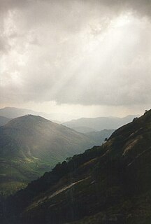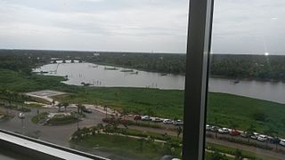
Idukki is one of the 14 districts of Kerala state, India, created on 26 January 1972. At that time, the district headquarters was at Kottayam. In June 1976 it was moved to Painavu. Idukki which lies in the Western Ghats of Kerala. Idukki is the second largest district in area but has the lowest population density. Idukki has a vast forest reserve area; more than a half of the district is covered by forests. The urban areas are densely populated whereas villages are sparsely populated. Idukki is also known as the spice garden of Kerala.

Thekkady is the location of the Periyar National Park, which is an important tourist attraction in the Kerala state of India.

Ernakulam refers to the central, mainland portion of the city of Kochi in central Kerala, India and has lent its name to the Ernakulam district. The Kerala High Court, the office of the Kochi Municipal Corporation and the Cochin Stock Exchange are situated here. The Ernakulam Junction is a major railway station of the Indian Railways. Initially, Ernakulam was the headquarters of the Ernakulam District but was later shifted to Kakkanad. Ernakulam was once the capital of the Kingdom of Cochin. It is located 220 kilometres (137 mi) north-west of the state capital Thiruvananthapuram. The city has served as an incubator for many Malayali entrepreneurs and is a major financial and commercial hub of Kerala.

Ponkunnam is a census town in the eastern high-ranges of Kerala, India, part of Kottayam district under Kanjirappally Taluk. Ponkunnam literally means 'The Town on a Golden Mountain'. Nearby towns are Kanjirappalli, Manimala and Pala. This part of Kerala is famous for its fertile land and rubber plantations. It is at an altitude of 495 feet above mean sea level. The town is at the junction of two major roads in Kerala: NH220 and main Eastern highway. The climate is moderate with timely cold breezes; the town is the gateway to the eastern high ranges.The town is famous for its volleyball traditions and customs. Almost every year there is an ever-rolling volleyball tournament happening in Ponkunnam Mahatma Gandhi Mini stadium.

Cheranallur or Cheranellore or Cheranelloor is a suburb of Kochi city in the state of Kerala, India and lies on the banks of the Periyar River. According to tradition, the area was named by its earlier inhabitants who found this place very fertile and beautiful. The name in its local language Malayalam means "Good Village of Cheras".

The Kerala Tourism Development Corporation (KTDC) is a public sector undertaking that conducts and regulates the tourism activities in the Indian state of Kerala. The KTDC is headquartered at Thiruvananthapuram and has offices across all the districts of Kerala. The agency also operates hotels, resorts, and tourist rest houses in key locations in the state. Its official slogan is "Official host to God's own country." It is one of the most profitable ventures of the Kerala government.

Peermade, also spelt Peerumedu is a hill station in the state of Kerala, India. It lies 915 metres (3,002 ft) above sea level in the Western Ghats (Sahyadri) some 85 kilometres (53 mi) east of Kottayam on the way to Thekkady through the nearby city of Kanjirappally.

Kumily is the largest Gram Panchayat in the Idukki district of Kerala. It is a town in Cardamom Hills near Thekkady and Periyar Tiger Reserve. Kumily is gateway town in Kerala to Tamil Nadu.

Nedumkandam is the headquarters of Udumbanchola taluk which is situated in Idukki district of the Indian state of Kerala. Nedumkandam is among the fastest growing towns in the Idukki district. Nedumkandam is well known for its spices production and is a major contributor to the production of spices like cardamom and pepper. This town situated an average elevation of 900 meter above sea level and maximum elevation respectively 1190 meter 1100 meter and 975 meter and is a destination for economical stay and shopping for tourists in the popular Kumily-Munnar tourist route.

Pattimattom is a village in Ernakulam district in the Indian state of Kerala. It is situated 17 km northwest of Muvattupuzha at the junction of Kolenchery-Perumbavoor Road and SH41 Palarivattom-Muvattupuzha Road. It is one of the main parts of Perumbavoor, situated in the middle of both Perumbavoor and Kolenchery.

Vandiperiyar (Malayalam:വണ്ടിപ്പെരിയാർ) is a town in Idukki district, Kerala, India. It is famous for tourism, tea and coffee plantations, black pepper and other spice products. A number of tea factories are situated here. The famous river Periyar flows through the city.

Thookupalam is a developing commercial centre lying about 10 kilometres (6.2 mi) from the Kerala-Tamil Nadu border in the Idukki district of Kerala, India. It lies on the banks of river Kallar and is one of the main tourist hubs between Thekkady, Munnar and Ramakkalmedu.

Kaloor is a downtown region in the city of Kochi, in the state of Kerala, India. It is just 2 km from the Ernakulam North Railway Station. Kaloor Junction is also the name of a major intersection in this part of the city, intersecting the two major arteries of downtown Kochi, namely Banerji Road and the Kaloor-Kadavanthra Road. The nearest major intersections are Palarivattom to the east and Lissie Junction to the west.

The Thekkady boat disaster occurred on 30 September 2009, when the double-decker passenger boat Jalakanyaka sank in Lake Thekkady, Periyar National Park, Kerala, India. When the boat capsized, 45 tourists died, most of them from Delhi and Kolkata. A total of 82 people were on the boat. The boat's helmsman, Victor Samuel, and another crew member were arrested on 5 October.

Thammanam is a region in the city of Kochi, in the state of Kerala, India. The region is classified as per official records as a suburban residential area within the Kochi city limit and falls under the Kannayanur taluk. Thammanam can be claimed to lie at the heart of the city, and is equidistant from crucial city junctions, namely Palarivattom and Vyttila. The Palarivattom-Vyttila connection road passes through Thammanam, and meets Ponnurunni and Pipeline Samskara Junction as well. Thammanam is connected to the commercial hub of Kochi- MG Road- which is situated at a distance of around 5 km, by a convenient road network through Kathrikkadavu. The region is also situated just a km from the main National Highway of Kerala connecting Trivandrum in the South to the North of Kerala.

The Kochi Bypass is a segment of NH66(National Highway 66) that bypasses the CBD of the city of Kochi in Kerala, India. The highway stretches 17 km from Edapally in the Ernakulam district to Aroor in Alappuzha district, via. Palarivattom, Vyttila, Kundannoor, Madavana, Kumbalam. The Government of Kerala began the preliminary works in 1973. After a slow progress, it was partially opened for traffic in the beginning years of the 1980s. The section between Edapally and Vyttila had four lanes from the beginning. The rest of the carriageway was also upgraded to different sections of 4 lane, 5lane and 6 lanes by 2010

Parunthumpara is a village in the Indian state of Kerala's Idukki District. It is a small scenic location near Wagamon en route to Peerumedu. Parunthin Para also known as 'Parunthumpara'. From here, the Makarajyothi of Sabarimala is visible. The main attractions of Parunthumpara are Suicide Point and Tagor Head. A nearby tourist spot is Thekkady.

Panchalimedu is a hill station and view point near Kuttikkanam in Peerumedu tehsil of Idukki district in the Indian state of Kerala. On the Makar Sankranti day, lots of Ayyappa devotees camps there to witness the sacred Makaravilakku that appears in the Ponnambalamedu near Sabarimala temple.


