
U.S. Route 21 or U.S. Highway 21 (US 21) is a north–south United States Numbered Highway, spanning 393 miles (632 km) from Hunting Island State Park, South Carolina, to Wytheville, Virginia. The route traverses three states, South Carolina, North Carolina, and Virginia. It connects southeastern cities, including Columbia, South Carolina, and Charlotte, North Carolina.

Anantapur, officially Anantapuramu, is a city in Anantapur district of the Indian state of Andhra Pradesh. It is the mandal headquarters of Anantapuru mandal and also the divisional headquarters of Anantapur revenue division. The city is located on National Highway. It was also the headquarters of the Datta Mandalam in 1799. It was also a position of strategic importance for the British Indian Army during the Second World War. The GDP of Anantapur City is $ 1.728 Billion.

Kalpetta is a major City, Town and municipality in the Wayanad district of the Indian state of Kerala. Kalpetta is the headquarters of Wayanad district, as well as the headquarters of Vythiri taluk. It is a bustling city, town surrounded by dense coffee and tea plantations and mountains. It lies on the Kozhikode-Mysore National Highway NH 766 at an altitude of about 780 m above sea level. Kalpetta is 72 km from Kozhikode and 140 km from Mysore.
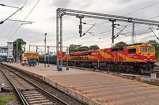
Guntakal is a City in Anantapur district of the Indian state of Andhra Pradesh. It is the headquarters of Guntakal mandal and Guntakal revenue division.It is also the headquarters of the Guntakal Railway Division in South Central Railway.

Hindupuram is a city in Sri Sathya Sai district of the Indian state of Andhra Pradesh. It is located to the edge of the Andhra–Karnataka border and is the headquarters of Hindupuram mandalam. Hindupuram is the Parliamentary Constituency in the newly formed District Sri Sathya Sai. It is located about 67 km from district headquarters Puttaparthi, 100 km from Bengaluru the capital of Karnataka, 95 km From Kadiri.
Neelangarai is a census town and is a locality in the south of Chennai. it is situated in Chennai district in the Indian state of Tamil Nadu about seven kilometers south of Adyar, Chennai. The former name of the city was Thiruneelakandapuram, named after the Thiruneelakandeshwarar temple. Neelankarai is located with Palavakkam in the north, Vettuvankeni in the south, Thoraipakkam in the west and the Bay of Bengal in the east. Over the years Neelankarai has developed tremendously and has made a significant name for itself in popularity for various reasons.

Lakkidi is a rain forest located in a gateway of the Wayanad district of the Indian state of Kerala. During British Raj, a horse track in Wayanad attracted European investors and traders. They cultivated Malabar pepper, spices, tea, and coffee. National Highway 766 connects Kozhikode in Kerala with Kollegal in Karnataka via Mysore, creating business opportunities in tourism and agriculture. Lakkidi is surrounded by a biodiverse environment and unspoiled nature which attracts visitors interested in bird-watching, trekking, and off-roading. Jawahar Navodaya Vidyalaya is situated there.

Lakkidi or Lakkidi Perur is a small village in Ottapalam Taluk of Palakkad district, Kerala, India. It is located 23 km west of Palakkad on the Palakkad - Pattambi Road. The nearest town is Ottapalam, which is 10 km away. Lakkidi is situated 303 km from the state capital, Thiruvananthapuram. The pin code of Lakkidi Post Office is 679301 and the STD code is 0466.
Lakkidi-Perur-I is a village in Palakkad district in the state of Kerala, India.
Lakkidi-Perur-II is a village in Palakkad district in the state of Kerala, India.
In India, this is the network of roads maintained by the state governments. These roads are constructed and managed by the states' Public Works Department. The state highways are usually roads that link important cities, towns and district headquarters within the state and connect them with National Highways or state highways of neighbouring states.
State Highway 74 is a State Highway in Kerala, India that starts in Vazhakode and ends in Alathur. The highway is 33.69 km long. The road connects important towns Chelakkara and Pazhayannur

Vythiri is a village located in Wayanad district in the Indian state of Kerala. Along with Mananthavady and Sulthan Bathery, it is one of the three taluks in the district.

National Highway 766 is a National Highway in Southern India. NH 766 connects Kozhikode in Kerala with Kollegal in Karnataka via Mysore. Of the total distance of 272 km, 117 km is in Kerala and 155 is in Karnataka. At Kollegal, it joins National Highway 948, which connects Bengaluru and Coimbatore. The highway passes through dense forests of Western ghats of India. The NH-766 passes through 19.7 km Bandipur National Park and Wayanad wild life sanctuary.
National Highway 325 (NH 325) is a National Highway in India that connects Balotra, Rajasthan, with Sanderao, Rajasthan. The total length of NH 325 is 135 kilometres (84 mi). This highway connects NH 25 in Balotra to NH 62 in Sanderao.

The district capital of Wayanad is Kalpetta town. Kalpetta has very good road connectivity with the rest of Kerala and neighboring South Indian cities. National Highway 766 (India) NH766 connects Kalpetta with Kozhikode and Mysore. State Highways connect Kalpetta with Ooty in Tamil Nadu and Madikeri in Karnataka.

National Highway 77 is a National Highway in India. This is the main National Highway to connect Pondicherry with Krishnagiri. It starts from Tindivanam in Villupuram district then runs westward till Uthangarai via Thiruvannamalai and then joins NH 48 at Krishnagiri. NH-77 runs entirely in the state of Tamil Nadu.

Thamarassery Churam is a mountain pass in Kerala, India across the Western Ghats. "Churam" is the Malayalam word for 'mountain pass'. It is a part of the National highway 766.
National Highway 133B, commonly referred to as NH 133B is a national highway in India. It is a spur road of National Highway 33. NH-333B traverses the states of Jharkhand and Bihar in India.
National Highway 179A, commonly referred to as NH 179A, is a national highway in India, which comes under Ministry of Road Transport & Highways, Government of India. It is a secondary route of National Highway 79. NH-179A traverses the state of Tamil Nadu in India.

