
Kottayam is one of fourteen districts in the state of Kerala, India. Kottayam district comprises six municipal towns: Kottayam, Changanassery, Pala, Erattupetta, Ettumanoor, and Vaikom. It is the only district in Kerala that neither border the Arabian Sea nor any other states.

Ernakulam, IPA: [erɐɳɐːguɭɐm]; IAST: Eṟaṇākuḷaṁ, in Malayalam: എറണാകുളം) is a district of Kerala, India, that takes its name from the eponymous city division in Kochi. It is situated in the central part of the state, spans an area of about 3,000 square kilometres (1,200 sq mi), and is home to over 9% of Kerala's population. Its headquarters are located at Kakkanad. The district includes Kochi, also known as the commercial capital of Kerala, which is famous for its ancient Hindu temples, churches, synagogues and mosques. The district includes the largest metropolitan region of the state: Greater Cochin. Ernakulam is the district that yields the most revenue and the largest number of industries in the state. Ernakulam is the third most populous district in Kerala, after Malappuram and Thiruvananthapuram. The district also hosts the highest number of international and domestic tourists in Kerala state.

Pathanamthitta District is a district in the southern part of Kerala, India. The district headquarters is in the town of Pathanamthitta. There are four municipalities in Pathanamthitta: Tiruvalla, Adoor, Pathanamthitta and Pandalam.

Wayanad, is an Indian district in the north-east of Kerala state with administrative headquarters at the municipality of Kalpetta. It is the sole Plateau in Kerala. The Wayanad Plateau forms a continuation of Mysore Plateau, which is the southern portion of Deccan Plateau. It is set high on the Western Ghats with altitudes ranging from 700 to 2100 meters. Vellari Mala, a 2,240 m (7,349 ft) high peak situated on the trijunction of Wayanad, Malappuram, and Kozhikode districts, is the highest point in Wayanad district. The district was formed on 1 November 1980 as the 12th district in Kerala by carving out areas from Kozhikode and Kannur districts. About 885.92 sq.km of area of the district is under forest. Wayanad has three municipal towns—Kalpetta, Mananthavady and Sulthan Bathery. There are many indigenous tribals in this area. The Kabini River, which is a tributary of Kaveri River, originates at Wayanad. Wayanad district, along with the Chaliyar valley in neighbouring Nilambur region in Malappuram district, is known for natural Gold fields, which is also seen in other parts of Nilgiri Biosphere Reserve. Chaliyar river, which is the fourth longest river of Kerala, originates in Wayanad plateau. The historically important Edakkal Caves are located in Wayanad district.

Idukki (ഇടുക്കി), IPA: [iɖukːi], is a district in the Indian state of Kerala. It was constituted on 26 January 1972, by splitting the district of Kottayam into two parts. Its division was previously headquartered at Kottayam city, but moved to Kuyilimala near Painavu and Cheruthoni in June 1976. Idukki district lies amid the Cardamom Hills of Western Ghats in Kerala.
Kollam district is one of 14 districts of the state of Kerala, India. The district has a cross-section of Kerala's natural attributes; it is endowed with a long coastline, a major Laccadive Sea seaport and an inland lake. The district has many water bodies. Kallada River is one among them, and the east side land of river is East Kallada and the west side land is West Kallada.

Thiruvambady is a major hill town and a suburb in southeastern Kozhikode district in Kerala, India. Thiruvambady is a Panchayat headquarters, and a legislative assembly constituency, situated 35 kilometres (22 mi) from the district headquarters of Kozhikode.

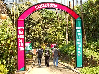
Vagamon is an Indian hill station and a revenue village primarily located in Peerumedu taluk of Idukki district, and also Meenachil taluk and Kanjirappally taluk of Kottayam district in the state of Kerala, India... Gifted with magnificent hill formations, natural attractions and panoramic views Vagamon has emerged as a major tourist destination in the recent times comparable with places like Munnar and Kumarakam in popularity.

Peermade, also spelt Peerumedu is a village, Grama Panchayat and hill station in the state of Kerala, India. It lies 915 metres (3,002 ft) above sea level in the Western Ghats (Sahyadri) about 85 kilometres (53 mi) east of Kottayam on the way to Thekkady through the nearby city of Kanjirappally.
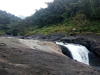
Thusharagiri Falls is a waterfall located in Kozhikode district in the Indian state of Kerala, India.

Rajakkad is a town in the Idukki district in the Indian state of Kerala situated in the Western Ghats.

Vechoor is a village in Vaikom taluk, Kottayam district in the state of Kerala, India. Vechoor is a short drive away from one of Kerala's tourist destinations, Kumarakom. The Vechur Cow breed of cattle is named after this village.
Kodanchery is a town in Kozhikode district in the state of Kerala, India.

Thamarassery, formerly known as Thazhmalachery, is a major town in the Kozhikode district of Kerala, India, 30 km north-east of Kozhikode (Calicut) City and 29 km east of Koyilandy. It lies on the Calicut - Wayanad - Mysore route.
Mukkam is a major municipality town in Kozhikode, state of Kerala, India. Mukkam is one of the major regional suburb of the Kozhikode district. Mukkam is located about 27 km east of Calicut city on the bank of river Iruvanjippuzha, one of the major tributaries of river Chaliyar. Mukkam is also well knows for its secularistic features. The urban region of Mukkam is spread across Mukkam Municipality and the North Karassery region of Karassery Grama Panchayath. The town begins from North Karassery junction region and runs till Agasthianmuzhi Junction region.

Aripara Falls [alternate spelling: Arippara Falls (അരിപ്പാറ)] is a tourist spot in Anakkampoyil near Thiruvambady Town in Kozhikode district, Kerala. It is located on the Thiruvambady - Anakkampoyil route, 15 km from Thiruvambadi. The waterfall is a tributary of Iruvanjippuzha. There is a proposal for implementing a hydro power project on the Arippara waterfall.
Kakkadampoyil, is a small village between the border of Kozhikode and malappuram district in Kerala, India. The village has recently emerged as a major tourist destination in the district.

Anakkara is a geographic area of around 50 square kilometres that spans across Vandanmedu, Chakkupallam Panchayats in the Udumbanchola Taluk of Idukki District. Anakkara is the administrative capital of Chakkupallam Gram Panchayat and Anakkara Revenue Village. Situated at about 18 Kilometers from Thekkady wildlife sanctuary on the Kumily-Munnar state highway, Anakkara is a fast-growing tourist destination for its unique spice gardens and many picnic spots in and around. It is one of the 36 distinct places identified by Government of India and United Nations Development Programme for exploring and promoting the unique tourism potential of these places.
Pullurampara, is a village situated near the town of Thiruvambady in the Calicut district of the Indian state of Kerala. It is approximately 42 km from Calicut and is in two panchayats, Thiruvambady and Kodencheri. Iruvanjippuzha river flows through Pullurampara. The two main junctions in Pullurampara are Pallippadi and Pullurampara valiyangaadi. St. Alphonsa Playground is the main Park. St. Joseph's Church is located in Pallippadi.

Poovaranthode is a small village located in Kozhikode District, Kerala, India. As a hilltop village, it is one of the coolest places in the Malabar region. Poovaranthode has a generally humid tropical climate with a very hot season extending from March to May. The average annual rainfall is more than 3500 mm, the highest in Kozhikode district. Hindus, Christians, and Muslims coexist in harmony. It is an agricultural area and a large portion of its population are farmers. Nutmeg, cocoa, cashew, Banana and coconut are the major products. Nowadays people are used to doing pig farming and poultry farming too.

