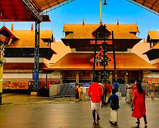
GuruvayurIPA:[guɾuʋɐːjuːr]) is a municipal temple town in Thrissur district, of Kerala State in India. It is a suburban town of Thrissur city, located 27 kilometres (17 mi) from Thrissur towards the north-west. It houses the Guruvayur Shri Krishna Temple. It is located at a distance of 292 km (181 mi) from the state capital Trivandrum towards the north-west, 80 km (50 mi) from Kochi towards the north, 90 km (56 mi) from Calicut towards south.

Attingal is a municipality in Thiruvananthapuram metropolitan area in Thiruvananthapuram district of Kerala state, India. It was the location of the Attingal kingdom, under Travancore. It is the headquarters of Chirayinkeezhu Taluk, and the important government institutions of the taluk such as the Taluk office, court complex, office of the deputy superintendent of Police, civil station, and treasuries are situated in Attingal. It is one of the oldest municipalities of Kerala which was constituted prior to its independence in 1924. In 1914 itself Attingal Town Improvement Authority (TIA) was formed which was the term used before the municipality regulation act of 1922. Attingal Town is located 25 kilometres (16 mi) north of Thiruvananthapuram. Attingal is the 3rd densely populated municipality in the district.

Nedumangad is a municipal town in the Thiruvananthapuram district in the Indian state of Kerala. It is the headquarters of Nedumangad Tehsil and Nedumangad Revenue Division. It is a suburb of the extended metropolitan region of Thiruvananthapuram. It is located around 16 km (9.9 mi) to the north-east of Thiruvananthapuram on the State Highway 2. It is an important commercial center in the district. It is a growing commercial and educational hub and all important government institutions are situated in the town. The Nedumangadu market has significance in southern Kerala.

Thiruvananthapuram District is the southernmost district in the Indian state of Kerala. The district was created in 1949, with its headquarters in the city of Thiruvananthapuram, which is also Kerala's administrative centre. The present district was created in 1956 by separating the four southernmost Taluks of the erstwhile district to form Kanyakumari district. The city of Thiruvananthapuram is also known as the Information technology capital of the State, since it is home to the first and largest IT park in India, Technopark, established in 1990. The district is home to more than 9% of total population of the state.

Shankumugham Beach is a beach in Thiruvananthapuram district of Kerala, south India. The beach is on the western side of Thiruvananthapuram (Trivandrum) and is very close to Trivandrum International Airport.

Kilimanoor is a panchayat and a town in the Chirayinkeezhu taluk of Thiruvananthapuram district in Kerala, India. It is located on MC/SH 1 Road, 33 kilometres (21 mi) North-west of the city of Thiruvananthapuram (Trivandrum), 14 km (8.7 mi) east of Attingal and 20 km (12 mi) east of Varkala.

Chathannoor is a town in the Indian state of Kerala situated at the Kollam District on the banks of Ithikkara River. It is about 16 km (9.9 mi) from Kollam(Quilon) City. Chathannoor is around 55 km (34 mi) north of the state capital Thiruvananthapuram(Trivandrum). Chathannoor is a Special Grade Panchayath and is one of the fastest developing towns in Kerala.. Shri ChandraKumar is the current president of Chathannoor Grama Panchayat.
Kattakada is a town in Thiruvananthapuram district of Kerala. It is situated 13 km north of Neyyattinkara town, 18 km south of Nedumangad town and 20 km east of the Capital City, Thiruvananthapuram.
Alamcode is a census town and neighbourhood of Attingal in Thiruvananthapuram district of Kerala, India. The nearest Airport is Trivandrum International Airport (33 km) and Kadakkavur Railway Station (6.3 km) is the nearest Railway Station.

Kadakkavoor is a developing special grade town consisting central government postal office, railway station, sub treasury, police station, electricity board, telecom office and banks; Thiruvananthapuram district in the state of Kerala, India.
Karakulam is a panchayat in Nedumangad Taluk in Thiruvananthapuram District in the state of Kerala, India. It is the most populated panchayat in the district according to 2011 census.
Malayinkeezhu is a suburb of Trivandrum, the largest city and capital of the Indian state of Kerala. It is located at the south-eastern side of Thiruvananthapuram Metropolitan Area, and is at a distance of 13 km from the heart of the city. The town is famous for the religious festival named Malayinkeezhu Aarattu. Neyyar Wildlife Sanctuary, one of the major tourist destinations in Thiruvananthapuram district is situated 17 km away from the town. The nearest airport is Trivandrum International Airport (16 km) and Balaramapuram Railway Station (9.1 km) is the nearest Railway Station. The Pincode of Malayinkeezhu Post Office is 695571 which comes under the postal circle of Neyyattinkara region.
Vamanapuram is a village in the Thiruvananthapuram district of Kerala, India. It is the location of Shri 'Vamana', one of the ten incarnations of Maha Vishnu. The Lord Vamana temple is situated here, which is reflected in the name Vamanapuram, meaning, 'the city of the lord Vamana'.
Vattappara is a village in Thiruvananthapuram district in the state of Kerala, India. , well known for its geographical peculiarities with quarries that are generally used for extracting building materials (rock).This town is by the side of MC Road connecting Trivandrum and Kottayam and 14 km away from Trivandrum City. The nearest township is Nedumangad.There is no recorded history on the origin of this place. The major occupation in Vattappara is farming(Rubber, Coconut).
Vellarada is a border village situated in Thiruvananthapuram district in the state of Kerala, India. It is 42 km from Thiruvananthapuram. It is the southernmost part of Kerala state, sharing its border with Tamil Nadu. Vellarada is said to be the threshold to the high-range areas of the eastern part of Thiruvananthapuram district. The southernmost point of Western Ghats in Kerala is near Vellarada.
Kallambalam is a suburb of Varkala Town situated in Thiruvananthapuram district. Kallambalam joins Varkala with National Highway 66. It is 36 km north from state capital Trivandrum, 8 km East of Varkala and 12 km West of Kilimanoor.

Anchuthengu, formerly known as Anjengo, Angengo or Anjenga, is a coastal panchayath and town in the Thiruvananthapuram District of Kerala. It is situated 9km south-west of Varkala Town along Trivandrum - Varkala - Kollam coastal highway.
Venjaramoodu is a north-east suburb of Trivandrum city, the capital of Kerala. It is 9 km (5.6 mi) east of Attingal, 11 km (6.8 mi) northwest of Nedumangad and 12 km (7.5 mi) northeast of Trivandrum City.

Avanavanchery Sri Indilayappan Temple is a popular Hindu temple in Attingal of Thiruvananthapuram district, Kerala. The temple is dedicated to Lord Indilayappan and is one of the oldest temples in the state of Kerala. Lord Indilayappan is worshipped by devotees for getting good health, courage and better life prospects.
Pazhanchira Devi Temple is a Hindu temple situated between Ambalathara and Paravankunnu in Thiruvananthapuram district of Kerala state, India. It is about 3.2 km (2.0 mi) to the south of Padmanabhaswamy temple in Thiruvananthapuram. The temple is 8 km (5.0 mi) from Kovalam beach, 4 km (2.5 mi) from Trivandrum International Airport, 3 km (1.9 mi) from Thiruvananthapuram, 3 km (1.9 mi) from Attukal temple and 2 km (1.2 mi) from Thiruvallam Parasurama temple. This heritage structure is placed under the list of monuments of national importance.


