Thiruvananthapuram, formerly known as Trivandrum, is the capital city of the Indian state of Kerala. It is the most populous city in Kerala with a population of 957,730 as of 2011. The encompassing urban agglomeration population is around 1.68 million. Located on the west coast of India near the extreme south of the mainland, Thiruvananthapuram is a major information technology hub in Kerala and contributes 55% of the state's software exports as of 2016. Referred to by Mahatma Gandhi as the "Evergreen city of India", the city is characterised by its undulating terrain of low coastal hills.

Neyyattinkara, is a significant municipal town and a prominent center for both industry and commerce, positioned at the southernmost tip of the Thiruvananthapuram metropolitan area in Trivandrum, the capital of Kerala State. It also serves as the administrative headquarters of Neyyattinkara Taluk.Nestled along the banks of the Neyyar River, one of the district's principal rivers, the town derives its name from its location, with 'Neyyatinkara' in Malayalam translating to 'the shore of the river Neyyar.' Neyyattinkara ranks as the second most densely populated municipality in the district, following Varkala. Notably, the Vizhinjam International Seaport Thiruvananthapuram is situated within Neyyattinkara Taluk."

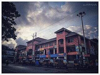
Nedumangad is a municipal town in the Thiruvananthapuram district in the Indian state of Kerala. It is the headquarters of Nedumangad Tehsil and Nedumangad Revenue Division. It is a suburb of the extended metropolitan region of Thiruvananthapuram. It is located around 16 km (9.9 mi) to the north-east of Thiruvananthapuram on the State Highway 2. It is an important commercial center in the district. It is a growing commercial and educational hub and all important government institutions are situated in the town. The Nedumangadu market has significance in southern Kerala.

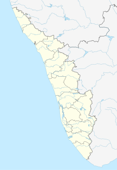
Thiruvananthapuram District is the southernmost district in the Indian state of Kerala. The district was created in 1949, with its headquarters in the city of Thiruvananthapuram, which is also Kerala's administrative centre. The present district was created in 1956 by separating the four southernmost Taluks of the erstwhile district to form Kanyakumari district. The city of Thiruvananthapuram is also known as the Information technology capital of the State, since it is home to the first and largest IT park in India, Technopark, established in 1990. The district is home to more than 9% of total population of the state.
Nemom is an area in the city of Thiruvananthapuram. It is surrounded by Thirumala in the north, Malayinkeezhu in the north-east, Balaramapuram in the south-east, Kovalam in the south and Thiruvallam in the west. Nemom falls within the municipal corporation of Thiruvananthapuram, though partly exclusive. It is connected with Thiruvananthapuram, Neyyattinkara, Vizhinjam, Poovar, Kattakkada, Nagarcoil, and Kanyakumari through the main arterial highway National Highway 66.

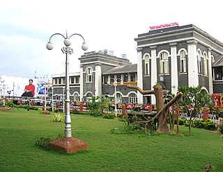
Thiruvananthapuram Central, or Trivandrum Central, is a major railway station that serves the city of Thiruvananthapuram, the capital of Kerala in India. It is Kerala's busiest railway station and a Southern Railway hub. The station, a Thiruvananthapuram landmark, is in the center of the city (Thampanoor) opposite the central bus station.
Kattakada is a town in Thiruvananthapuram district of Kerala. It is situated 13km north of Neyyattinkara town, 18km south of Nedumangad town and 20km east of Capital City Thiruvananthapuram.
Kanjiramkulam is an educational hub in Trivandrum Thiruvananthapuram district of Kerala State, India and is located on Thiruvananthapuram – Kanyakumari NH 66 bypass signal junction and in between Neyyattinkara, municipality – Vizhinjam International mother port. It is located 4.5 km from Neyyattinkara town and 22 km from the Kerala State capital Thiruvananthapuram. The Indian Postal PIN Code of this village is 695 524. The nearest railway station is Neyyattinkara Railway Station (6 km) and the nearest airport is Thiruvananthapuram International Airport (27 km). The people well educated and spread all over the world. Kanjiramkulam residence association is the registered NGO in panchayath. Major water source Kanjiramkulam pond.
Maranalloor is a village in Thiruvananthapuram district in the state of Kerala, India.
Pappanamcode(Abode of Mahouts) is a locality of Thiruvananthapuram, the capital of Kerala, India. Only 5 km from Trivandrum central railway station and bus stand. It is one of the major industrial centres in Trivandrum.
The Indian city of Thiruvananthapuram has a well-developed transport infrastructure. The city and its suburbs may be traversed using road and rail. Within the city, city buses, taxis and auto rickshaws provide mobility. Scooters and motorcycles are the favored means of personal transport. Ola, Uber and other taxi services operate there.
Thiruvananthapuram Railway Division (TVC) or Trivandrum Railway Division(TVC) is one of the six administrative divisions of the Southern Railway, Indian Railways. It has its headquarters at Thiruvananthapuram, the capital city of the state of Kerala, India. Thiruvananthapuram Division was formed on 2 October 1979which serves the eight districts of southern part of the Kerala, Kanniyakumari district and some parts of Tirunelveli District in Tamil Nadu. With 104 stations in its territorial jurisdiction, it is the fourth largest out of six divisions in Southern Railway. It is the southernmost railway division of India and manages 625 km of route track and 108 railway stations in the states of Kerala and Tamil Nadu. The major stations of the division are Thiruvananthapuram Central, Ernakulam Junction, Kollam Junction, Thrissur, Kottayam, Ernakulam Town, Chengannur, Kayamkulam, Aluva, Nagercoil Junction, Kanniyakumari,Changanasseri, Tiruvalla, Kochuveli, Varkala,Mavelikara,Karunagappally.
Arikkadamukku is a place in Thiruvananthapuram district, Kerala, India. It is located 9 kilometres (5.6 mi) south of Thiruvananthapuram city centre and is a part of Pallichal village. It is connected with Trivandrum, Neyyattinkara, Vizhinjam, Poovar, Kattakkada, Nagarcoil, and Kanyakumari through the nearby National Highway 66. A Post Office is available in Arikkadamukku and Nemom railway station near Arikkadamukku The pincode is 695020.

Kollam Junction railway station is a junction station situated in the city of Kollam in Kerala, India. It is the second largest railway station in Kerala in terms of area and largest in terms of number of tracks and one of the oldest railway stations in the state. It is also the second busiest railway station in Kerala in terms of trains handled per day. World's third longest railway platform is situated at Kollam railway station.

Paravur railway station(Code:PVU) is a railway station in the Indian municipal town of Paravur in Kollam district, Kerala. Paravur railway station falls under the Thiruvananthapuram railway division of the Southern Railway zone of Indian Railways. It is a 'NSG 5' class railway station coming under the Southern Railway zone.

Madurai railway division is a railway division belonging to the Southern Railways (SR), India. Officially created in 1956, it spans over 1,356 km (843 mi) making it the largest railway division of the Southern Railways. Prior to the formation of the Thiruvananthapuram railway division which was carved out of the division, it was one of the largest railway divisions in the whole of the country. Currently it covers up to 12 districts of Tamil Nadu and 1 in Kerala. Its headquarters is in Madurai.

Kannur has a good road network connecting to Bangalore, Mangalore, Kodagu and Cochin. The railway station is also well connected to all parts of India. There is new International airport from Kannur opened on 9 December 2018, other nearest airports are at Calicut and Mangalore. Thalassery, Payyanur, Taliparamba and Iritty are the other transport hubs.
Kottamom is a village in the Neyyattinkara Taluk which is part of the Thiruvananthapuram district of Kerala, a state in India. Kottamom comes under Chenkal Panchayat and comes under the South Kerala Division. Kottamom is located 4 km from Parassala, 5.5 km from Neyyattinkara, and 30 km from Thiruvananthapuram. This village has a post office, and comes under the Thiruvananthapuram pin code - 695122.
The Thiruvananthapuram–Nagercoil–Kanyakumari line is a line in the Southern Railway zone of Indian Railways. It connects the cities Thiruvananthapuram and Nagercoil. The railway opened on 15 April 1979. This is the southernmost section of Indian Railways. The terminus of the line is at Kanyakumari railway station.