In 1901, Chakrata Tehsil was part of the Dehradun district, of United Provinces, with a collective population of 51,101, which consisted of the towns of Chakrata (population 1250) and Kalsi, with a population of 760,[2] which is most known for the rock edict of the Mauryan king Ashoka 2nd century BC, first discovered by John Forest, in 1860.[3]
The cantonment
A cantonment of British Indian Army, was established in 1869 [4] by Colonel Hume of the 55th Regiment, British Indian Army,[5] and the troops and officers first occupied the cantonment in April 1869.[1]
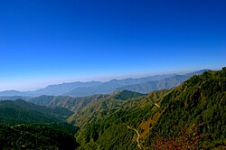
View from Deoban of Chakrata
Chakrata is an access-restricted military cantonment, and foreigners face severe restrictions in visiting. Notably, it is the permanent garrison of the Research & Analysis Wing's two special forces units; the Special Frontier Force and Special Group. Weapons and survival training is also imparted by other intelligence services in Chakrata, in support of Indian foreign policy goals, especially pertaining to other countries in the Indian Subcontinent.
Tourism and transportation
Misty mornings at Budher forest rest houseForest Rest House – DeobanAncient Wooden Mahasu Devta Temple at Hanol.
Chakrata can be reached from Dehradun via Mussoorie or Vikasnagar passing through Kalsi Gate.
Tiger Falls is one of the highest direct waterfalls in Uttarakhand. It is 20km from Chakrata and has an elevation of 312ft.
Manjhgaon is an ancient Hindu temple dedicated to Lord Shiva. It is called Massu Devta in regional language. It is 15 kilometres from Chakrata market. It is the oldest temple in the region.
Demographics
As of 2011[update] India census,[6] Chakrata town falls under 15.70 square km. There are 759 households, and urban Chakrata has a population of 5,117 of which males are 3,717 (73%) and females 1,400 (27%). 73% of the population falls under the general category, while 11% are from schedule caste and 17% are schedule tribes. Child (aged under 6 years) population of Chakrata (CB) cantonment board is 7%, among them 54% are boys and 46% are girls. There are 759 households in the city and an average 7 persons live in every family. 84% of the population (4,293 persons) is 'literate'.[7]
The sub-district Chakrata has a total population of 67,258, with 34,938 males and 32,320 females. The total area of the sub-district is 542.59 square km. Apart from the area under the cantonment board, Chakrata falls under the 'rural' category.[8]
In the sub-district, the demographics are starkly different from the urban area, with 34.6% (23,265 persons) belonging to Scheduled castes, and 54.9% (36,919 persons) to Scheduled Tribes. 51.2% of the population, i.e. 34,440 persons are 'literate'.[6]
Civic Administration
The urban area of Chakrata falls under the jurisdiction of the Urban Local Body in Chakrata, the Cantonment Board (CB). There are 6 wards.[6] The cantonment board consists of 12 members, including 6 elected members.[9]
This page is based on this Wikipedia article Text is available under the CC BY-SA 4.0 license; additional terms may apply. Images, videos and audio are available under their respective licenses.


