Related Research Articles
New Tehri is a city and a municipal board in Tehri Garhwal District in the Indian state of Uttarakhand. It is the administrative headquarters of Tehri Garhwal District. This urban municipality area has 11 wards, from Vidhi Vihar to Vishwakarma Puram.

Dehradun, also known as Dehra Doon, is the capital and the most populous city of the Indian state of Uttarakhand. It is the administrative headquarters of the eponymous district and is governed by the Dehradun Municipal Corporation, with the Uttarakhand Legislative Assembly holding its winter sessions in the city as its winter capital. Part of the Garhwal region, and housing the headquarters of its Divisional Commissioner. Dehradun is one of the "Counter Magnets" of the National Capital Region (NCR) being developed as an alternative center of growth to help ease the migration and population explosion in the Delhi metropolitan area and to establish a smart city in the Himalayas. It is the third largest city in the Himalayas after Kathmandu and Srinagar.

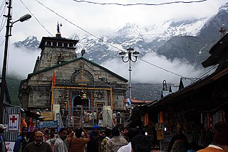
Uttarakhand, also known as Uttaranchal, is a state in northern India. It is often referred to as the "Devbhumi" due to its religious significance and numerous Hindu temples and pilgrimage centres found throughout the state. Uttarakhand is known for the natural environment of the Himalayas, the Bhabar and the Terai regions. It borders the Tibet Autonomous Region of China to the north; the Sudurpashchim Province of Nepal to the east; the Indian states of Uttar Pradesh to the south and Himachal Pradesh to the west and north-west. The state is divided into two divisions, Garhwal and Kumaon, with a total of 13 districts. The winter capital of Uttarakhand is Dehradun, the largest city of the state, which is a rail head. Gairsain, a town in Chamoli district, is the summer capital of Uttarakhand declared on 5 March 2020. The High Court of the state is located in Nainital, but is to be moved to Haldwani in future.

Garhwali is an Indo-Aryan language of the Central Pahari subgroup. It is primarily spoken by over 2.5 million Garhwali people in the Garhwal region of the northern Indian state of Uttarakhand in the Indian Himalayas.
Gairsain is a town in Chamoli district of the Indian state of Uttarakhand near state's summer capital Bhararisain. A town and Nagar Panchayat, Gairsain is situated at the eastern edge of the vast Dudhatoli mountain range, and is located in Chamoli district almost at the centre of the state, at a distance of approximately 250 kilometres from Dehradun. It is easily accessible from both the Garhwal and the Kumaon divisions, and in a way, acts as the bridge between the two regions. It is being considered as the future Permanent capital of Uttarakhand.
Dehradun district is a district in Garhwal which is a part of Uttarakhand state in northern India. The district headquarters is Dehradun, which has also served as the interim capital of Uttarakhand since its founding in 2000. The district has 6 tehsils, 6 community development blocks, 17 towns and 764 inhabited villages, and 18 unpopulated villages. As of 2011, it is the second most populous district of Uttarakhand, after Haridwar. Dehradun district also includes the prominent towns of Rishikesh, Mussoorie, Landour and Chakrata. The district stretches from the Ganges river in the east to the Yamuna river in the west, and from the Terai and Shivaliks in the south and southeast to the Great Himalaya in the northwest. During the days of British Raj, the official name of the district was Dehra Dun. In 1842, Dun was attached to Saharanpur district and placed under an officer subordinate to the Collector of the district but since 1871 it is being administered as separate district.
Pauri Garhwal is a district in the Indian state of Uttarakhand. Its headquarters is in the town of Pauri. It is sometimes referred to simply as Garhwal district, though it should not be confused with the larger Garhwal region of which it is only a part of.

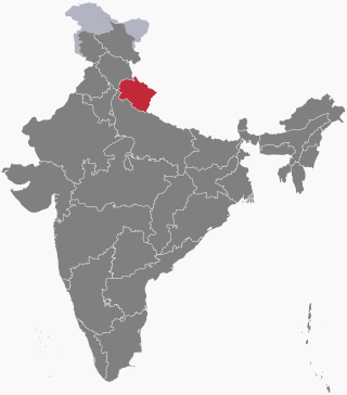
Tehri Garhwal is a district in the hill state of Uttarakhand, India. Its administrative headquarters is at New Tehri. The district has a population of 618, 931, a 2.35% increase over the previous decade. It is surrounded by Rudraprayag District in the east, Dehradun District in the west, Uttarkashi District in the north, and Pauri Garhwal District in the south. Tehri Garhwal is a part of the Himalayas.

Uttarkashi District is a district of Garhwal division of the Uttarakhand state in northern India, and has its headquarters at Uttarkashi city. It has six Tehsils namely Barkot, Dunda, Bhatwadi, Chinyalisaur, Purola and Mori.

Gauchar is a Hill Town sort of a valley town located in Karnaprayag tehsil within Chamoli district of Uttarakhand state in India. Gauchar is situated on the left bank of river Alaknanda and is en route to the celebrated holy destination of Badrinath. It is well known for being one of the cleanest place in country. It has previously topped Swachta sarvekshan best ganga town award. Situated at an altitude of 800 metres (2,620 ft) above the sea level, Gauchar is surrounded by seven mountains. Gauchar is well known for its historic trade fair and airstrip. Gauchar town known for its great work to curb loss of lives in 2013 flood disaster of Uttarakhand. This town is unique in terms of its geographical location and topography. Gauchar is located on one of the largest pieces of flatland in this mountainous region of Uttarakhand. Education institution in Gauchar includes a beautiful Kendriya Vidyalaya adjacent to the main playground.

Dehradun is the capital of The Indian state of Uttarakhand, and has a rich and eventful history, it also finds mention in scriptures as well.
Uttarakhand is a state in North India. Its name, which means "northern land" or "section" or "northern part" in Sanskrit, is mentioned in early Hindu texts as the combined region of Kedarkhand and Manaskhand.

Dehradun Terminal railway station is a railway station in Dehradun, Uttarakhand, India, on the Northern line of the Northern Railway network. It is owned by Indian Railways.
Rani Karnavati of Garhwal Kingdom, also known as Tehri Garhwal, was the wife of Mahipat Shah, the Rajput king of Garhwal who used the title Shah.
The following outline is provided as an overview of and topical guide to Uttarakhand:

Guru Ram Rai Darbar Sahib is a Sikh place of worship in Dehradun, India, dedicated to Baba Ram Rai, eldest son of Guru Har Rai, the seventh of the ten Sikh Gurus. Baba Ram Rai settled here with his followers in the mid-17th century, after he was banished by the Sikh orthodoxy for mistranslating scripture in front of the Mughal emperor Aurangzeb, so as to not cause offence. It is believed the city, Dehradun, gets its name from the religious camp established by him: a "dera", or camp, in the "doon" valley.

Kipling Trail is the old walking route that connects Dehradun with the hill station of Mussoorie in India. It was the only means of reaching Mussoorie before the cart roads, for tongas, or roads for automobiles were constructed. It is named after the English novelist Rudyard Kipling, who is believed to have walked the trail in the 1880s, though there is no definite evidence. The trail fell out of use when cars or buses became the preferred mode of transport, but the route is being revived by nature, colonial history and hiking enthusiasts.
Bijapur Dam is situated in the Garhi Cantonment area of Dehradun, Uttarakhand, India. The Bijapur check dam was built on the Tons river close to Karkuli valley by Britishers in the year 1841, witnessing the civil engineering proficiency of British official Sir Proby Thomas Cautley, who worked on this one of the oldest check dams in Uttarakhand to improve the water supply in the region.
References
- 1 2 "The missing canals of Dun - Times of India". The Times of India.
- 1 2 "How 'City of Canals' lost its tag | Dehradun News - Times of India". The Times of India.
- ↑ "Canals Vanishing Due to Increasing Population - Breaking Uttarakhand News". pioneeredge.in. Retrieved 24 July 2020.
- ↑ Rawat, Ajay S. (24 November 2002). Garhwal Himalayas: A Study in Historical Perspective. Indus Publishing. ISBN 9788173871368 – via Google Books.