
Brahmagiri, is a mountain range in the Western Ghats of south India. It is situated on the border between Kodagu district in Karnataka state in the north and Wayanad district of Kerala state on the south. Brahmagiri Hill, at 1608 m height, is a scenic tourist attraction. The top of Brahmagiri Hill is well forested and has much wildlife.

Kalpetta is the largest town and municipality in the Wayanad district, state of Kerala, India. Kalpetta is the headquarters of Wayanad district as well as the headquarters of Vythiri taluk. It is a bustling town surrounded by dense coffee and tea plantations and mountains. It lies on the Kozhikode-Mysore National Highway NH 766 at an altitude of about 780 m above sea level. Kalpetta is 72 km from Kozhikode and 140 km from Mysore.

Thiruvambady is a major hill town and a suburb in southeastern Kozhikode district in Kerala, India. Thiruvambady is a Panchayat headquarters, and a legislative assembly constituency, situated 35 kilometres (22 mi) from the district headquarters of Kozhikode.

Oorpally is a small village near Koyileri, Mananthavady on the banks of the river Kabini in the Wayanad district of Kerala state, south India.

Chembra Peak is a mountain in the state of Kerala, India, with an elevation of 2,100 m (6,890 ft) above sea level. The highest peak in the Wayanad hills and one of the highest peaks in the Western Ghats, adjoining the Nilgiri Hills and Vellarimala, it is located in the Wayanad district of Kerala, near the town of Meppadi and 8 km (5 mi) south of Kalpetta.
Vellarimala Hills is a mountain range in Kerala, India, spread across Thiruvambady Panchayat in Kozhikode district and Meppadi Panchayat in Wayanad district.

Valliyoorkkavu is an ancient Bhagavathy temple located near Mananthavady in the Wayanad district. The temple is for Goddess Durga as its presiding deity in three forms namely: Vana Durga, Bhadrakali, and Jala Durga.

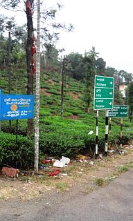
Kottathara or Venniyode is a gram panchayat of Wayanad district, Kerala State, India.
Noolpuzha is a village near Sulthan bathery in Wayanad district in the state of Kerala, India.

Thirunelly is a village in Wayanad district in the state of Kerala, India.
Thomattuchal is a village in Wayanad district in the state of Kerala, India.
Thovarimala Ezhuthupara is a remotely located rock shelter in the Wayanad district of Kerala in India. Pre-historic stone age petroglyphs dating from around 1000 BC and after had been discovered here at a height of 500 m on Thovarimala. One can see the stone age rock engravings on the walls of these natural caves from top of Thovarimala. The rare historic treasure at Thovarimala throwing light into human habitation in the Wayanad area since ancient times, is yet to receive the protection of agencies like Archaeology Department, which preserves the Edakkal Caves just five kilometers away. The carvings, found on the upper side of the cave, depict few geometrical figures, an arrow, and one carving closely resembles a female genital organ. Recently more writings were located in this cave. The name Ezhuthupara means "writings on the stone."

Aripara Falls [alternate spelling: Arippara Falls (അരിപ്പാറ)] is a tourist spot in Anakkampoyil near Thiruvambady Town in Kozhikode district, Kerala. It is located on the Thiruvambady - Anakkampoyil route, 15 km from Thiruvambadi. The waterfall is a tributary of Iruvanjippuzha. There is a proposal for implementing a hydro power project on the Arippara waterfall.
The State Highway 59 (SH-59) is the longest state highway in Kerala. The proposed highway extends from Nandarapadavu in Kasaragod district to Palode,Vithura, Aryanad Parassala in Thiruvananthapuram district, will have a length of 1332.16 km and will pass through 13 of the 14 districts, the exception being Alappuzha as that district is not part of the hilly ranges of Kerala. The expected outlay for the project is Rs.1,500 crore.
State Highway 29 is a State Highway in Kerala, India that starts at junction of NH 212 at Chundale near Kalpetta and ends in Kerala State Boundary with Tamil Nadu. This highway was originally Kozhikode - Vythiri - State Border and was 97 km long. After the section of the highway from Kozhikode until Chundale became part of NH 212, this highway is now 31.0 km long.
Pullurampara, is a village situated near the town of Thiruvambady in the Calicut district of the Indian state of Kerala. It is approximately 42 km from Calicut and is in two panchayats, Thiruvambady and Kodencheri. Iruvanjippuzha river flows through Pullurampara. The two main junctions in Pullurampara are Pallippadi and Pullurampara valiyangaadi. St. Alphonsa Playground is the main Park. St. Joseph's Church is located in Pallippadi.

Vythiri is a small town and tourist destination located in the Wayanad district in the Indian state of Kerala. It is one of the three Taluks in the district with the other two being Mananthavady and Sulthan Bathery.
Boys Town is a small village near Mananthavady in Wayanad, Kerala, India. The village is 13 km from Mananthavady.

The district capital of Wayanad is Kalpetta town. Kalpetta has very good road connectivity with the rest of Kerala and neighboring South Indian cities. National Highway 766 (India) NH766 connects Kalpetta with Kozhikode and Mysore. State Highways connect Kalpetta with Ooty in Tamil Nadu and Madikeri in Karnataka.

Neervaram Dasanakara is a village near Panamaram in Wayanad district of Kerala province, India.


