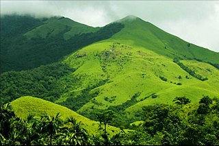
Kodagu district is an administrative district in the Karnataka state of India. Before 1956, it was an administratively separate Coorg State, at which point it was merged into an enlarged Mysore State.

Madikeri is a hill station town in Madikeri taluk and headquarters of Kodagu district in Karnataka, India. Its original name was Muddurajanakeri which means "the city of Mudduraja".

Kasaragod is a municipal town and administrative headquarters of Kasaragod district in the state of Kerala, India. Established in 1966, Kasaragod was the first municipal town in the district. It is the northernmost district of Kerala and is also known as Sapta Bhasha Sangama Bhumi.

Gudalur is a municipality and taluk in Nilgiris district in the Indian state of Tamil Nadu.

Chittoor district is one of the eight districts in the Rayalaseema region of the Indian state of Andhra Pradesh. It had a population of 18,72,951 at the 2011 census of India. It is a major market centre for mangoes, grains, sugarcane, and peanuts. The district headquarters is at Chittoor City.

Hassan is one of the 31 districts of Karnataka, India. The district headquarter is Hassan. It was carved out from Mysore district in the year 1866, during the Commissioner's Rule of Mysore (1831-81).

Kushalanagar or Kushalanagara is a city located in the Kodagu district of the Indian state of Karnataka. Surrounded by Kaveri river, it is the gateway to Kodagu district. It also serves as the headquarters of Kushalanagar Taluk. By population, Kushalanagar is the second largest town in Kodagu district after Madikeri and the fastest developing town in the district. Kushalnagar is an important commercial centre in Kodagu.

Ulikkal is a growing town in Kannur District in Kerala. It is the HQ of Ulikkal Grama Panchayat in Iritty Taluk. Kerala State Hill highway SH 59 passes through Ulikkal Town.

Nagamangala is a PuraSabhe and a taluk in Mandya district, in the Indian state of Karnataka.
Narasimharajapura or NRpura is a town and taluk headquarter in Chikkmagaluru district, Karnataka, India. It is situated in the Malenadu region of the district. In 1915, Yuvaraja Shri Narasimharaja Wodeyar visited Yedehalli and in his memory, the town was named after him. The taluk was ruled by Ganga, Kadamba, Santhara, Hoysala and Vijayanagara kings.

Bhagamandala is a pilgrimage place in Kodagu district of the Indian state of Karnataka.

Kasaragod is one of the 14 districts in the southern Indian state of Kerala. Its northern border Thalappady is located just 9 km south to Ullal, which is the southernmost portion of the major port city Mangalore, on the southwestern Malabar coast of India.

Kutta is a small village in Ponnampet taluk of Kodagu, in Karnataka state of India. As per census survey 2011, location code number of Kutta is 618078.
Bidarur is a village in the southern state of Karnataka, India. It is located in the Somvarpet taluk of Kodagu district. As per census survey 2011, the location code number of Bidarur is 617892.
Halligattu is a village in the southern state of Karnataka, India. It is located in the Ponnampet taluk of Kodagu district.

Hulikal is a village located in the Hosanagara taluk of the Shimoga district in the Indian state of Karnataka and is known for its heavy rainfall. The Hulikal village lies in western ghat region of Karnataka state. The range of ghat is known by the name Hulikal ghat or Balebare ghat. The road running between Hosangadi and Mastikatte through Hulikal ghati connects coastal district of Udupi with Shivamogga district. The Mani dam reservoir and Savehoklu reservoir are nearby. KPCL has its colony at Mastikatte near to Hulikal. The nearest airport is at Mangalore, situated 123 km south-west of Hulikal. It has an elevation of 600m.
Shanthalli is a village in Somwarpet taluk in Kodagu district of Karnataka, India.
Napoklu is a village in Madikeri taluk in Kodagu district of Karnataka, India. As per census survey of India 2011, the location code number of Napoklu is 617851.
Hanbal or Hanbalu is a hobli in Sakleshpura taluk in Hassan district of Karnataka, India. As per census survey of India 2011, the location code number of Hanbalu village is 614849.
Hethur is a hobli in Sakleshpura taluk in Hassan district of Karnataka, India. As per census survey of India, 2011, the location code number of Hethur village is 615012.


