Ajodhya Hills | |
---|---|
Ajodhya Pahar | |
Highest point | |
Peak | Chamtaburu |
Elevation | 719 m (2,359 ft) |
Listing | Hills of West Bengal |
Coordinates | 23°17′12″N86°06′56″E / 23.28667°N 86.11556°E |
Geography | |
Parent range | Chhotanagpur Plateau |
Ajodhya Hills, is a small plateau with hilly surroundings located in the Purulia district of the state West Bengal, India. It is the easternmost part of the Chhotanagpur Plateau and extended part of Eastern Ghats range. Highest peak of Ajodhya Hills is Chamtaburu (719 m). The nearby populated town area is Bagmundi.
It is a popular place for young mountaineers to learn the basic course in rock climbing. There are three routes available to reach Ajodhya Hills. Via Jhalda, via Sirkabad and via Baghmundi. There are two Forest Rest Houses here, one at Ajodhya hill top and the other is at Matha range office. Other accommodation facilities are also available in Ajodhya Hill top and Bagmundi. There are Eco-resorts, 1. Gorgaburu Eco-resort, 2. Palash Bitan Jungle Hut at Murguma 3. Eco-Adventure Resort at Khairabera, 4. Hotel Palash Awashan and Palashbari Restora, Indian-Chinese-Tandoori Restaurant at Ajodhya Hilltop. Gorgaburu (677 m), [1] Mayuri etc. are some of the peaks of Ajodhya hills range. [2] Chamtaburu (712 m) is also the highest peak of southern West Bengal.
The area forms the lowest step of the Chota Nagpur Plateau. The general scenario is undulating land with scattered hills. The area around Baghmundi or Ajodhya Hill is an extended plateau. [3]
During Mughal times the area was a part of Bengal Subah. Later on after defeat of Mughals, the area became a part of Manbhum district under the British Raj. After the independence the area became a part of Bihar state. After states were reorganised in mid fifties the area came under West Bengal.
Famous Deulghata Jain temples (11th cent AD) lies about 15 K.M. north of Ajodhya Hills. Charida the village of Chhau mask makers, lies just south of the southern boundary of the hills. It is said that the mask making for famous ‘Chhau’ dance started under the auspices of king Madan Mohan Singh Deo of Banghmundi.
According to Hindu mythology, Rama and Sita had come to Ajodhya Hills and stayed during their exile. Sita was thirsty and Ram pierced an arrow through the Earth's soil crust and through that water gushed out. Sita quenched her thirst. The place is known as Sita-kunda. During the full moon day in Baisakh every year Santhal, Bhumij and Munda tribals of nearby areas come and join in the game of hunting wild animals, called Disum Sendra. [2] [4]
Rocks that make up Ajodhya hills belong to a group of rocks called Chhotanagpur Granite Gneiss Complex. Investigations have revealed that they formed more than a billion years ago in Mesoproterozoic era. [5] Since then the area underwent multiple phases of tectonic movements , and witnessed metamorphic and magmatic episodes, thus forming varieties of rocks that we see today. Prolonged erosion through ages sculpted the area and formed its admirable river valleys, residual hills, lakes, springs and waterfalls that make the area a major ecotourism hot spot. There are at least 37 locations where tourists can see and admire these rocks and landforms. [6] They are called geosites which are known for their distinct aesthetic appeal as well as for being archives that record the history of Earth. They are rather popular among geotourists.
Apart from being geodiverse, the area is known for being home to diverse flora and fauna. Many species of mammals, amphibians, insects etc can be spotted in dry, deciduous forests of the region. One such species is Madras Tree Shrew which is small mammal, not common in West Bengal. [7] Among the trees, Sal, Palash , Kusum, Mohua, Kend, various bamboos are commonly observed.
Purulia Pumped Storage Project with an installed capacity of 900 MW (4 X 225 MW) has been set up in Ajodhya hills under Baghmundi police station with the loan assistance of Japan Bank for International Cooperation. [8]
Near Ajodhya Hills, there is Turga Dam and the Lake, and the pleasant waterfall formed by the River Bamni. The site of the Turga Dam site is a perfect tourist spot, where the visitors can spend their day. [2]
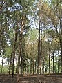
Purulia district is one of the twenty-three districts of West Bengal state in Eastern India. Purulia is the administrative headquarters of the district. Some of the other important towns of Purulia district are Raghunathpur-Adra, Jhalda, Anara and Balarampur.
Jhalda is a city and a municipality in Purulia district in the Indian state of West Bengal. It is the headquarters of the Jhalda subdivision.
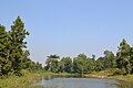
Tulin is a village and a gram panchayat in the Jhalda I CD block in the Jhalda subdivision of the Purulia district in the state of West Bengal, situated beside the Subarnarekha River.
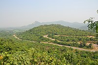
Baghmundi is a community development block that forms an administrative division in the Jhalda subdivision of the Purulia district in the Indian state of West Bengal.
Baghmundi is a village, with a police station, in the Baghmundi CD block in the Jhalda subdivision of the Purulia district in the state of West Bengal, India.
Purulia Sadar West subdivision was a subdivision of the Purulia district in the state of West Bengal, India, till reorganisation of the subdivisions in Purlia district in 2017.
Begunkodor is a census town in the Jhalda II CD block in the Jhalda subdivision of the Purulia district of West Bengal near its border with Jharkhand, situated 46 km away from district town Purulia. Jhalda is the sub division headquarter of the census town which is 8 km away.
Joypur is a census town in the Joypur CD block in the Jhalda subdivision of the Purulia district in the state of West Bengal, India.
Kotshila is a village, with a police station and a railway junction station, in the Jhalda II CD block in the Jhalda subdivision of the Purulia district in the state of West Bengal, India.
Sirkabad is a village in the Arsha CD block in the Purulia Sadar subdivision of the Purulia district in the state of West Bengal, India.
Patardi is a village in the Baghmundi CD block in the Jhalda subdivision of the Purulia district in the state of West Bengal, India.
Baghadih is a village in the Balarampur CD block in the Purulia Sadar subdivision of the Purulia district in the state of West Bengal, India. It is close to Balarampur.
Jhalda subdivision is a subdivision of the Purulia district in the state of West Bengal, India.
Ananda Nagar is a village in the Joypur CD block in the Jhalda subdivision of the Purulia district in the state of West Bengal, India.
Suisa is a village in the Tunturi-Suisa panchayat in the Baghmundi CD block in the Jhalda subdivision of the Purulia district in the state of West Bengal, India.
Jargo is a village in the Ilu Jargo panchayat in the Jhalda I CD block in the Jhalda subdivision of the Purulia district in the state of West Bengal, India.
Jiudaru is a village in the Jhalda II CD block in the Jhalda subdivision of the Purulia district in the state of West Bengal, India.
Charida is a village in the Baghmundi CD block in the Jhalda subdivision of the Purulia district in the state of West Bengal, India.
Chekya is a census town and a gram panchayat in the Jhalda II CD block in the Purulia Sadar subdivision of the Purulia district in the state of West Bengal, India.
Agharpur is a village in the Joypur CD block in the Jhalda subdivision of the Purulia district in the state of West Bengal, India.
{{cite web}}
: CS1 maint: unfit URL (link)