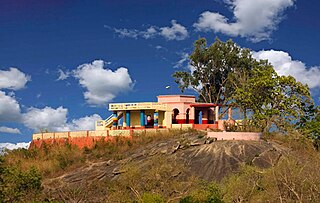
Jhalda is a city and a municipality in Purulia district in the Indian state of West Bengal. It is the headquarters of the Jhalda subdivision.
Tulin is a village and a gram panchayat in the Jhalda I CD block in the Jhalda subdivision of the Purulia district in the state of West Bengal, situated beside the Subarnarekha River.

Ajodhya Hills, is a small plateau with hilly surroundings located in the Purulia district of the state West Bengal, India. It is the easternmost part of the Chhotanagpur Plateau and extended part of Eastern Ghats range. Highest peak of Ajodhya Hills is Chamtuburu. The nearby populated town area is Bagmundi.

Baghmundi is a community development block that forms an administrative division in the Jhalda subdivision of the Purulia district in the Indian state of West Bengal.
Baghmundi is a village, with a police station, in the Baghmundi CD block in the Jhalda subdivision of the Purulia district in the state of West Bengal, India.
Hura is a village, with a police station, in the Hura CD block in the Purulia Sadar subdivision of the Purulia district in the state of West Bengal, India.
Sirkabad is a village in the Arsha CD block in the Purulia Sadar subdivision of the Purulia district in the state of West Bengal, India.
Masina is a village in the Jhalda I CD block in the Jhalda subdivision of the Purulia district in the state of West Bengal, India.
Patardi is a village in the Baghmundi CD block in the Jhalda subdivision of the Purulia district in the state of West Bengal, India.
Baghadih is a village in the Balarampur CD block in the Purulia Sadar subdivision of the Purulia district in the state of West Bengal, India. It is close to Balarampur.
Radhanagar is a village in the Bishnupur CD block in the Bishnupur subdivision of the Bankura district in the state of West Bengal, India

Jhalda subdivision is a subdivision of the Purulia district in the state of West Bengal, India.
Daldali is a village and a gram panchayat in the Hura CD block in the Purulia Sadar subdivision of the Purulia district in the state of West Bengal, India.
Suisa is a village in the Tunturi-Suisa panchayat in the Baghmundi CD block in the Jhalda subdivision of the Purulia district in the state of West Bengal, India.
Jargo is a village in the Ilu Jargo panchayat in the Jhalda I CD block in the Jhalda subdivision of the Purulia district in the state of West Bengal, India.

}} Charida is a village in the Baghmundi CD block in the Jhalda subdivision of the Purulia district in the state of West Bengal, India.
Agharpur is a village in the Joypur CD block in the Jhalda subdivision of the Purulia district in the state of West Bengal, India.
Ajodhya is a village in the Bishnupur CD block in the Bishnupur subdivision of the Bankura district in the state of West Bengal, India.

The Murguma Dam is constructed on the Saharajhore River, one of the tributary of Kangsabati River in West Bengal, India. The dam is constructed near Murguma village in the foothill of Ajodhya Hills, Purulia District. It's under the jurisdiction of Kotshila Police Station. A number of other streams also flow into the dam directly from Ajodhya Hills. The dam is surrounded by hills, forests and a number of small islands within it. The place is situated at the north west end of Ajodhya Hills which is considered as an eastern extension of Chota Nagpur Plateau.


