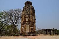
Chapari is a census town in the Para CD block in the Raghunathpur subdivision of the Puruliya district in the state of West Bengal, India.
Santaldih is a census town in the Raghunathpur II CD block in the Raghunathpur subdivision of the Purulia district in the Indian state of West Bengal.
Gobag is a village in the Neturia CD block in the Raghunathpur subdivision of the Purulia district in the state of West Bengal, India.
Nabagram is a census town in the Raghunathpur II CD block in the Raghunathpur subdivision of the Purulia district in West Bengal, India.
Para is a village, with a police station, in the Para CD block in the Raghunathpur subdivision of the Purulia district in West Bengal, India.

Joychandi Pahar is a hill which is a popular tourist attraction in the Indian state of West Bengal in Purulia district. It is two kilometres from the subdivisional town of Raghunathpur and four kilometres from Adra town. The hill is situated 2 kilometers south from Purulia – Barakar road via Nanduara village and 1 kilometer west from Raghunathpur-Adra Road via a growing township known as Annapurna pally. It is also just four kilometres away from Adra Junction railway station and 1.5 kilometres from Joychandipahar railway station, which is situated on Adra-Asansol section. Joychandi hill is a popular tourist centre and major attraction for rock climbing. Joychandi Pahar railway station is on the Asansol – Adra section of South Eastern Railway, in the state capital of Kolkata. The other rock climbing centre nearby is at Susunia Pahar.
Anara is a Town in the Para CD block in the Raghunathpur subdivision of the Purulia district, West Bengal, India, about 14 km from Adra Junction. Anara Railway Station is having 2 platforms for up trains and down trains. Anara has large number of Railway employees mostly Running staff residing in 3 pockets viz. Bungalow side, Old colony and new colony apart from the market area. There is a big railway school and adjacent to it a play ground.
Santuri is a village, with a police station, in the Santuri CD block in the Raghunathpur subdivision of the Purulia district in West Bengal, India.
Nituria is a village, with a police station, in the Neturia CD block in the Raghunathpur subdivision of the Purulia district in West Bengal, India.
Kalloli is a village in the Kashipur CD block in the Raghunathpur subdivision of the Purulia district in the state of West Bengal, India. It is close to Kashipur.

Cheliyama is a village in the Raghunathpur II CD block in the Raghunathpur subdivision of the Purulia district in the state of West Bengal, India.
Achkoda is a village in the Neturia CD block in the Raghunathpur subdivision of the Purulia district in the state of West Bengal, India.
Haraktor is a village in the Para CD block in the Raghunathpur subdivision of the Purulia district in the state of West Bengal, India.
Usir is a village in the Raghunathpur II CD block in the Raghunathpur subdivision of the Purulia district in the state of West Bengal, India.
Sarbari is a village in West Bengal, India. It is located within Neturia CD block of Raghunathpur subdivision of Purulia district.
Kanki is a census town in the Para CD block in the Raghunathpur subdivision of the Purulia district in the state of West Bengal, India.
Dubra is a census town and a gram panchayat in the Para CD block in the Raghunathpur subdivision of the Purulia district in the state of West Bengal, India.
Shankara is a census town and a gram panchayat in the Para CD block in the Raghunathpur subdivision of the Purulia district in the state of West Bengal, India.
Harmadih is a village in the Neturia CD block in the Raghunathpur subdivision of the Purulia district in the state of West Bengal, India.
Kantaranguri is a census town in the Kashipur CD block in the Raghunathpur subdivision of the Purulia district in the state of West Bengal, India.


