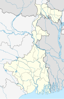
Hijuli is a census town in the Neturia CD block in Raghunathpur subdivision of the Purulia district in the Indian state of West Bengal.

Parbelia is a census town in the Neturia CD block in the Raghunathpur subdivision of the Purulia district in the Indian state of West Bengal.

Raghunathpur is a city and a municipality in Purulia district in the state of West Bengal, India. It is the headquarters of the Raghunathpur subdivision. Industrial City Raghunathpur is located near Adra on the North-East part of Purulia district. It is connected with other cities through five main way road's, which are Purulia – Barakar road, Raghunathpur-Adra-Hura road, Raghunathpur-Chas road, Cheliyama road and Raghunathpur-Bankura road. The nearest main junction stations are Joychandi Pahar railway station and Adra Junction railway station.

Panchet Dam was the last of the four multi-purpose dams included in the first phase of the Damodar Valley Corporation (DVC). It was constructed across the Damodar River at Panchet in Dhanbad district in the Indian state of Jharkhand, and opened in 1959.

Garh Panchkot is a ruined fort located in the eastern part of India at the foothills of Panchet Hill in the district of Purulia, West Bengal. The ruins of the Panchkot Palace are a silent testimony to the Bargi attack during the 18th century.

Madhukunda is a census village under Bailtora village panchayat of Santuri intermediate panchayat in Purulia district in the Indian state of West Bengal. It is located on the south bank of Damodar River. It is served by the post office at Sunuri.

Gobag is a village in the Neturia CD block in the Raghunathpur subdivision of the Purulia district in the state of West Bengal, India.

Dishergarh is a neighbourhood in Asansol of Paschim Bardhaman district in the Indian state of West Bengal. It is governed by Asansol Municipal Corporation. It is situated at the border of the Purulia district and Paschim Bardhaman district in West Bengal. The State Highway 5 (SH5) passes through Dishergarh. The neighbourhood is located on the banks of Damodar River.

Neturia is a community development block that forms an administrative division in the Raghunathpur subdivision of the Purulia district in the Indian state of West Bengal.

Kashipur is a village, with a police station, in the Kashipur CD block in the Raghunathpur subdivision of the Purulia district in West Bengal, India. Kalloli, where the CD Block headquarters are located, is close to Kashipur.

Panchakot Mahavidyalaya, established in 2001, is the general degree college in the Purulia district. It offers undergraduate courses in arts, commerce and sciences. It is affiliated to Sidho Kanho Birsha University.

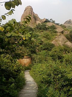
Joychandi Pahar is a hill which is a popular tourist attraction in the Indian state of West Bengal in Purulia district. It is two kilometres from the subdivisional town of Raghunathpur and four kilometres from Adra town. The hill is situated 2 kilometers south from Purulia – Barakar road via Nanduara village and 1 kilometer west from Raghunathpur-Adra Road via a growing township known as Annapurna pally. It is also just four kilometres away from Adra Junction railway station and 1.5 kilometres from Joychandipahar railway station, which is situated on Adra-Asansol section. Joychandi hill is a popular tourist centre and major attraction for rock climbing. Joychandi Pahar railway station is on the Asansol – Adra section of South Eastern Railway, in the state capital of Kolkata. The other rock climbing centre nearby is at Susunia Pahar.

Santuri is a village, with a police station, in the Santuri CD block in the Raghunathpur subdivision of the Purulia district in West Bengal, India.

Nituria is a village, with a police station, in the Neturia CD block in the Raghunathpur subdivision of the Purulia district in West Bengal, India.

Muraddi is a village in the Santuri CD block in the Raghunathpur subdivision of the Purulia district in the state of West Bengal, India. Muradi Dam is a tourist spot.

Ramchandrapur is a village in Santuri CD Block in Raghunathpur subdivision of Purulia district in the state of West Bengal, India.

Baranti is a small tribal village in the Santuri in the Raghunathpur subdivision of the Purulia district in the Indian state of West Bengal. It is situated beside Baranti Lake. This is a growing, but quiet, tourist spot.

Achkoda is a village in the Neturia CD block in the Raghunathpur subdivision of the Purulia district in the state of West Bengal, India.

Sarbari is one of the villages in the Neturia CD block in the Raghunathpur subdivision of the Purulia district in the state of West Bengal, India.

Harmadih is a village in the Neturia CD block in the Raghunathpur subdivision of the Purulia district in the state of West Bengal, India.


