Para, Purulia

Last updated

Para
Village
West Bengal location map.svg
Red pog.svg
Para
Location in West Bengal, India
India location map.svg
Red pog.svg
Para
Para (India)
Coordinates: 23°31′N86°31′E / 23.52°N 86.52°E / 23.52; 86.52
CountryFlag of India.svg  India
State West Bengal
District Purulia
Subdivision Raghunathpur
Government
  Body Gram panchayat
Languages
  Official Bengali, English
Time zone UTC+5:30 (IST)
ISO 3166 code IN-WB
Lok Sabha constituency Purulia
Vidhan Sabha constituency Para
Website wb.gov.in

Para is a village, with a police station, in the Para CD block in the Raghunathpur subdivision of the Purulia district in West Bengal, India.

Contents

Geography

Para, Purulia
Places in Raghunathpur subdivision in Purulia district
M: municipal town, CT: census town, R: rural/ urban centre, H: historical/ religious centre, T: tourist centre
Owing to space constraints in the small map, the actual locations in a larger map may vary slightly

Location

Para is located at 23°31′N86°31′E / 23.52°N 86.52°E / 23.52; 86.52 .

Area overview

Purulia district forms the lowest step of the Chota Nagpur Plateau. The general scenario is undulating land with scattered hills. [1] Raghunathpur subdivision occupies the northern part of the district. 83.80% of the population of the subdivision lives in rural areas. However, there are pockets of urbanization and 16.20% of the population lives in urban areas. There are 14 census towns in the subdivision. [2] It is presented in the map given alongside. There is a coal mining area around Parbelia [3] and two thermal power plants are there – the 500 MW Santaldih Thermal Power Station [4] and the 1200 MW Raghunathpur Thermal Power Station. The subdivision has a rich heritage of old temples, some of them belonging to the 11th century or earlier. The Banda Deul is a monument of national importance. [5] [6] The comparatively more recent in historical terms, Panchkot Raj has interesting and intriguing remains in the area. [7] [8]

Note: The map alongside presents some of the notable locations in the subdivision. All places marked in the map are linked in the larger full screen map.

Demographics

According to the 2011 Census of India Para had a total population of 9,697 of which 5,031 (52%) were males and 4,666 (48%) were females. There were 1,158 persons in the age range of 0–6 years. The total number of literate persons in Para was 5,453 (63,86% of the population over 6 years). [9]

Civic administration

Police station

Para police station, along with Santaldih police station, has jurisdiction over the Para CD block. The area covered is 270.59 km2 and the population covered is 200,621. [10] [11]

CD block HQ

The headquarters of the Para CD block are located at Para. [12] [13]

Education

Santaldih College was established in 2008 at Usir, PO Chatarmahul. [14]

Para Shib Narayan High School is a Bengali-medium coeducational institution established in 1916. It has facilities for teaching from class V to class XII. It has a play ground and 2,500 books in the library. [15]

Culture

Para was probably capital of the Panchkot Raj at some point of time. It may also have been associated with some other royal establishment. However, what remains of its royal connections are three dilapidated temples (all the three are deuls), one built of bricks, another built of stone and third one built of bricks and stone. Scholars date the brick temple as belonging to 10th-11th century. The stone temple, standing nearby, probably predates the brick temple. In the stone temple one can still see some of the intricate designs. It has a lot of similarity with another remarkable temple, located nearby, at Banda. [16] There is an 11th-century rekha deul at Banda. [17]

Numerous statues related to Jainism and Hinduism have been found at Haraktor. [18]

Rekha deul

David J. McCutchion says that the pre-dominant traditional architectural style for temples in the western areas of Bengal in the pre-Muslim period is the tall curvilinear rekha deul and it went on developing from the late 7th century or early 8th century to around the 12th century, increasing its complexity and height but retaining its basic features. Such temples had “curvilinear shikhara with chaitya mesh decoration, surmounted by a large amalaka and kalasa finial. Examples of such dilapidated deulas are still standing at Satdeula (in Bardhaman), Bahulara and Sonatapal (in Bankura) and Deulghat (in Purulia). On the brick deulas already mentioned here, plus Jatar (in 24 Parganas) and Para (in Purulia), “we find extensive and remarkably fine stucco work on carved brick”. [19]

Healthcare

Para Block Primary Health Centre, with 30 beds, is a major government medical facility in the Para CD block. [20]

Related Research Articles

Arra is a census town in the Raghunathpur I CD block in the Raghunathpur subdivision of the Puruliya district in the state of West Bengal, India.

Chapari is a census town in the Para CD block in the Raghunathpur subdivision of the Puruliya district in the state of West Bengal, India.

Santaldih is a census town in the Raghunathpur II CD block in the Raghunathpur subdivision of the Purulia district in the Indian state of West Bengal.

Gobag is a village in the Neturia CD block in the Raghunathpur subdivision of the Purulia district in the state of West Bengal, India.

Nabagram is a census town in the Raghunathpur II CD block in the Raghunathpur subdivision of the Purulia district in West Bengal, India.
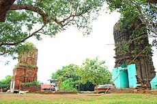
Anara is a Town in the Para CD block in the Raghunathpur subdivision of the Purulia district, West Bengal, India, about 14 km from Adra Junction. Anara Railway Station is having 2 platforms for up trains and down trains. Anara has large number of Railway employees mostly Running staff residing in 3 pockets viz. Bungalow side, Old colony and new colony apart from the market area. There is a big railway school and adjacent to it a play ground.

Kalloli is a village in the Kashipur CD block in the Raghunathpur subdivision of the Purulia district in the state of West Bengal, India. It is close to Kashipur.

<span class="mw-page-title-main">Cheliyama</span> Village in West Bengal, India

Cheliyama is a village in the Raghunathpur II CD block in the Raghunathpur subdivision of the Purulia district in the state of West Bengal, India.

Muraddi is a village in the Santuri CD block in the Raghunathpur subdivision of the Purulia district in the state of West Bengal, India. Muradi Dam is a tourist spot.

Haraktor is a village in the Para CD block in the Raghunathpur subdivision of the Purulia district in the state of West Bengal, India.

Usir is a village in the Raghunathpur II CD block in the Raghunathpur subdivision of the Purulia district in the state of West Bengal, India.

Sarbari is a village in West Bengal, India. It is located within Neturia CD block of Raghunathpur subdivision of Purulia district.

Kanki is a census town in the Para CD block in the Raghunathpur subdivision of the Purulia district in the state of West Bengal, India.

Dubra is a census town and a gram panchayat in the Para CD block in the Raghunathpur subdivision of the Purulia district in the state of West Bengal, India.

Shankara is a census town and a gram panchayat in the Para CD block in the Raghunathpur subdivision of the Purulia district in the state of West Bengal, India.

Saltore is a census town and a gram panchayat in the Neturia CD block in the Raghunathpur subdivision of the Purulia district in the state of West Bengal, India.

Harmadih is a village in the Neturia CD block in the Raghunathpur subdivision of the Purulia district in the state of West Bengal, India.

Murulia is a census town in the Santuri CD block in the Raghunathpur subdivision of the Purulia district in the state of West Bengal, India.

Kantaranguri is a census town in the Kashipur CD block in the Raghunathpur subdivision of the Purulia district in the state of West Bengal, India.

Lapara is a census town in the Kashipur CD block in the Raghunathpur subdivision of the Purulia district in the state of West Bengal, India.

References

  1. Houlton, Sir John, Bihar, the Heart of India, 1949, p. 170, Orient Longmans Ltd.
  2. "District Statistical Handbook 2014 Purulia". Tables 2.1, 2.2. Department of Planning and Statistics, Government of West Bengal. Archived from the original on 21 January 2019. Retrieved 12 January 2020.
  3. "Area wise Closed User Group (CUG) Telephone Numbers" (PDF). Sodepur Area. Eastern Coalfields Limited. Retrieved 11 August 2018.
  4. "Santaldih Thermal Power Station - WBPDCL". WBPDCL. Archived from the original on 11 January 2010. Retrieved 24 August 2011.
  5. "Old temple at Banda (locally known as deul)". ASI, Kolkata Circle. Retrieved 23 January 2020.
  6. "List of Ancient Monuments and Archaeological Sites and Remains of West Bengal - Archaeological Survey of India". Item no. 134. ASI. Retrieved 25 January 2020.
  7. "Capital in shambles: Garh Panchakot, Purulia". Heritage in Peril. Retrieved 1 December 2016.
  8. "Historical ruins". Trek Earth. Retrieved 1 December 2016.
  9. "2011 Census – Primary Census Abstract Data Tables". West Bengal – Distri ct-wise. Registrar General and Census Commissioner, India. Retrieved 2 October 2016.
  10. "District Statistical Handbook 2014 Purulia". Tables 2.1, 2.2. Department of Statistics and Programme Implementation, Government of West Bengal. Archived from the original on 29 July 2017. Retrieved 2 October 2016.
  11. "Para PS". Purulia District Police. Retrieved 2 October 2016.
  12. "Para Development Block". Purulia district administration. Retrieved 12 September 2016.
  13. "District Census Handbook: Puruliya" (PDF). Map of District Puruliya with CD Block HQs and Police Stations (on the fifth page). Directorate of Census Operations, West Bengal, 2011. Retrieved 2 December 2016.
  14. "Santaldih College". SC. Retrieved 1 February 2020.
  15. "Para S.N. High School". ICBSE. Retrieved 1 February 2020.
  16. Dutta, Rangan. "Temples of Para, Purulia". Wordpress. Retrieved 10 January 2020.
  17. "Old temple at Banda (locally known as deul)". ASI, Kolkata Circle. Retrieved 23 January 2020.
  18. Ananda Bazar Patrika, in Bengali, 28 December 2019, Amar Gram
  19. McCutchion, David J., Late Mediaeval Temples of Bengal, first published 1972, reprinted 2017, pages 3,13. The Asiatic Society, Kolkata, ISBN   978-93-81574-65-2
  20. "Rural Health". Purulia district administration. Retrieved 2 December 2016.

Commons-logo.svg Media related to Para, Purulia at Wikimedia Commons