Ghatal is a city and a municipality in Paschim Medinipur district, West Bengal, India. It is the headquarters of the Ghatal subdivision.

Chandrakona is a town and a municipality in the Ghatal subdivision of Paschim Medinipur district in the state of West Bengal, India. The city is located between Ghatal and Garhbeta. The king – Chandraketu was the founder of the kingdom of Chandrakona. In Ain-E-Akbari it was mentioned as ‘Mana’.

Egra is a town in Purba Medinipur district in the state of West Bengal, India. It is the headquarters of the Egra subdivision. The ancient name of Egra was "Agrapattan".

Khirpai, also known as Kshirpai, is a city and a municipality in the Ghatal subdivision of the Paschim Medinipur district in the state of West Bengal, India. The city is situated between Ghatal and Chandrakona, near the banks of the rivers Shilabati and Kethai, and is one of the oldest municipalities in India. Khirpai is also famous for its ‘Babarsha’, a special type of sweetmeat, which is not available elsewhere.
Daspur is a village, with a police station, in Daspur I CD Block in Ghatal subdivision of Paschim Medinipur district in the state of West Bengal, India.
Bhagabanpur is a village, in Bhagabanpur I CD block in Egra subdivision of Purba Medinipur district in the state of West Bengal, India.
Mankar is a village in Galsi I CD Block in Bardhaman Sadar North subdivision of Purba Bardhaman district in the state of West Bengal, India.
Kajlagarh is a village and a gram panchayat in Bhagabanpur I CD block in Egra subdivision of Purba Medinipur district in the state of West Bengal, India.
Paikbheri is a village in the Bhagabanpur I CD block in the Egra subdivision of the Purba Medinipur district in the state of West Bengal, India.
Alangiri is a village in the Egra I CD block in the Egra subdivision of the Purba Medinipur district in the state of West Bengal, India.
Jukhia is a village and a gram panchayat in the Bhagabanpur II CD block in the Contai subdivision of the Purba Medinipur district in the state of West Bengal, India.
Purbba Gopalpur is a village in the Panskua CD block in the Tamluk subdivision of the Purba Medinipur district in the state of West Bengal, India.
Shrirampur is a village in the Sabang CD block in the Kharagpur subdivision of the Paschim Medinipur district in the state of West Bengal, India.
Tilantapara is a village in the Sabang CD block in the Kharagpur subdivision of the Paschim Medinipur district in the state of West Bengal, India.
Dihi Baliharpur is a village in the Daspur I CD block in the Ghatal subdivision of the Paschim Medinipur district in the state of West Bengal, India.
Radhakantapur is a village in the Daspur I CD block in the Ghatal subdivision of the Paschim Medinipur district in the state of West Bengal, India.
Gobindanagar is a village in the Daspur I CD block in the Ghatal subdivision of the Paschim Medinipur district in the state of West Bengal, India.
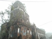
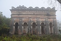
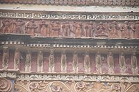
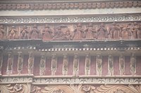
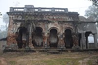
Bengal temple architecture is about temple styles developed and used in Bengal, particularly the chala, ratna and dalan temples.
Jalchak is a village in the Pingla CD block in the Kharagpur subdivision of the Paschim Medinipur district in the state of West Bengal, India.
Loyada is a village in the Debra CD block in the Kharagpur subdivision of the Paschim Medinipur district in the state of West Bengal, India.