Sidheswari

Last updated

Sidheswari
Village
West Bengal location map.svg
Red pog.svg
Sidheswari
Location in West Bengal, India
India location map.svg
Red pog.svg
Sidheswari
Sidheswari (India)
Coordinates: 26°23′12″N89°30′46″E / 26.38673°N 89.51272°E / 26.38673; 89.51272
CountryFlag of India.svg  India
State West Bengal
District Cooch Behar
Population
 (2011)
  Total4,467
Time zone UTC+5:30 (IST)
PIN
736133
Telephone/STD code03582
Vehicle registration WB
Lok Sabha constituency Cooch Behar
Vidhan Sabha constituency Cooch Behar Uttar
Website coochbehar.gov.in

Sidheswari is a village in the Cooch Behar II CD block in the Cooch Behar Sadar subdivision of the Cooch Behar district in West Bengal, India

Contents

Geography

Sidheswari
This is a stopgap mapping solution, while attempts are made to resolve technical difficulties with {{ OSM Location map }}
Places in the Cooch Behar Sadar subdivision in Cooch Behar district
CT: census town, M: municipal town, R: rural/ urban centre, H: historical/ religious centre
Owing to space constraints in the small map, the actual locations in a larger map may vary slightly

Location

Sidheswari is located at 26°23′12″N89°30′46″E / 26.38673°N 89.51272°E / 26.38673; 89.51272 .

Area overview

The map alongside shows the north-central part of the district. It has the highest level of urbanisation in an overwhelming rural district. 22.08% of the population of the Cooch Behar Sadar subdivision lives in the urban areas and 77.92% lives in the rural areas. [1] The entire district forms the flat alluvial flood plains of mighty rivers. [2]

Note: The map alongside presents some of the notable locations in the subdivision. All places marked in the map are linked in the larger full screen map.

Demographics

As per the 2011 Census of India, Sidheswari had a total population of 4,467. There were 2,327 (52%) males and 2,140 (48%) females. There were 496 persons in the age range of 0 to 6 years. The total number of literate people in Sidheswari was 3,382 (85.17% of the population over 6 years). [3]

Transport

New Baneswar railway station, on the New Jalpaiguri–New Bongaigaon section of the Barauni–Guwahati line, is about 1.6 kilometres (0.99 mi) from Sidheswari. [4] [5]

Culture

The temple of Sidheswari Devi is a brick-built structure having an unusual octagonal shape with a dome on top of it. It has a height of 9.3 metres (31 ft). There is a raised platform in front of the temple. The internal distance from one corner of the temple to another is around 2.5 metres (8 ft 2 in). The 15.5 centimetres (6.1 in) tall idol of Sidheswari Devi in the garbhagriha is made of ashtadhatu. The four-handed goddess is worshipped as a form of goddess Kali. According to Madho Sarup Vats, of the Archaeological Survey, the temple is an example of British architectural influence. He particularly points out the pillars in the structure. The temple seems to have been built by the Maharajas of Cooch Behar State in end 19th century or early 20th century.[ citation needed ]

Related Research Articles

<span class="mw-page-title-main">Pundibari</span> Village in West Bengal, India

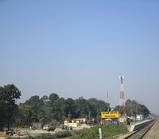
Pundibari is a village in the Cooch Behar II CD block in the Cooch Behar Sadar subdivision of the Cooch Behar district of West Bengal, India.

Dewanhat is a village in the Cooch Behar I CD block in the Cooch Behar Sadar subdivision of the Cooch Behar district of West Bengal, India.

Baneswar is a census town in the Cooch Behar II CD block in the Cooch Behar Sadar subdivision of the Cooch Behar district in West Bengal, India.

<span class="mw-page-title-main">Cooch Behar II</span> Community development block in West Bengal, India

Cooch Behar II is a community development block that forms an administrative division in the Cooch Behar Sadar subdivision of the Cooch Behar district in the Indian state of West Bengal.

Gosanimari is both a village and an archaeological site in Dinhata I CD block, in the Dinhata subdivision of the Cooch Behar district of West Bengal, north-eastern India. The name of this site was taken from the modern grampanchyat name of the Dinhata subdivision.

Ghughumari is a village and a gram panchayat in the Cooch Behar I CD block in the Cooch Behar Sadar subdivision of the Cooch Behar district in the state of West Bengal, India.

Kalarayerkuthi is a village in the Cooch Behar II CD block in the Cooch Behar Sadar subdivision of the Cooch Behar district in the state of West Bengal, India.

Sitai is a village and gram panchayat in the Sitai CD block in the Dinhata subdivision of the Cooch Behar district in the state of West Bengal, India.

Dhaliabari is a census town in the Cooch Behar I CD block in the Cooch Behar Sadar subdivision of the Cooch Behar district in the state of West Bengal, India.

Baisguri is a census town in the Cooch Behar II CD block in the Cooch Behar Sadar subdivision of the Cooch Behar district in the state of West Bengal, India.

Chakchaka is a census town and gram panchayat in the Cooch Behar II CD block in the Cooch Behar Sadar subdivision of the Cooch Behar district in the state of West Bengal, India.

Takagachh is a census town in the Cooch Behar II CD block in the Cooch Behar Sadar subdivision of the Cooch Behar district in the state of West Bengal, India.

Kamat Phulbari is a census town in the Tufanganj I CD block in the Cooch Behar Sadar subdivision of the Cooch Behar district in the state of West Bengal, India.

Chamta is a village in the Tufanganj I CD block in the Tufanganj subdivision of the Cooch Behar district in West Bengal, India

Nakkatigachhi is a village in the Tufanganj I CD block in the Tufanganj subdivision of the Cooch Behar district in West Bengal, India

Bara Kodali is a village and a gram panchayat in the Tufanganj II CD block in the Tufanganj subdivision of the Cooch Behar district in West Bengal, India.

Gudam Maharaniganj is a village in the Cooch Behar I CD block in the Cooch Behar Sadar subdivision of the Cooch Behar district in West Bengal, India

Haripur is a village in the Cooch Behar II CD block in the Cooch Behar Sadar subdivision of the Cooch Behar district in West Bengal, India

Baikunthapur is a village in the Cooch Behar II CD block in the Cooch Behar Sadar subdivision of the Cooch Behar district in West Bengal, India

<span class="mw-page-title-main">Baneswar Shiva temple</span>

Baneswar Shiva temple is at Baneswar in the Cooch Behar II CD block in the Cooch Behar Sadar subdivision of the Cooch Behar district in West Bengal, India.

References

  1. "District Statistical Handbook 2013 Cooch Behar". Tables 2.2, 2.4b. Department of Planning and Statistics, Government of West Bengal. Archived from the original on 21 January 2019. Retrieved 5 August 2020.
  2. "District Census Handbook, Koch Bihar, Series 20, Part XIIA" (PDF). Census of India 2011, pages 17-21 Physical feafures. Directorate of Census Operations, West Bengal. Retrieved 5 August 2020.
  3. "C.D. Block Wise Primary Abstract Data(PCA)". West Bengal – District-wise CD Blocks. Registrar General and Census Commissioner, India. Retrieved 9 August 2020.
  4. Koch Bihar Jelar Purakirti (in Bengali), Data compilation and writing by Dr. Shyamachand Mukhopadhayay, published by the Department of Archaeology, Government of West Bengal, Second edition 1974, Pages 59-61.
  5. "Rangiya New Jalpaiguri Express". Time Table. IndiaRailInfo. Retrieved 10 August 2020.