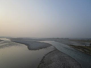
Pundibari

Last updated

Pundibari
Village
Pundibari Station Nameplate.JPG
Pundibari Station Nameplate
West Bengal location map.svg
Red pog.svg
Pundibari
Location in West Bengal, India
India location map 3.png
Red pog.svg
Pundibari
Pundibari (India)
Asia laea location map.svg
Red pog.svg
Pundibari
Pundibari (Asia)
Coordinates: 26°24′32″N89°22′57″E / 26.408888°N 89.382372°E / 26.408888; 89.382372 Coordinates: 26°24′32″N89°22′57″E / 26.408888°N 89.382372°E / 26.408888; 89.382372
CountryFlag of India.svg  India
State West Bengal
District Cooch Behar
Languages
  Official Bengali [1] [2]
  Additional official English [1]
Time zone UTC+5:30 (IST)
PIN
736165
Vehicle registration WB
Nearest citycoochbehar
Website coochbehar.nic.in

Pundibari is a village in the Cooch Behar II CD block in the Cooch Behar Sadar subdivision of the Cooch Behar district of West Bengal, India.

Contents

Geography

Places in the Cooch Behar Sadar subdivision in Cooch Behar district
CT: census town, M: municipal town, R: rural/ urban centre, H: historical/ religious centre
Owing to space constraints in the small map, the actual locations in a larger map may vary slightly

Location

Pundibari is located at 26°24′32″N89°22′57″E / 26.408890°N 89.382388°E / 26.408890; 89.382388 . [3] It is the headquarters of Cooch BeharII Community Development Block under Cooch Behar Sadar subdivision of the district. [4]

Area overview

The map alongside shows the north-central part of the district. It has the highest level of urbanisation in an overwhelming rural district. 22.08% of the population of the Cooch Behar Sadar subdivision lives in the urban areas and 77.92% lives in the rural areas. [5] The entire district forms the flat alluvial flood plains of mighty rivers. [6]

Note: The map alongside presents some of the notable locations in the subdivision. All places marked in the map are linked in the larger full screen map.

Civic administration

Police station

There is a police station at Pundibari. [7] [8]

Transport

The Pundibari railway station is on the New Jalpaiguri–New Bongaigaon section of the Barauni–Guwahati line. [9]

Education

Uttar Banga Krishi Vishwavidyalaya initially started functioning as a satellite campus of Bidhan Chandra Krishi Vishwavidyalaya and was formally established in 2001. [10]

Healthcare

Pundibari Rural Hospital, with 30 beds at Pundibari, is the major government medical facility in the Cooch Behar II CD block. [11]

Related Research Articles

Haldibari, India City in West Bengal, India

Haldibari is a city and a municipality in the Mekhliganj subdivision of the Cooch Behar district in the Indian state of West Bengal.

Khagrabari Census Town in West Bengal, India

Khagrabari is a census town in the Cooch Behar II CD block in the Cooch Behar Sadar subdivision of the Cooch Behar district in the Indian state of West Bengal.

Kharimala Khagrabari Census Town in West Bengal, India

Kharimala Khagrabari is a census town in the Cooch Behar I CD block in the Cooch Behar Sadar subdivision of the Cooch Behar district in the Indian state of West Bengal.

Mainaguri Census Town in West Bengal, India

Mainaguri is a census town in the Maynaguri CD block in the Jalpaiguri Sadar subdivision of the Jalpaiguri district in the state of West Bengal, India. It is known as the "Gateway of the Dooars" and is a regionally significant tourist destination for "Jalpesh Temple" of Lord Shiva and nearby Gorumara National Park.

Mathabhanga City in West Bengal, India

Mathabhanga is a city and a municipality in Cooch Behar district in the Indian state of West Bengal. It is the headquarters of the Mathabhanga subdivision.

Uttar Banga Krishi Viswavidyalaya

Uttar Banga Krishi Vishwavidyalaya is an agricultural university in Pundibari about 11 km North-West of Cooch Behar, West Bengal, India. It has faculties of Agricultural Engineering, Agriculture and Horticulture.

Dewanhat Village in West Bengal, India

Dewanhat is a village in the Cooch Behar I CD block in the Cooch Behar Sadar subdivision of the Cooch Behar district of West Bengal, India.

Cooch Behar Sadar subdivision Subdivision in West Bengal, India

Cooch Behar Sadar subdivision is a subdivision of the Cooch Behar district in the state of West Bengal, India.

Mekhliganj subdivision Subdivision in West Bengal, India

Mekhliganj subdivision is a subdivision of the Cooch Behar district in the state of West Bengal, India.

Madarihat Census Town in West Bengal, India

Madarihat is a census town and a gram panchayat in the Madarihat-Birpara CD block in the Alipurduar subdivision of the Alipurduar district, West Bengal, India. This town is situated on the outskirts of Jaldapara National Park, which is famous for Indian rhinoceros. This is one of the main tourist spots in North Bengal, surrounded by tea gardens, forests, hills, and small rivers, and also having highly diverse population. Madarihat is also world famous for the local wooden furniture.

Cooch Behar II Community development block in West Bengal, India

Cooch Behar II is a community development block that forms an administrative division in the Cooch Behar Sadar subdivision of the Cooch Behar district in the Indian state of West Bengal.

Haldibari (community development block) Community development block in West Bengal, India

Haldibari is a community development block that forms an administrative division in the Mekhliganj subdivision of the Cooch Behar district in the Indian state of West Bengal.

Bakshirhat Neighbourhood in Cooch Behar, West Bengal, India

Bakshirhat is a neighbourhood in the Tufanganj II CD block in the Tufanganj subdivision of the Cooch Behar district in the state of West Bengal, India.

Uttar Mandabari Village in West Bengal, India

Uttar Mandabari is a village and a gram panchayat in the Kalchini CD block in the Alipurduar subdivision of the Alipurduar district in the state of West Bengal, India.

Ghoksadanga Neighbourhood in Cooch Behar, West Bengal, India

Ghoksadanga is a neighbourhood and a gram panchayat in the Mathabhanga II CD block in the Mathabhanga subdivision of the Cooch Behar district in the state of West Bengal, India.

Ghughumari Village in West Bengal, India

Ghughumari is a village and a gram panchayat in the Cooch Behar I CD block in the Cooch Behar Sadar subdivision of the Cooch Behar district in the state of West Bengal, India.

Kalarayerkuthi Village in West Bengal, India

Kalarayerkuthi is a village in the Cooch Behar II CD block in the Cooch Behar Sadar subdivision of the Cooch Behar district in the state of West Bengal, India.

Sitalkuchi, Cooch Behar Village in West Bengal, India

Sitalkuchi is a village and a gram panchayat in the Sitalkuchi CD block in the Mathabhanga subdivision of the Cooch Behar district in the state of West Bengal, India.

Baikunthapur Village in West Bengal, India

Baikunthapur is a village in the Cooch Behar II CD block in the Cooch Behar Sadar subdivision of the Cooch Behar district in West Bengal, India

Sidheswari Village in West Bengal, India

Sidheswari is a village in the Cooch Behar II CD block in the Cooch Behar Sadar subdivision of the Cooch Behar district in West Bengal, India

References

  1. 1 2 "Fact and Figures". www.wb.gov.in. Retrieved 12 March 2019.
  2. "52nd Report of the Commissioner for Linguistic Minorities in India" (PDF). nclm.nic.in. Ministry of Minority Affairs. p. 85. Archived from the original (PDF) on 25 May 2017. Retrieved 12 March 2019.
  3. "Google maps location of Pundibari". Google maps. Retrieved 11 February 2018.
  4. "Cooch Behar District profile". Official website of Cooch Behar district. Retrieved 25 December 2008.
  5. "District Statistical Handbook 2013 Cooch Behar". Tables 2.2, 2.4b. Department of Planning and Statistics, Government of West Bengal. Archived from the original on 21 January 2019. Retrieved 5 August 2020.
  6. "District Census Handbook, Koch Bihar, Series 20, Part XIIA" (PDF). Census of India 2011, pages 17-21 Physical feafures. Directorate of Census Operations, West Bengal. Retrieved 5 August 2020.
  7. "Police Stations". Cooch Behar Police. Retrieved 26 July 2020.
  8. "Police Stations under Cooch Behar district". Cooch Behar Police. Retrieved 26 July 2020.
  9. "Rangiya New Jalpaiguri Express". Time Table. IndiaRailInfo. Retrieved 10 August 2020.
  10. "Uttar Banga Krishi Vishwavidyalaya". UBKV. Retrieved 6 August 2020.
  11. "Health & Family Welfare Department" (PDF). Health Statistics – Rural Hospitals. Government of West Bengal. Retrieved 29 July 2020.