Gudam Maharaniganj

Last updated

Gudam Maharaniganj
Village
West Bengal location map.svg
Red pog.svg
Gudam Maharaniganj
Location in West Bengal, India
India location map.svg
Red pog.svg
Gudam Maharaniganj
Gudam Maharaniganj (India)
Coordinates: 26°17′28″N89°27′10″E / 26.2911°N 89.4528°E / 26.2911; 89.4528
CountryFlag of India.svg  India
State West Bengal
District Cooch Behar
Population
 (2011)
  Total1,639
Time zone UTC+5:30 (IST)
PIN
736170
Telephone/STD code03582
Vehicle registration WB
Lok Sabha constituency Cooch Behar
Vidhan Sabha constituency Cooch Behar Dakshin
Website coochbehar.gov.in

Gudam Maharaniganj is a village in the Cooch Behar I CD block in the Cooch Behar Sadar subdivision of the Cooch Behar district in West Bengal, India

Contents

Geography

Gudam Maharaniganj
This is a stopgap mapping solution, while attempts are made to resolve technical difficulties with {{ OSM Location map }}
Places in the Cooch Behar Sadar subdivision in Cooch Behar district
CT: census town, M: municipal town, R: rural/ urban centre, H: historical/ religious centre
Owing to space constraints in the small map, the actual locations in a larger map may vary slightly

Location

Gudam Maharaniganj is located at 26°17′28″N89°27′10″E / 26.2911°N 89.4528°E / 26.2911; 89.4528 .

Area overview

The map alongside shows the north-central part of the district. It has the highest level of urbanisation in an overwhelming rural district. 22.08% of the population of the Cooch Behar Sadar subdivision lives in the urban areas and 77.92% lives in the rural areas. [1] The entire district forms the flat alluvial flood plains of mighty rivers. [2]

Note: The map alongside presents some of the notable locations in the subdivision. All places marked in the map are linked in the larger full screen map.

Demographics

As per the 2011 Census of India, Gudam Maharaniganj had a total population of 1,639. There were 836 (51%) males and 803 (49%) females. There were 167 persons in the age range of 0 to 6 years. The total number of literate people in Gudam Maharaniganj was 1,137 (77.24% of the population over 6 years). [3]

Culture

The mazar named Torsha Pirdham and a mosque here are famous. [4]

A Pir used to be engaged in religious activities in the early years of the 18th century on the banks of the Torsha River near where the railway bridge now stands. He is said to have certain supernatural powers. It is said that Maharaja Harendra Narayan of the Cooch Behar State was an admirer of his but the Torsha Pir did not show any special respect for him. The Maharaja donated around 7 bighas of land for the upkeep of the place where the Torsha Pir lived. Attracted by him, many people converted to Islam. There now is a mazar at the place. [5]

Related Research Articles

<span class="mw-page-title-main">Cooch Behar district</span> District in West Bengal, India

Cooch Behar district is a district of Indian state of West Bengal.

Khagrabari is a census town in the Cooch Behar II CD block in the Cooch Behar Sadar subdivision of the Cooch Behar district in the Indian state of West Bengal.

<span class="mw-page-title-main">Cooch Behar I</span> Community development block in West Bengal, India

Cooch Behar I is a community development block that forms an administrative division in the Cooch Behar Sadar subdivision of the Cooch Behar district in the Indian state of West Bengal.

<span class="mw-page-title-main">Cooch Behar II</span> Community development block in West Bengal, India

Cooch Behar II is a community development block that forms an administrative division in the Cooch Behar Sadar subdivision of the Cooch Behar district in the Indian state of West Bengal.

Andaranfulbari is a village and a gram panchayat in the Tufanganj I CD block in the Tufanganj subdivision of the Cooch Behar district in West Bengal, India.

Kalarayerkuthi is a village in the Cooch Behar II CD block in the Cooch Behar Sadar subdivision of the Cooch Behar district in the state of West Bengal, India.

Sitalkuchi is a village and a gram panchayat in the Sitalkuchi CD block in the Mathabhanga subdivision of the Cooch Behar district in the state of West Bengal, India.

Dhaliabari is a census town in the Cooch Behar I CD block in the Cooch Behar Sadar subdivision of the Cooch Behar district in the state of West Bengal, India.

Kamat Phulbari is a census town in the Tufanganj I CD block in the Cooch Behar Sadar subdivision of the Cooch Behar district in the state of West Bengal, India.

Airani Chitalia is a village in the Tufanganj I CD block in the Tufanganj subdivision of the Cooch Behar district in West Bengal, India

Chamta is a village in the Tufanganj I CD block in the Tufanganj subdivision of the Cooch Behar district in West Bengal, India

Nakkatigachhi is a village in the Tufanganj I CD block in the Tufanganj subdivision of the Cooch Behar district in West Bengal, India

Bhuchungmari is a village in the Tufanganj I CD block in the Tufanganj subdivision of the Cooch Behar district in West Bengal, India

Bara Kodali is a village and a gram panchayat in the Tufanganj II CD block in the Tufanganj subdivision of the Cooch Behar district in West Bengal, India.

<span class="mw-page-title-main">Rajpat</span> Archaeological site in West Bengal, India

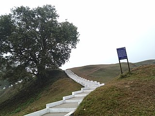
Rajpat or Kamtapur Fort is an archaeological site in present-day Gosanimari in the Dinhata I CD block in the Dinhata subdivision of the Cooch Behar district in West Bengal, India.

Kamteswari temple is at Gosanimari in the Dinhata I CD block in the Dinhata subdivision of the Cooch Behar district in West Bengal, India.

Haripur is a village in the Cooch Behar II CD block in the Cooch Behar Sadar subdivision of the Cooch Behar district in West Bengal, India

Baikunthapur is a village in the Cooch Behar II CD block in the Cooch Behar Sadar subdivision of the Cooch Behar district in West Bengal, India

Sidheswari is a village in the Cooch Behar II CD block in the Cooch Behar Sadar subdivision of the Cooch Behar district in West Bengal, India

<span class="mw-page-title-main">Baneswar Shiva temple</span>

Baneswar Shiva temple is at Baneswar in the Cooch Behar II CD block in the Cooch Behar Sadar subdivision of the Cooch Behar district in West Bengal, India.

References

  1. "District Statistical Handbook 2013 Cooch Behar". Tables 2.2, 2.4b. Department of Planning and Statistics, Government of West Bengal. Archived from the original on 21 January 2019. Retrieved 5 August 2020.
  2. "District Census Handbook, Koch Bihar, Series 20, Part XIIA" (PDF). Census of India 2011, pages 17-21 Physical feafures. Directorate of Census Operations, West Bengal. Retrieved 5 August 2020.
  3. "C.D. Block Wise Primary Abstract Data(PCA)". West Bengal – District-wise CD Blocks. Registrar General and Census Commissioner, India. Retrieved 3 August 2020.
  4. Koch Bihar Jelar Purakirti (in Bengali), Data compilation and writing by Dr. Shyamachand Mukhopadhayay, published by the Department of Archaeology, Government of West Bengal, Second edition 1974, Page 22.
  5. Koch Bihar Jelar Purakirti (in Bengali), Data compilation and writing by Dr. Shyamachand Mukhopadhayay, published by the Department of Archaeology, Government of West Bengal, Second edition 1974, Page 44.