Gurap

Last updated

Gurap
Village
Gurap village in Hooghly district 02.jpg
West Bengal location map.svg
Red pog.svg
Gurap
Location in West Bengal, India
India location map.svg
Red pog.svg
Gurap
Gurap (India)
Coordinates: 23°02′14″N88°07′18″E / 23.037144°N 88.121556°E / 23.037144; 88.121556
CountryFlag of India.svg  India
State West Bengal
District Hooghly
Elevation
16 m (52 ft)
Population
 (2011)
  Total7,856
Languages
  Official Bengali, English
Time zone UTC+5:30 (IST)
PIN
712303 (Gurap)
Telephone/STD code03213
Lok Sabha constituency Hooghly
Vidhan Sabha constituency Dhanekhali
Website hooghly.gov.in

Gurap is a village in Dhaniakhali CD block in Chinsurah subdivision of Hooghly district in the state of West Bengal, India.

Contents

Geography

Invisible Square.svg
Mapscaleline.svg
8km
5miles
Red pog.svg
Dwarhatta
R
Invisible Square.svg
Hooghly
River
Haripal
R
Invisible Square.svg
Barun Napara
R
Invisible Square.svg
Dadpur
R
Invisible Square.svg
Polba
R
Invisible Square.svg
Gurap
R
Dhaniakhali
R
Invisible Square.svg
Borai
CT
Invisible Square.svg
Baruipara
CT
Invisible Square.svg
Jagatnagar
CT
Invisible Square.svg
Nasibpur
CT
Invisible Square.svg
Singur
CT
Invisible Square.svg
Balarambati
CT
Invisible Square.svg
Bargachhia
CT
Invisible Square.svg
Tarakeswar
M
Invisible Square.svg
Champdani
M
Invisible Square.svg
Cities and towns in the Chandannagore subdivision and Polba Dadpur and Dhaniakhali CD Blocks of Chinsurah subdivision in Hooghly district
M: municipal corporation/ municipal city/ town, CT: census town, R: rural/ urban centre,
Owing to space constraints in the small map, the actual locations in a larger map may vary slightly

Location

The area is composed of flat alluvial plains that form a part of the Gangetic Delta. [1]

Police station

Gurap police station has jurisdiction over a part of Dhaniakhali CD block. [2] [3]

Urbanisation

In Chandannagore subdivision 58.52% of the population is rural and the urban population is 41.48%. Chandannagore subdivision has 1 municipal corporation, 3 municipalities and 7 census towns. The single municipal corporation is Chandernagore Municipal Corporation. The municipalities are Tarakeswar Municipality, Bhadreswar Municipality and Champdany Municipality. [4] Of the three CD Blocks in Chandannagore subdivision, Tarakeswar CD Block is wholly rural, Haripal CD Block is predominantly rural with just 1 census town, and Singur CD Block is slightly less rural with 6 census towns. Polba Dadpur and Dhaniakhali CD Blocks of Chinsurah subdivision (included in the map alongside) are wholly rural. [5] The municipal areas are industrialised. All places marked in the map are linked in the larger full screen map.

Demographics

As per the 2011 Census of India, Gurap had a total population of 7,856 of which 3,880 (49%) were males and 3,976 (51%) were females. Population below 6 years was 748. The total number of literates in Gurap was 5,126 (72.12% of the population over 6 years). [5]

Transport

Gurap railway station is situated on the Howrah-Bardhaman chord. [6]

The Kolkata-Agra National Highway 19/Durgapur Expressway passes through Gurap. [7]

Culture

David J. McCutchion mentions the Nandadulala temple (1751) at Gurap as a standard atchala temple with porch on triple archway having leafy swathes. He mentions the dol-mancha (18th century) near the Nandadulala temple as having rich terracotta. There are porches on neo classical pillars later attached to the atchala. [8]

The temple of Nandadulala at Gurap (at Sr No S-WB-63) is included in the List of State Protected Monuments in West Bengal by the Archaeological Survey of India. [9] [10]

Related Research Articles

<span class="mw-page-title-main">Hooghly district</span> District in West Bengal, India

Hooghly district is one of the districts of the Indian state of West Bengal. It can alternatively be spelt Hoogli or Hugli. The district is named after the Hooghly River.

<span class="mw-page-title-main">Bhadreswar, Hooghly</span> City in West Bengal, India

Bhadreswar is a city and a municipality of Hooghly district in the Indian state of West Bengal. It is a part of the area covered by Kolkata Metropolitan Development Authority (KMDA).

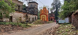
Champdani is a city and a municipality of Hooghly district in the Indian state of West Bengal. It is under Bhadreswar police station in Chandannagore subdivision. It is a part of the area covered by Kolkata Metropolitan Development Authority (KMDA). This town is famous for six factories, viz.the GIS Cotton Mill, Dalhousie Jute Mill, North Brook jute Mill, Angus jute Mill, Champdany Garbage Refinary Ltd, Lagan Engineering, and Braithwate Ltd.

<span class="mw-page-title-main">Singur</span> Census Town in West Bengal, India

Singur is a census town in Singur CD Block in Chandannagore subdivision of Hooghly district in the Indian state of West Bengal.

<span class="mw-page-title-main">Tarakeswar</span> City in West Bengal, India

Tarakeswar is a famous sacred city and a municipality in Hooghly district in the Indian state of West Bengal. Tarakeswar is called "Baba Dham" or "The city of Shiva". It is one of the major tourist and holy place of West Bengal as well as India. Tarakeswar is a place of pilgrimage of Lord Shiva sect in West Bengal 58 kilometres (36 mi) away from State Capital Kolkata and about 1,520 kilometres away from National Capital New Delhi. Tarakeswar can be reached conveniently by train and bus from various places of West Bengal. Tarakeswar Station is well connected by Howrah Station. This city is also famous for agriculture, Tarakeswar's potato is also famous in all over India.

<span class="mw-page-title-main">Chinsurah subdivision</span> Subdivision in West Bengal, India

Chinsurah subdivision is an administrative subdivision of the Hooghly district in the state of West Bengal, India.

<span class="mw-page-title-main">Chandannagar subdivision</span> Subdivision in West Bengal, India

Chandannagore subdivision is an administrative subdivision of the Hooghly district in the state of West Bengal, India.

<span class="mw-page-title-main">Haripal</span> Village in West Bengal, India

Haripal is a village in Haripal CD Block in Chandannagore subdivision of Hooghly district in the Indian state of West Bengal.

Dhaniakhali is a village in Dhaniakhali CD Block in Chinsurah subdivision of Hooghly district in the Indian state of West Bengal. The place has lent its name to the popular Dhaniakhali Sari.

Polba is a village in Polba Dadpur CD Block in Chinsurah subdivision of Hooghly district in the state of West Bengal, India.

<span class="mw-page-title-main">Baruipara</span> Census Town in West Bengal, India

Baruipara is a census town in Singur CD Block in Chandannagore subdivision of Hooghly district in the state of West Bengal, India.

<span class="mw-page-title-main">Jagatnagar</span> Census Town in West Bengal, India

Jagatnagar is a census town in Singur CD Block in Chandannagore subdivision of Hooghly district in the state of West Bengal, India.

Dadpur is a village in Polba Dadpur CD Block in Chinsurah subdivision of Hooghly district in the state of West Bengal, India.

Barun Napara is a village in Polba Dadpur CD Block in Chinsurah subdivision of Hooghly district in the state of West Bengal, India.

Bargachhia is a census town of Nalikul Purba Gram Panchayat in Haripal CD Block in Chandannagore subdivision of Hooghly district in the Indian state of West Bengal.

Balarambati is a census town in Singur CD Block in Chandannagore subdivision of Hooghly district in the Indian state of West Bengal.

Nasibpur is a census town in Singur CD Block in Chandannagore subdivision of Hooghly district in the Indian state of West Bengal.

Borai is a census town in Singur CD Block in Chandannagore subdivision of Hooghly district in the Indian state of West Bengal.

Dwarhatta is a village and a gram panchayat in the Haripal CD block in the Chandannagore subdivision of Hooghly district in the Indian state of West Bengal.

<span class="mw-page-title-main">Mahanad</span> Village in West Bengal, India

Mahanad is a gram panchayat, or village, in Polba-Dadpur CD block in Chinsurah subdivision of Hooghly district in the Indian state of West Bengal

References

  1. "District Census Handbook: Hugli, Series-20, Part XIIA" (PDF). Physiography, Page 17-24. Directorate of Census Operations, West Bengal, 2011. Retrieved 28 September 2018.
  2. "District Statistical Handbook 2014 Hooghly". Tables 2.1, 2.2. Department of Statistics and Programme Implementation, Government of West Bengal. Retrieved 3 October 2018.
  3. "Hooghly District Police". West Bengal Police. Retrieved 20 June 2017.
  4. "District Statistical Handbook 2014 Hooghly". Table 2.1, 2.2, 2.4(a). Department of Statistics and Programme Implementation, Government of West Bengal. Retrieved 27 September 2018.
  5. 1 2 "C.D. Block Wise Primary Census Abstract Data(PCA)". 2011 census: West Bengal – District-wise CD Blocks. Registrar General and Census Commissioner, India. Retrieved 27 September 2018.
  6. "36811 Howrah Bardhaman Jn Chord Local". Time Table. indiarailinfo. Retrieved 20 June 2017.
  7. "Rationalisation of Numbering Systems of National Highways" (PDF). New Delhi: Department of Road Transport and Highways. Archived from the original (PDF) on 1 February 2016. Retrieved 20 June 2017.
  8. McCutchion, David J., Late Mediaeval Temples of Bengal, first published 1972, reprinted 2017, pages 48, 73, 75. The Asiatic Society, Kolkata, ISBN   978-93-81574-65-2
  9. "Protected Monuments in West Bengal". Archaeological Survey of India. Archived from the original on 3 September 2013. Retrieved 27 September 2020.
  10. "Gurap: A Hidden Gem of Ancient Terracotta Works, Temples and More". Outlook India. Retrieved 18 March 2024.