Mirdhanga

Last updated
Mirdhanga
Census Town
West Bengal location map.svg
Red pog.svg
Mirdhanga
Location in West Bengal, India
India location map 3.png
Red pog.svg
Mirdhanga
Mirdhanga (India)
Coordinates: 23°11′25″N88°24′54″E / 23.19017°N 88.41494°E / 23.19017; 88.41494 Coordinates: 23°11′25″N88°24′54″E / 23.19017°N 88.41494°E / 23.19017; 88.41494
CountryFlag of India.svg  India
State West Bengal
District Hooghly
Population
 (2011)
  Total8,482
Languages
  Official Bengali, English
Time zone UTC+5:30 (IST)
PIN
712512
Telephone code03454
Vehicle registration WB
Lok Sabha constituency Hooghly
Vidhan Sabha constituency Balagarh
Website hooghly.gov.in

Mirdhanga is a census town in Balagarh CD Block in Chinsurah subdivision of Hooghly district in the Indian state of West Bengal.

Contents

Geography

Cities and towns in the Chinsurah subdivision (except Polba Dadpur and Dhaniakhali CD Blocks) in Hooghly district
M: municipal city/ town, CT: census town, R: rural/ urban centre,
Owing to space constraints in the small map, the actual locations in a larger map may vary slightly

Location

Mirdhanga is located at 23°11′25″N88°24′54″E / 23.19017°N 88.41494°E / 23.19017; 88.41494 . [1]

The Balagarh CD Block is mostly part of the Hooghly Flats, one of the three natural regions in the district composed of the flat alluvial plains that form a part of the Gangetic Delta. The region is a narrow strip of land along the 80 km long stretch of the Hooghly River, that forms the eastern boundary of the district. [2]

Urbanisation

There are 13 statutory towns and 64 census towns in Hooghly district. The right bank of the Hooghly River has been industrialised over a long period. With foreigners dominating the area’s industry, trade and commerce for over two centuries, it is amongst the leading industrialised districts in the state. At the same time the land is fertile and agricultural production is significant. [3]

In Chinsurah subdivision 68.63% of the population is rural and the urban population is 31.37%. It has 2 statutory and 23 census towns. [4] In Chinsurah Mogra CD Block 64.87% of the population is urban and 35.13% is rural. Amongst the four remaining CD Blocks in the subdivision two were overwhelmingly rural and two were wholly rural. [5]

The map alongside shows a portion of Chinsurah subdivision. All places marked in the map are linked in the larger full screen map.

Demographics

As per 2011 Census of India Mirdhanga had a total population of 8,482 of which 4,325 (51%) were males and 4,157 (49%) were females. Population below 6 years was 817. The total number of literates in Mirdhanga was 6,232 (81.30% of the population over 6 years). [5]

Transport

Mirdhanga is on State Highway 6 (locally known as STKK Road). [6]

The railway station at Behula on the Bandel-Katwa Branch Line is located nearby. [7]

Related Research Articles

Amodghata Census Town in West Bengal, India

Amodghata is a census town in Chinsurah Mogra CD Block in Chinsurah subdivision of Hooghly district in the state of West Bengal, India. It is a part of Kolkata Urban Agglomeration.

Badhagachhi Census Town in West Bengal, India

Badhagachhi is a census town in Balagarh CD Block in Chinsurah subdivision of Hooghly district in the Indian state of West Bengal.

Chak Bansberia Census Town in West Bengal, India

Chak Bansberia is a census town in Chinsurah Mogra CD Block in Chinsurah subdivision of Hooghly district in the state of West Bengal, India. It is a part of Kolkata Urban Agglomeration.

Dharmapur, West Bengal Census Town in West Bengal, India

Dharmapur is a census town in Chinsurah Mogra CD Block in Chinsurah subdivision of Hooghly district in the state of West Bengal, India. It is a part of Kolkata Urban Agglomeration.

Kodalia Census Town in West Bengal, India

Kodalia is a census town in Chinsurah Mogra CD Block in Chinsurah subdivision of Hooghly district in the Indian state of West Bengal. It is a part of Kolkata Urban Agglomeration.

Kulihanda Census Town in West Bengal, India

Kulihanda is a census town in Chinsurah Mogra CD Block in Chinsurah subdivision of Hooghly district in the Indian state of West Bengal. It is a part of Kolkata Urban Agglomeration.

Madhusudanpur Census Town in West Bengal, India

Madhusudanpur is a census town in Chinsurah Mogra CD Block in Chinsurah subdivision of Hooghly district in the Indian state of West Bengal. It is a part of Kolkata Urban Agglomeration.

Raghunathpur (PS-Magra) Census Town in West Bengal, India

Raghunathpur is a census town in Chinsurah Mogra CD Block in Chinsurah subdivision of Hooghly district in the Indian state of West Bengal. It is a part of Kolkata Urban Agglomeration.

Simla, West Bengal Census Town in West Bengal, India

Simla is a census town in Chinsurah Mogra CD Block in Chinsurah subdivision of Hooghly district in the Indian state of West Bengal. It is a part of Kolkata Urban Agglomeration.

Balagarh Village in West Bengal, India

Balagarh is a village in Balagarh CD Block in Chinsurah subdivision of Hooghly district in the state of West Bengal, India.

Jirat Town in West Bengal

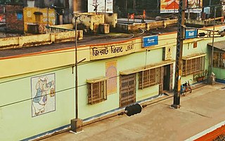
Jirat is a census town located in Hooghly District in the Indian State of West Bengal. This is the ancestral town of Sir Ashutosh Mukherjee and Shyama Prasad Mukherjee, bengali actor Anil Chatterjee, inventor of wooden bengali alphabet typeface Panchanan Karmakar, politician Ashim Kumar Majhi, bengali poet Charuchandra Banerjee and bengali sonnet writer Debendranath Sen were born in Jirat. There are few temples located in Jirat has historical relevance, Durga Puja is the main attraction of the town. It is the administrative headquarter of Balagarh Block. Jirat Hospital, Jirat College and Balagarh BDO Office are located in Jirat Bus Stand area.

Naldanga, Hooghly Census Town in West Bengal, India

Naldanga is a census town in Chinsurah Mogra CD Block in Chinsurah subdivision of Hooghly district in the Indian state of West Bengal. It is a part of Kolkata Urban Agglomeration.

Keota, Hooghly Census Town in West Bengal, India

Keota is a census town in Chinsurah Mogra CD Block in Chinsurah subdivision of Hooghly district in the Indian state of West Bengal. It is a part of Kolkata Urban Agglomeration.

Purusattompur Census Town in West Bengal, India

Purusattompur is a census town in Pandua CD Block in Chinsurah subdivision of Hooghly district in the Indian state of West Bengal.

Namajgram Census Town in West Bengal, India

Namajgram is a census town in Pandua CD Block in Chinsurah subdivision of Hooghly district in the Indian state of West Bengal.

Sripur, Hooghly Census Town in West Bengal, India

Sripur is a census town in Balagarh CD Block in Chinsurah subdivision of Hooghly district in the Indian state of West Bengal.

Kola, Hooghly Census Town in West Bengal, India

Kola is a census town in Chinsurah Mogra CD Block in Chinsurah subdivision of Hooghly district in the Indian state of West Bengal. It is a part of Kolkata Urban Agglomeration.

Hansghara Census Town in West Bengal, India

Hansghara is a census town in Chinsurah Mogra CD Block in Chinsurah subdivision of Hooghly district in the Indian state of West Bengal. It is a part of Kolkata Urban Agglomeration.

Alikhoja Census Town in West Bengal, India

Alikhoja is a census town in Chinsurah Mogra CD Block in Chinsurah subdivision of Hooghly district in the Indian state of West Bengal. It is a part of Kolkata Urban Agglomeration.

Manushpur Census Town in West Bengal, India

Manushpur is a census town in Chinsurah Mogra CD Block in Chinsurah subdivision of Hooghly district in the Indian state of West Bengal. It is a part of Kolkata Urban Agglomeration.

References

  1. "Census of India 2011, West Bengal: District Census Handbook, Hooghly" (PDF). Map of Balagarh CD Block, page 433. Directorate of Census Operations, West Bengal. Retrieved 25 September 2018.
  2. "District Census Handbook: Hugli, Series-20, Part XIIA" (PDF). Physiography, Page 17. Directorate of Census Operations, West Bengal, 2011. Retrieved 27 September 2018.
  3. "District Census Handbook: Hugli, Series-20, Part XIIA" (PDF). Physical features: pages 20, 24. Directorate of Census Operations, West Bengal, 2011. Retrieved 27 September 2018.
  4. "District Statistical Handbook 2014 Hooghly". Table 2.1, 2.2, 2.4(a). Department of Statistics and Programme Implementation, Government of West Bengal. Archived from the original on 21 January 2019. Retrieved 27 September 2018.
  5. 1 2 "C.D. Block Wise Primary Census Abstract Data(PCA)". 2011 census: West Bengal – District-wise CD Blocks. Registrar General and Census Commissioner, India. Retrieved 27 September 2018.
  6. Google maps
  7. "37911 Howrah Katwa Local". Indiarailinfo. Retrieved 4 June 2017.