Chinsurah subdivision

Last updated

Chinsurah subdivision
Subdivision
Bandel Basilica, Hooghly (West-Bengal).jpg
Bandel Church, founded in 1599, by the Portuguese, the oldest place of Christian worship in Bengal
Chinsurah Sadar (subdivision) in Hooghly (West Bengal).svg
Coordinates: 22°54′N88°23′E / 22.90°N 88.39°E / 22.90; 88.39
CountryFlag of India.svg  India
State West Bengal
District Hooghly
Headquarters Hugli-Chuchura
Area
  Total1,148.15 km2 (443.30 sq mi)
Population
 (2011)
  Total1,657,518
  Density1,400/km2 (3,700/sq mi)
Languages
  Official Bengali, English
Time zone UTC+5:30 (IST)
ISO 3166 code ISO 3166-2:IN
Vehicle registration WB
Website wb.gov.in

Chinsurah subdivision is an administrative subdivision of the Hooghly district in the state of West Bengal, India.

Contents

Overview

The eastern portion of Chinsurah subdivision is part of the Hooghly Flats, a natural physiographic region, that is a narrow strip of land along the Hooghly. The interior of the subdivision is part of the Hooghly-Damodar Plain, the agriculturally rich alluvial plains lying between the Hooghly and the Damodar. The entire area is a part of the Gangetic Delta. The Hooghly is a tidal river and has a high west bank. The Portuguese, the Dutch, the French, the Danes and the British dominated industry, trade and commerce in this area for more than two centuries, and as a result the Hooghly Flats region is highly industrialised. [1]

Subdivisions

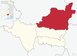
The Hooghly district is divided into the following administrative subdivisions: [2]

Hooghly Subdivision Map (en).svg
SubdivisionHeadquarters
Area
km2
Population
(2011)
Rural
Population %
(2011)
Urban
Population %
(2011)
Chinsurah Hugli-Chuchura 1,148.151,657,51868.6331.37
Chandannagore Chandannagar 508.081,127,17658.5241.48
Srirampore Serampore 422.451,469,84926.8873.12
Arambag Arambag 1,058.871,264,60294.775.23
Hooghly district Chinsurah 3,149.005,519,14561.4338.57
Chinsurah subdivision
Cities and towns in the Chinsurah subdivision (except Polba Dadpur and Dhaniakhali CD Blocks) in Hooghly district
M: municipal city/ town, CT: census town, R: rural/ urban centre,
Owing to space constraints in the small map, the actual locations in a larger map may vary slightly

Administrative units

Chinsurah subdivision has 9 police stations, 5 community development blocks, 5 panchayat samitis, 69 gram panchayats, 756 mouzas, 741 inhabited villages, 2 municipalities, 1 outgrowth and 23 census towns. The municipalities are Hooghly Chinsurah Municipality and Bansberia Municipality. The census towns are: Kola, Hansghara, Raghunathpur, Madhusudanpur, Amodghata, Alikhoja, Shankhanagar, Chak Bansberia, Manushpur, Keota, Kodalia, Naldanga, Kulihanda, Dharmapur, Simla, Badhagachhi, Mirdhanga, Sripur, Jirat, Batika, Pandua, Purusattompur and Namajgram. The subdivision has its headquarters at Hugli-Chuchura. [3] [4]

Subdivision of Hooghly District.jpg

The right bank of the Hooghly River has been industrialised over a long period. With the leading European powers dominating the area's industry, trade and commerce for over two centuries, it is amongst the leading industrialised areas in the state. At the same time the land is fertile and agricultural production is significant. [5]

In Chinsurah Mogra CD Block 64.87% of the population is urban and 35.13% is rural. Amongst the four remaining CD Blocks in the subdivision two are overwhelmingly rural and two are wholly rural. [6]

The map alongside shows a portion of Chinsurah subdivision. All places marked in the map are linked in the larger full screen map.

Kolkata Urban Agglomeration

The following Municipalities, Outgrowth and Census Towns in Chinsurah subdivision were part of Kolkata Urban Agglomeration in the 2011 census: Hugli-Chinsurah (M), Bansberia (M), Bara Khejuria (Out Growth), Shankhanagar (CT), Amodghata (CT), Chak Bansberia (CT), Naldanga (CT), Kodalia (CT), Kulihanda (CT), Simla (CT), Dharmapur (CT) and Keota (CT). [7]

Police stations

Police stations in Chinsurah subdivision have the following features and jurisdiction: [8] [9]

Police stationArea covered
km2
Municipal townCD Block
Dhaniakhali n/a- Dhaniakhali (partly)
Gurap n/a- Dhaniakhali (partly)
Pandua n/a- Pandua
Balagarh n/a- Balagarh
Chinsurah n/a Hugli-Chuchura, Bansberia Chinsurah Mogra (partly)
Chinsurah (Women) n/a Hugli-Chuchura -
Mogra n/a Bansberia Chinsurah Mogra (partly)
Polba n/a- Polba Dadpur
Dadpur n/a- Polba Dadpur

Blocks

Community development blocks in Chinsurah subdivision are: [2] [6]

Hooghly Tehsil Map (en).svg
CD BlockHeadquarters
Area
km2
Population
(2011)
SC  % ST  % Hindus  % Muslims  %Literacy
Rate %
Census
Towns
Balagarh Patuligram, Jirat 202.15228,99840.799.2389.248.8176.944
Chinsurah Mogra Mogra 81.86247,05529.513.6487.8010.3983.0115
Pandua Pandua 276.43316,19732.0415.3668.5824.1575.164
Dhaniakhali Dhaniakhali 275.68320,53433.0114.2680.8516.3475.66-
Polba Dadpur Barun Napara 285.69263,55535.7911.4777.9319.2975.14-

Gram panchayats

The subdivision contains 69 gram panchayats under 5 community development blocks: [10]

Economy

Industry

Industries are concentrated in the cities and towns of the Chinsurah Mogra area (outside the CD Block area), along the Hooghly. In the 17th and 18th centuries different industrial units came into existence with the development of various European settlements along the Hooghly. Initially, it was traditional industries, but later comparatively heavier industries came in. Amongst the better known industrial units in Chinsurah subdivision are: [11]

Handloom weaving

The handloom sarees of Dhaniakhali, Begampur, Jangipara, Rajbalhat areas and dhutis of Haripal, Rajbalhat, Khanakul areas of Hooghly district are widely familiar. [22]

Agriculture

Hooghly is an agriculturally prosperous district of West Bengal. Although the economy has been shifting away from agriculture, it is still the pre-dominant economic activity and the main source of livelihood for the rural people of the district. One third of the district income comes from agriculture. [23] Given below is an overview of the agricultural production (all data in tonnes) for Chinsurah subdivision, other subdivisions and the Hooghly district, with data for the year 2013-14. [24]

CD Block/ SubdivisionRiceWheatJutePulsesOil seedsPotatoesSugarcane
Dhaniakhali 64,0548325,499-5,11895,184-
Pandua 40,707---865288,975-
Balagarh 57,671480,44042,17660,285-
Chinsurah Mogra 10,5725560-167106,280-
Polba Dadpur 65,557-4,719-2,036262,084162
Chinsurah subdivision235,56192111,218410,362812,808162
Chandannagore subdivision 189,79112136,276-6,522313,692-
Srirampore subdivision 126,8521139,820128,058436,1112,437
Arambag subdivision 255,01175134,5413019,477514,903123,934
Hooghly district 807,215190421,8554644,4192,077,514126,533

Education

Hooghly district had a literacy rate of 81.80% as per the provisional figures of the census of India 2011. Chinsurah subdivision had a literacy rate of 79.17%, Chandannagore subdivision 83.01%, Srirampore subdivision 86.13% and Arambag subdivision 79.05. [25]

The table below (data in numbers) gives a comprehensive picture of the education scenario in Hooghly district for the year 2013-14: [25]

SubdivisionPrimary
School
Middle
School
High
School
Higher Secondary
School
General
College, Univ
Technical /
Professional Instt
Non-formal
Education
InstitutionStudentInstitutionStudentInstitutionStudentInstitutionStudentInstitutionStudentInstitutionStudentInstitutionStudent
Chinsurah89985,213463,8859848,722109124,068716,3422610,5642,41345,289
Chandannagore 60653,382323,3124622,0007789,132620,45067781,29729,127
Srirampore 57764,207253,6116537,99797108,199816,63137931,33733,060
Arambag 93580,705495,4628348,5137691,911716,95032281,83857,383
Hooghly district 3,013283,40715216,270292157,232359413,3102870,3733812,3636,885164,859

Note: Primary schools include junior basic schools; middle schools, high schools and higher secondary schools include madrasahs; technical schools include junior technical schools, junior government polytechnics, industrial technical institutes, industrial training centres, nursing training institutes etc.; technical and professional colleges include engineering colleges, medical colleges, para-medical institutes, management colleges, teachers training and nursing training colleges, law colleges, art colleges, music colleges etc. Special and non-formal education centres include sishu siksha kendras, madhyamik siksha kendras, centres of Rabindra mukta vidyalaya, recognised Sanskrit tols, institutions for the blind and other handicapped persons, Anganwadi centres, reformatory schools etc. [25]

The following institutions are located in Chinsurah subdivision:

Healthcare

The table below (all data in numbers) presents an overview of the medical facilities available and patients treated in the hospitals, health centres and sub-centres in 2014 in Hooghly district. [50]

SubdivisionHealth & Family Welfare Deptt, WB Other
State
Govt
Deptts
Local
bodies
Central
Govt
Deptts /
PSUs
NGO /
Private
Nursing
Homes
TotalTotal
Number
of
Beds
Total
Number
of
Doctors*
Indoor
Patients
Outdoor
Patients
Hospitals
Rural
Hospitals
Block
Primary
Health
Centres
Primary
Health
Centres
Chinsurah12324---31611,09110894,2131,830,358
Chandannagore 13-8---41538285670,7241,105,060
Srirampore 32212---80991,8948563,6191,252,941
Arambag 11516---35589195783,4691,743,719
Hooghly district 681060---1872714,732306312,0255,932,078

.* Excluding nursing homes

Medical facilities in Chinsurah subdivision are as follows:
Hospitals in: (Name, location, beds) [51]
Hugli District Hospital, Hooghly Chinsurah Municipality, 550 beds
Chunchura Police Hospital, Hooghly Chinsurah Municipality, 98 beds
Hugli Jail Hospital, Hooghly Chinsurah Municipality, 27 beds
Bandel ESI Hospital, Chinsurah Mogra CD Block, PO Bandel, 250 beds
Bandel Railway Hospital, Polba Dadpur CD Block, PO Bandel, 4 beds
Bandel Thermal Power Station Hospital, Bansberia Municipality, PO Tribeni, 10 beds

Rural Hospitals: (Name, block, location, beds) [51]
Pandua Rural Hospital, Pandua CD Block, Pandua, 30 beds
Dhaniakhali Rural Hospital, Dhaniakhali CD Block, Dhaniakhali, 30 beds
Mogra Rural Hospital, Chinsurah Mogra CD Block, Mogra, 30 beds
Ahmedpur Rural Hospital, Balagarh CD Block, Patuligram, 30 beds
Polba Rural Hospital, Polba Dadpur CD Block, Polba, 30 beds

Primary Health Centres: (CD Block-wise)(CD Block, PHC location, beds) [51]
Chinsurah Mogra CD Block: Digsui (10 beds), R.N.Debdas (Naldanga), Bandel (6 beds)
Bansberia Municipality: Bansberia (5 beds)
Balagarh CD Block: Bakulia, Bakuliagram (6 beds), Dumurdaha-Nityanadapur, Gopalpur (10 beds), Guptipara (10 beds), Mohipalpur, Bridabanpur (4 beds), Sukharia, Somra (4 beds), Sripur-Bolagarh, Balagarh (10 beds)
Pandua CD Block: B.L.Mukherjee (Boinchigram), Boinchi (10 beds), Itachuna (10 beds), Dwarbasini (4 beds), Ramswarpur-Gopalnagar, Chandpur (10 beds), Haraldaspur, Hatni (10 beds), Jamgram (6 beds).
Polba Dadpur CD Block: Danarpur (10 beds), Makalpur (10 beds), Kamdebpur, Sugandha (4 beds).
Dhaniakhali CD Block: Bhandarhati (10 beds), Chopa (10 beds), Gurup, Palashi (10 beds), Porabazar (6 beds), Khejurdaha-Milki, Bhastara (10 beds).

Private Hospitals:* (Name, location, beds) [52]
Vivekananda Seva Sadan, Vill & PO Mandra, Dhaniakhali, 25 beds
Jannedra Memorial Child Health Care Hospital, Lions Club, Dhaniakhali, 25 beds
.* Excluding nursing homes

Electoral constituencies

Lok Sabha (parliamentary) and Vidhan Sabha (state assembly) constituencies in Chinsurah subdivision were as follows: [53]

Lok Sabha constituencyReservationVidhan Sabha constituencyReservationCD Block and/or Gram panchayats and/or municipal areas
Hooghly None Chunchura None Hooghly-Chunchura municipality and Bandel, Debanandapur, Kodalia I and Kodalia II gram panchayats of Chinsurah Mogra community development block, and Polba, Rajhat and Sugandha gram panchayats of Polba Dadpur CD Block
-- Balagarh Reserved for SC Balagarh CD Block and Chandrahati I, Chandrahati II, Digsui and Mogra I GPs of Chinsurah Mogra CD Block
-- Pandua None Pandua CD Block
-- Saptagram None Bansberia municipality, Aknna, Amnan, Goswami Malipara, Harit and Mahanad GPs of Polba Dadpur CD Block, and Mogra II and Saptagram gram panchayats of Chinsurah Mogra CD Block
-- Dhanekhali Reserved for SCBelmuri, Bhastara, Dashghara I, Dashghara II, Dhanekhali I, Dhanekhali II, Gurap, Gurbari I, Gurbari II, Khajurdaha Milki, Mandra, Somaspur I and Somaspur II GPs of Dhaniakhali CD Block, and Babnan, Dadpur, Makalpur and Satithan GPs of Polba-Dadpur CD Block
--Other two assembly segments in Chandannagore subdivision--

Related Research Articles

<span class="mw-page-title-main">Hugli-Chuchura</span> City in West Bengal, India

Hugli-Chuchura or Hooghly-Chinsurah is a city of Hooghly district and the district headquarters of Hooghly division in the Indian state of West Bengal. It is one of the densely populated cities of West Bengal. It lies on the bank of Hooghly River, 35 km north of Kolkata. It is located in the district of Hooghly and is home to the district headquarters. Chuchura houses the Commissioner of the Burdwan Range. The District Court building of Chinsurah is the longest building in West Bengal. It is a part of Greater Kolkata covered by Kolkata Metropolitan Development Authority (KMDA).

<span class="mw-page-title-main">Hooghly district</span> District in West Bengal, India

Hooghly district is one of the districts of the Indian state of West Bengal. It can alternatively be spelt Hoogli or Hugli. The district is named after the Hooghly River.

<span class="mw-page-title-main">Bansberia</span> City in West Bengal, India

Bansberia is a city and a municipality of Hooghly district in the Indian state of West Bengal. It is about 45 km (28 mi) away from Kolkata, at the western end of the Iswar Gupta Setu (Kalyani-Bansberia) Bridge. It is a part of the area covered by Kolkata Metropolitan Development Authority (KMDA). Bans Beria railway station is 4 km from Bandel Junction on the Bandel-Katwa Line.The area covered by two police stations - Chinsurah (W.no.1-4) and Mogra (W.no.5-22). The part of both Police Stations governed by Chandannagar Police Commissionerate. Very good and innocent people live here so, The criminal reports are very few in this city. It is the "Peaceful City" of Hooghly District. Kartik Puja is the famous festival of Bansberia.

Chak Bansberia is a census town in Chinsurah Mogra CD Block in Chinsurah subdivision of Hooghly district in the state of West Bengal, India. It is a part of Kolkata Urban Agglomeration.

Kodalia is a census town in Chinsurah Mogra CD Block in Chinsurah subdivision of Hooghly district in the Indian state of West Bengal. It is a part of Kolkata Urban Agglomeration.

Shankhanagar is a census town in Chinsurah Mogra CD Block in Chinsurah subdivision of Hooghly district in the Indian state of West Bengal. It is a part of Kolkata Urban Agglomeration.

<span class="mw-page-title-main">Mogra</span> Village in West Bengal, India

Mogra is a gram panchayat, or village, which is home to the headquarters of the Chinsurah-Mogra community development block in the Chinsurah subdivision of the Hooghly district in the Indian state of West Bengal. It has a station on the Howrah-Bardhaman Main Rail Line, 47 km from Howrah Station and 7 km from Bandel Station.

<span class="mw-page-title-main">Dhaniakhali (community development block)</span> Community development block in West Bengal, India

Dhaniakhali is a community development block that forms an administrative division in Chinsurah subdivision of Hooghly district in the Indian state of West Bengal. The place has lent its name to the tant (handloom) sari it produces.

<span class="mw-page-title-main">Polba Dadpur</span> Community development block in West Bengal, India

Polba Dadpur is a community development block that forms an administrative division in Chinsurah subdivision of Hooghly district in the Indian state of West Bengal.

Balagarh is a village in Balagarh CD Block in Chinsurah subdivision of Hooghly district in the state of West Bengal, India.

<span class="mw-page-title-main">Chinsurah Mogra</span> Community development block in West Bengal, India

Chinsurah Mogra is a community development block that forms an administrative division in Chinsurah subdivision of Hooghly district in the Indian state of West Bengal.

Dhaniakhali is a village in Dhaniakhali CD Block in Chinsurah subdivision of Hooghly district in the Indian state of West Bengal. The place has lent its name to the popular Dhaniakhali Sari.

<span class="mw-page-title-main">Pandua (community development block)</span> Community development block in West Bengal, India

Pandua is a community development block that forms an administrative division in Chinsurah subdivision of Hooghly district in the Indian state of West Bengal.

Polba is a village in Polba Dadpur CD Block in Chinsurah subdivision of Hooghly district in the state of West Bengal, India.

<span class="mw-page-title-main">Jirat</span> Town in West Bengal, India

Jirat is a census town located in Hooghly District in the Indian State of West Bengal. It is the administrative headquarter of Balagarh Block. It is birthplace of the Dr. Gangaprasad Mukherjee, Writer Charuchandra Banerjee, Tollywood actor Anil Chatterjee, sonnet writer Debendranath Senthe and poet Mohitlal Majumdar etc.

Naldanga is a census town in Chinsurah Mogra CD Block in Chinsurah subdivision of Hooghly district in the Indian state of West Bengal. It is a part of Kolkata Urban Agglomeration.

Keota is a census town in Chinsurah Mogra CD Block in Chinsurah subdivision of Hooghly district in the Indian state of West Bengal. It is a part of Kolkata Urban Agglomeration.

Purusattompur is a census town in Pandua CD Block in Chinsurah subdivision of Hooghly district in the Indian state of West Bengal.

Mirdhanga is a census town in Balagarh CD Block in Chinsurah subdivision of Hooghly district in the Indian state of West Bengal.

Hansghara is a census town in Chinsurah Mogra CD Block in Chinsurah subdivision of Hooghly district in the Indian state of West Bengal. It is a part of Kolkata Urban Agglomeration.

References

  1. "District Census Handbook: Hugli, Series-20, Part XIIA" (PDF). Physiography, Page 17-24. Directorate of Census Operations, West Bengal, 2011. Retrieved 19 June 2017.
  2. 1 2 "District Statistical Handbook 2014 Hooghly". Table 2.2, 2.4(a). Department of Statistics and Programme Implementation, Government of West Bengal. Archived from the original on 21 January 2019. Retrieved 3 October 2018.
  3. "District Statistical Handbook 2014 Hooghly". Table 2.1. Department of Statistics and Programme Implementation, Government of West Bengal. Archived from the original on 21 January 2019. Retrieved 6 October 2018.
  4. "Directory of District, Subdivision, Panchayat Samiti/ Block and Gram Panchayats in West Bengal". Hooghly - Revised in March 2008. Panchayats and Rural Development Department, Government of West Bengal. Retrieved 19 June 2017.
  5. "District Census Handbook: Hugli, Series-20, Part XIIA" (PDF). Physical features: pages 20, 24. Directorate of Census Operations, West Bengal, 2011. Retrieved 27 September 2018.
  6. 1 2 "C.D. Block Wise Primary Census Abstract Data(PCA)". 2011 census: West Bengal – District-wise CD Blocks. Registrar General and Census Commissioner, India. Retrieved 24 October 2016.
  7. "Provisional Population Totals, Census of India 2011" (PDF). Constituents of Urban Agglomeration Having Population Above 1 Lakh. Census of India 2011. Retrieved 16 June 2017.
  8. "District Statistical Handbook 2014 Hooghly". Tables 2.1, 2.2. Department of Statistics and Programme Implementation, Government of West Bengal. Archived from the original on 21 January 2019. Retrieved 3 October 2018.
  9. "Hooghly District Police". West Bengal Police. Archived from the original on 5 July 2017. Retrieved 20 June 2017.
  10. "Directory of District, Subdivision, Panchayat Samiti/ Block and Gram Panchayats in West Bengal". Hooghly - Revised in March 2008. Panchayats and Rural Development Department, Government of West Bengal. Retrieved 20 June 2017.
  11. "District Human Development Report: Hooghly" (PDF). page 71. Development and Planning Department, Government of West Bengal, 2011. Archived from the original (PDF) on 7 August 2017. Retrieved 26 June 2017.
  12. "ET Markets". The Economic Times. Retrieved 26 June 2017.
  13. "Dunlop's Sahaganj factory a drag on group: Ruia". 25 October 2011. Live Mint. Retrieved 26 June 2017.
  14. "Paper Boards and Speciality Papers Division". ITC Ltd. Archived from the original on 30 June 2017. Retrieved 26 June 2017.
  15. "West Bengal Power Development Corporation". Bandel Thermal Power Station. WBPDC. Retrieved 26 June 2017.
  16. "Pailan Group – Ascon Agro Products Ltd". potatoPRO.com. Retrieved 19 July 2017.
  17. "SPS buys Pailan food unit". Business Standard, 8 April 2008. Retrieved 19 July 2017.
  18. "SPS group acquires 55% of Pailan Arm". The Telegraph, 9 April 2008. Archived from the original on 3 February 2013. Retrieved 19 July 2017.
  19. "Pailan group (India) exports potato flakes to Israel". potatoPRO.com, 19 December 2010. Retrieved 19 July 2017.
  20. "Pailan potato flakes unit launched". Business Standard. 8 October 2007. Retrieved 19 July 2017.
  21. "S.R.Industry". indiamart.com. Retrieved 14 July 2017.
  22. "District Human Development Report: Hooghly" (PDF). page 67. Development and Planning Department, Government of West Bengal, 2011. Archived from the original (PDF) on 7 August 2017. Retrieved 26 June 2017.
  23. "District Human Development Report: Hooghly" (PDF). page 58. Development and Planning Department, Government of West Bengal, 2011. Archived from the original (PDF) on 7 August 2017. Retrieved 26 June 2017.
  24. "District Statistical Handbook 2014 Hooghly". Tables 18.1. Data for subdivisions/ district calculated by totalling the CD Block data provided. Department of Statistics and Programme Implementation, Government of West Bengal. Archived from the original on 21 January 2019. Retrieved 6 October 2018.
  25. 1 2 3 "District Statistical Handbook 2014 Hooghly". Basic data: Table 4.4, 4.5, Clarifications: other related tables. Department of Statistics and Programme Implementation, Government of West Bengal. Archived from the original on 21 January 2019. Retrieved 6 October 2016.
  26. "Hooghly Mohsin College". HMC. Retrieved 30 June 2017.
  27. "Hooghly Mohsin College". College Admission. Retrieved 30 June 2017.
  28. "Hooghly Women's College". HWC. Retrieved 30 June 2017.
  29. "Hooghly Women's College". College Admission. Retrieved 30 June 2017.
  30. "Hooghly Engineering and Technology College". HETC. Retrieved 30 June 2017.
  31. "Abacus Institute of Engineering and Management". AIEM. Retrieved 30 June 2017.
  32. "Academy of Technology". AOT. Retrieved 30 June 2017.
  33. "Camellia Institute of Technology and Management". CITM. Retrieved 30 June 2017.
  34. "Techno India Group Public School, Hooghly". TIGPS. Retrieved 20 June 2018.
  35. "Saroj Mohan Institute of Technology". SMITGP. Retrieved 30 June 2017.
  36. "Modern Institute of Engineering and Technology". MIET. Retrieved 30 June 2017.
  37. "Polba Mahavidyalaya". PM. Retrieved 30 June 2017.
  38. "Polba Mahavidyalaya". College Admission. Retrieved 30 June 2017.
  39. "Balagarh Bijoy Krishna Mahavidyalaya". BBKM. Retrieved 30 June 2017.
  40. "Balagarh Bejoy Krishna Mahavidyala". College Admission. Retrieved 30 June 2017.
  41. "Sarat Centenary College". SCC. Retrieved 30 June 2017.
  42. "Sarat Centenary College". College Admission. Retrieved 30 June 2017.
  43. "Bejoy Narayan Mahavidyalaya". BNM. Archived from the original on 1 July 2017. Retrieved 30 June 2017.
  44. "Bejoy Narayan Mahaviyalaya, Itachuna, Hooghly". College Admission. Retrieved 30 June 2017.
  45. "Sreegopal Banerjee College". SBC. Archived from the original on 3 July 2017. Retrieved 30 June 2017.
  46. "Sreegopal Banerjee College". College Admission. Retrieved 30 June 2017.
  47. "Government Training College, Hooghly". GTC. Retrieved 30 June 2017.
  48. "Government Training College, Hooghly". College Admission. Retrieved 30 June 2017.
  49. "Indira Gandhi Teachers Training College". College Dekho. Retrieved 30 June 2017.
  50. "District Statistical Handbook 2014 Hooghly". Table 3.1, 3.3. Department of Statistics and Programme Implementation, Government of West Bengal. Archived from the original on 21 January 2019. Retrieved 6 October 2018.
  51. 1 2 3 "Health & Family Welfare Department". Health Statistics. Government of West Bengal. Archived from the original on 28 October 2021. Retrieved 15 July 2017.
  52. "Private Hospitals in Hooghly district" (PDF). The list includes Nursing Homes also, but below we are giving only Hospitals. Hooghly district administration. Retrieved 17 July 2017.
  53. "Delimitation Commission Order No. 18, 15 February 2006" (PDF). West Bengal. Election Commission of India. Retrieved 24 May 2017.