Mahanad | |
|---|---|
Village | |
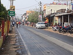 Mahanad Chowrasta | |
 Mahanad Location in West Bengal, India  Mahanad Mahanad (India) | |
| Coordinates: 23°00′N88°16′E / 23.00°N 88.26°E | |
| Country | |
| State | West Bengal |
| District | Hooghly |
| Government | |
| • Type | Panchayati raj (India) |
| • Body | Gram panchayat |
| Elevation | 15 m (49 ft) |
| Languages | |
| • Official | Bengali, English |
| Time zone | UTC+5:30 (IST) |
| PIN | 712149, 712148 |
| Telephone code | 03213 |
| ISO 3166 code | IN-WB |
| Vehicle registration | WB |
| Lok Sabha constituency | Hooghly |
| Vidhan Sabha constituency | Saptagram |
Mahanad is a gram panchayat, or village, in Polba-Dadpur CD block in Chinsurah subdivision of Hooghly district in the Indian state of West Bengal [1] [2] [3]


