Hetampur

Last updated

Hetampur
Town
Hetampur Royal Palace.jpg 04.jpg
Hetampur Royal palace
West Bengal location map.svg
Red pog.svg
Hetampur
Location in West Bengal, India
Coordinates: 23°46′55″N87°24′12″E / 23.781936°N 87.403346°E / 23.781936; 87.403346
CountryFlag of India.svg  India
State West Bengal
District Birbhum
Population
 (2011) [1]
  Total2,388
Languages
  Official Bengali, English
Time zone UTC+5:30 (IST)
PIN
731124
Telephone/STD code91 3462
ISO 3166 code IN-BR
Lok Sabha constituency Birbhum
Vidhan Sabha constituency Dubrajpur
Website birbhum.nic.in

Hetampur is a large village [1] in Suri Sadar subdivision of Birbhum District in the Indian state of West Bengal. It is situated near Dubrajpur. The village is famous for the Royal and historical palace. [2]

Contents

Geography

Invisible Square.svg
Mapscaleline.svg
8km
5miles
Red pog.svg
Ajay River
Bakreshwar
River
Mayurakshi
River
Tilpara
Barrage
B
Invisible Square.svg
Patharchapuri
R
Invisible Square.svg
Bakreshwar
RV
Invisible Square.svg
Deucha
R
Invisible Square.svg
Bara Chaturi
R
Invisible Square.svg
Nakrakonda
R
Invisible Square.svg
Abinashpur
R
Invisible Square.svg
Hetampur
R
Purandarpur
R
Invisible Square.svg
Angar Garia
R
Invisible Square.svg
BTPP Township
R
Invisible Square.svg
Kankartala
R
Invisible Square.svg
Khoyrasol
R
Invisible Square.svg
Panrui
R
Invisible Square.svg
Chandrapur
R
Invisible Square.svg
Lokpur
R
Invisible Square.svg
Mohammad Bazar
R
Invisible Square.svg
Dubrajpur
M
Invisible Square.svg
Sainthia
M
Invisible Square.svg
Suri
M
Invisible Square.svg
Rajnagar
CT
Invisible Square.svg
Ahmedpur
CT
Invisible Square.svg
Cities and towns in Suri Sadar subdivision of Birbhum district
M: municipal city/ town, CT: census town, R: rural/ urban centre, B: Barrage.
Owing to space constraints in the small map, the actual locations in a larger map may vary slightly

Location

Hetampur is located at 23°46′55″N87°24′12″E / 23.781936°N 87.403346°E / 23.781936; 87.403346 .

Demographics

As of the 2011 Census, Hetampur had a population of 2,388; 1,188 males and 1,200 females, giving a ratio of 1010 compared to the West Bengal state average of 950. [1] There were 282 children aged 0–6 and a child sex ratio of 1104, compared to the West Bengal state average of 956.

Hetampur village had a literacy rate of 76.21%, compared to 76.26% of West Bengal- male literacy was 84.82% and female was 67.59% [1]

Education

At Hetampur Krishna Chandra College, popularly known as Hetampur Mahavidyalaya is one of the reputed and oldest college of the West Bengal. There are also few schools and training institutes such as Hetampur Raj High School, Hetampur Girls’ High School, St. Andrus, Hetampur Model School, DAV Public School, Rabindra Najrul Smrit B. Ed College, Hetampur Rajbati Primary Teachers Training Institute etc. [3]

Culture

Rajbari

The Rajbari was built in the shape of a castle with 999 doors which has given it the name Hetampur HajarDuari. [4] (hajar is one thousand in Bengali, duari means doored). Hetampur Rajbari has been used by film directors such as Satyajit Ray, Mrinal Sen, Tarun Majumdar, Raja Sen, Dilip Roy, Sandip Ray and others in many Bengali films Goopy Gyne Bagha Byne, Abhijan, Mrigaya, and Ganadebata. [5] [6]

Temples

Hetampur has many interesting terracotta temples in various styles of architecture. During the late 1940s till about 1952 Indian artist Mukul Dey conducted detailed photographic survey of Birbhum-Barddhaman group of terracotta temples. He visited Hetampur and photo recorded the Gol-Mandir, the Chandranath Shiva temple and the Dewanji temples here. Chandranatha Siva Mandir in Hetampur of Dubrajpur, Birbhum built in 1847 is Octagonal pinnacled - Naba Ratna type with terracotta on three sides. Dewanji Mandir nearby is tightly ridged Rekha type with small terracotta facade of 19th century Birbhum-Barddhaman style having rich terracotta on two sides. Out of these three temples, the Gol-Mandir temple is no longer in existence at Hetampur. Its memory survives only in the photographs by Mukul Dey. A portrait of Queen Victoria, European nuns and priests form the theme of decoration on a 19th-century temple in Hetampur. [7]

Fair

Bipracharan Chakravarty of the Hetampur Raj family started a Saraswati Puja at Hetampur. His grandson, Ramranjan, started a 3-days fair on the occasion. The fair continues on the grounds of the Hetampur Rajbari. Gurusaday Dutt had once presented raibeshe bratachari during the fair. Many renowned personalities were invited to attend the fair and some of them came. Hetampur Royal Theatre and Ranjan Opera had their inaugural shows at the fair. [8]


Related Research Articles

<span class="mw-page-title-main">Bakreshwar</span> Village in West Bengal, India

Bakreshwar is a village in Dubrajpur CD Block in Suri Sadar subdivision of Birbhum district in the Indian state of West Bengal. Bakreshwar Thermal Power Station of West Bengal Power Development Corporation Limited and Bakreswar Thermal Power Plant Township are located some distance away from this town. The nearest railway station of Bakreshwar is Siuri.

<span class="mw-page-title-main">Dubrajpur</span> City in West Bengal, India

Dubrajpur is a town and a municipality in Suri Sadar subdivision of Birbhum district in the Indian state of West Bengal.

Ilambazar is a census town, with a police station, in Ilambazar CD block in Bolpur subdivision of Birbhum district in the Indian state of West Bengal.

<span class="mw-page-title-main">Rajnagar, Birbhum</span> Census Town in West Bengal, India

Rajnagar is a census town situated in the Rajnagar CD block within the Suri Sadar subdivision of Birbhum district in the Indian state of West Bengal. Once the capital of Royal Kingdoms in the area, Rajnagar's significance declined with the fading away of the kingdoms.

Patharchapuri is a village in Suri I CD Block in Suri Sadar subdivision of Birbhum District in the Indian state of West Bengal. It is 12 kilometres (7.5 mi) from Suri. It is famous for Patharchapuri Dargah Sharif the monument of Data Mehboob Shah Wali. The nearest railway station of Patharchapuri is Siuri railway station.

<span class="mw-page-title-main">Surul</span> Census Town in West Bengal, India

Surul is a census town in Bolpur Sriniketan CD block in Bolpur subdivision of Birbhum district in the Indian state of West Bengal.

<span class="mw-page-title-main">Dubrajpur (community development block)</span> Community development block in West Bengal, India

Dubrajpur is a community development block that forms an administrative division in Suri Sadar subdivision of Birbhum district in the Indian state of West Bengal.

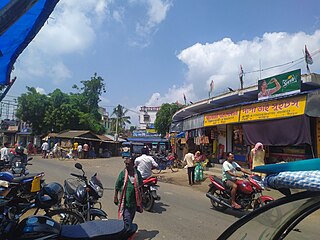
Purandarpur is a village in Suri II CD block in Suri Sadar subdivision of Birbhum district in the state of West Bengal, India.

<span class="mw-page-title-main">Suri, Birbhum</span> City in West Bengal, India

Suri is a city and a municipality in the Indian state of West Bengal. It is the headquarters of the Birbhum district.

<span class="mw-page-title-main">Panrui</span> Village in West Bengal, India

Panrui is a village in Sainthia and a community development block in the Suri Sadar subdivision of the Birbhum district, West Bengal, India. It is about 160 km (99 mi) from Kolkata and 18 km (11 mi) from Visva-Bharati University. It is also 18 km (11 mi) from Siuri, the sadar town of Birbhum district. It has a population of 1,146.

Deucha is a village and a gram panchayat in Mohammad Bazar CD Block in Suri Sadar subdivision of Birbhum district in the Indian state of West Bengal.

Bakreswar Thermal Power Plant Township is an industrial township in Suri I block in Suri Sadar subdivision of Birbhum district in the Indian state of West Bengal

Angar Garia is a village and gram panchayat in Mohammad Bazar CD Block in Suri Sadar subdivision of Birbhum district.

Karidhya is a census town in Suri I CD block in Suri Sadar subdivision of Birbhum district in the Indian state of West Bengal.

Lokpur is a village and gram panchayat in Khoyrasol CD Block in Suri Sadar subdivision of Birbhum district in the Indian state of West Bengal.

Kankartala is a village in Khoyrasol CD Block in Suri Sadar subdivision of Birbhum district in the Indian state of West Bengal.

Nakrakonda is a village and gram panchayat in Khoyrasol CD Block in Suri Sadar subdivision of Birbhum district in the Indian state of West Bengal.

Chandrapur is a village and gram panchayat in Rajnagar CD Block in Suri Sadar subdivision of Birbhum district in the Indian state of West Bengal.

Abinashpur is a village and gram panchayat in Suri II CD Block in Suri Sadar subdivision of Birbhum district in the Indian state of West Bengal.

Kalipur is a census town in Suri I CD block in Suri Sadar subdivision of Birbhum district, West Bengal, India.

References

  1. 1 2 3 4 "Hetampur Population - Birbhum, West Bengal". Census 2011. Archived from the original on 1 September 2018. Retrieved 1 September 2018.
  2. "Hetampur". Birbhum district administration. Archived from the original on 14 July 2011. Retrieved 24 August 2007.
  3. "Hetampur Rajbati Primary Teachers Training Institute". Hetampur Rajbati PTTI. Archived from the original on 26 July 2011. Retrieved 16 September 2007.
  4. "শীতের ছোট্ট ট্রিপে চলুন হেতমপুর রাজবাড়ি! এই বাড়িতেই হয়েছিল গুপি-বাঘার শ্যুটিং". News18 বাংলা (in Bengali). 11 December 2023. Retrieved 9 April 2024.
  5. "Where history speaks in whispers". The Statesman, 20 January 2007. Retrieved 16 September 2007.[ dead link ]
  6. Amitabha Gupta. "Tales of a palace: Exploring the built heritage of Hetampur" . Retrieved 9 April 2024.
  7. "Mukul Dey Archives". Chitralekha. Archived from the original on 27 September 2007. Retrieved 16 September 2007.
  8. Mukhopadhyay Aditya, Birbhumer Mela, Paschim Banga , Birbhum Special Issue, February 2006, (in Bengali), pp. 203-214, Information & Cultural Department, Government of West Bengal.