Dighalgram

Last updated

Dighalgram is a village located in Mohammad Bazar Block of Birbhum district, West Bengal with total 1360 families residing. The Dighalgram village has population of 6284 of which 3194 are males while 3090 are females as per Population Census 2011. [1]

Birbhum district District of West Bengal in India

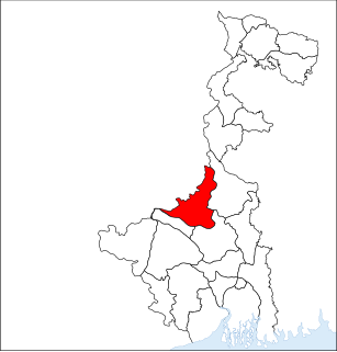
Birbhum district is an administrative unit in the Indian state of West Bengal. It is the northernmost district of Burdwan division—one of the five administrative divisions of West Bengal. The district headquarters is in Suri. Other important cities are Rampurhat, Bolpur and Sainthia. Jamtara, Dumka and Pakur districts of the state of Jharkhand lie at the western border of this district; the border in other directions is covered by the districts of Bardhaman and Murshidabad of West Bengal.

West Bengal State in Eastern India

West Bengal is a state in the eastern region of India along the Bay of Bengal. With over 91 million inhabitants, it is India's fourth-most populous state. West Bengal is the thirteenth-largest Indian state, with an area of 88,752 km2 (34,267 sq mi). Part of the ethno-linguistic Bengal region of the Indian subcontinent, it borders Bangladesh in the east, and Nepal and Bhutan in the north. It also borders the Indian states of Odisha, Jharkhand, Bihar, Sikkim, and Assam. The state capital is Kolkata (Calcutta) the seventh-largest city in India, and center of the third-largest metropolitan area in the country. West Bengal includes the Darjeeling Himalayan hill region, the Ganges delta, the Rarh region, and the coastal Sundarbans. The main ethnic group is the Bengalis, with Bengali Hindus forming the demographic majority.

In Dighalgram village population of children with age 0-6 is 949 which makes up 15.10% of total population of village. Average Sex Ratio of Dighalgram village is 967 which is higher than West Bengal state average of 950. Child Sex Ratio for the Dighalgram as per census is 981, higher than West Bengal average of 956. [1]

Dighalgram village has lower literacy rate compared to West Bengal. In 2011, literacy rate of Dighalgram village was 64.52% compared to 76.26% of West Bengal. In Dighalgram Male literacy stands at 68.66% while female literacy rate was 60.23%.

As per constitution of India and Panchyati Raaj Act, Dighalgram village is administrated by Sarpanch (Head of Village) who is elected representative of village. [1]

India Country in South Asia

India, officially the Republic of India, is a country in South Asia. It is the seventh-largest country by area, the second-most populous country, and the most populous democracy in the world. Bounded by the Indian Ocean on the south, the Arabian Sea on the southwest, and the Bay of Bengal on the southeast, it shares land borders with Pakistan to the west; China, Nepal, and Bhutan to the north; and Bangladesh and Myanmar to the east. In the Indian Ocean, India is in the vicinity of Sri Lanka and the Maldives; its Andaman and Nicobar Islands share a maritime border with Thailand and Indonesia.

Caste Factor :

Schedule Caste (SC) constitutes 7.11% while Schedule Tribe (ST) were 3.93% of total population in Dighalgram village.

Work Profile :

In Dighalgram village out of total population, 1675 were engaged in work activities. 60.78% of workers describe their work as Main Work (Employment or Earning more than 6 Months) while 39.22% were involved in Marginal activity providing livelihood for less than 6 months. Of 1675 workers engaged in Main Work, 112 were cultivators (owner or co-owner) while 339 were Agricultural labourer. [1]

Related Research Articles

Gairkata Census Town in West Bengal, India

Gairkata is a census town in Jalpaiguri district in the state of West Bengal, India. It is the native town of prominent Bengali writer Samaresh Majumdar, poet and journalist Bikash Sarkar and CPI leader Samar Ganguly. Gairkata, home to Gosaihat Eco-Park, features Telipara as its main industrial hub. An NGO named Aaranyak was also located in Gairkata.

Ikolahi village in Punjab, India

Ikolahi is a village in Khanna tehsil in Ludhiana district of Punjab State, India. It is located 39 km to the east of District headquarters Ludhiana. 7 km from Khanna. 68 km from State capital Chandigarh Ikolahi Pin code is 141401 and postal head office is Khanna. Libra (2 km), Bhamadi (2 km), Daudpur (2 km), Rasulra (2 km), Chakohi (3 km) are the nearby villages to Ikolahi.

Asaveerankudikkadu village in Tamil Nadu, India

Asaveerankudikkadu is a village in the Sendurai taluk of Ariyalur district, Tamil Nadu, India.

Puritipenta Village in Andhra Pradesh, India

Puritipenta is located in Gajapathinagaram Mandal/Tehsil of Vizianagaram District in Andhra Pradesh State, India.

Pamena is a village and panchayat in Ranga Reddy district, Telangana, India. It falls under Chevella mandal. Pamena a village is on the Chevella-Shadnagar road route. It also a part of Hyderabad Metropolitan Development Authority.

Dhak Pandori Village in Punjab, India

Dhak Pandori is a village in Kapurthala district in North India, in the central part of the Punjab. Dhak Pandori is a small village located in Phagwara Tehsil of Kapurthala district, Punjab with total 441 families residing. The Dhak Pandori village has population of 2439 of which 1297 are males while 1142 are females as per Population Census 2011.

Gundrevula Village in Andhra Pradesh, India

Gundrevula is a large village located in C.Belagal Mandal of Kurnool district, Andhra Pradesh with total 1137 families residing. The Gundrevula village has population of 5014 of which 2561 are males while 2453 are females as per Population Census 2011.

Boraj Tawaran village in Rajasthan, India

Boraj Tawaran is a village in the Udaipur district of Rajasthan, India. It comes under the Malpur gram panchayat, in Salumber block. The village is located 8 km east of Salumber. It is also known as Boraj Tanwaran or Boraj Tavraan. Salumbar is nearest town to Boraj Tawaran village. Around 1700 CE, a Thakur of the Tanwar clan moved to Salumber during the rule of Rawat Kesari Singh Chundawat. In 1876, his descendant Thakur Tej Singh Tanwar was granted the jagir of the present-day village site to Rawat Jodh Singh Chundawat.

Maliara Village in West Bengal, India

Maliara is a Village in Barjora in Bankura district of West Bengal State, India. It belongs to Burdwan Division. It is located 38 km towards north of district headquarter Bankura, 8 km from Barjora, 179 km from State capital Kolkata. This area had taken a pioneering role in India's freedom struggle. A large number of freedom fighters who had bravely faced the gallows are the sons of the soil of Maliara to free their motherland from the yokes of bondage, they had willingly sacrificed themselves in the freedom pyre. Maliara Raj Badi is a place where the last ruling kings of maliara resided, Now their ancestors do reside in this place. Durga puja is celebrated in maliara raj badi by ancestors of raja niladri narayan chandradhurjee. The idol of goddess durga which is being worshiped is more than 500 years old. A scenic place to view with historic temple in maliara bado rajbadi. The history of maliara boasts more than 1500 years back wherein the king came from Uttar Pradesh in a horse saving his idols from the intruders and was gifted land in west bengal. Where he created a village Maliara. Maliara has more than ten lakes, Making it village of lakes in WestBengal. A place to visit particularly in Durga Puja where you could plunge into the festival fever of Maliara Bado Rajbadi.

Annangi Village in Andhra Pradesh, India

Annangi is a village located in Maddipadu Mandal of Prakasam district, Andhra Pradesh, India This village in located on the banks of the Gundlakamma river.

Deengli village in Bikaner, India

Deengli is a village in Rajgarh, Churu, Rajasthan, India. As per 2011 Census of India, the village has population of 2197 of which 1144 are males while 1053 are females. It comes under ‘’’Sulkhnia chhotta’’’ Panchayath. It belongs to Bikaner Division. As per constitution of India and Panchyati Raaj Act, Deengli village is administrated by Sarpanch who is elected representative of village. It is located 65 km towards East from District headquarters Churu. 230 km from State capital Jaipur. The most famous place in Deengli is Net Dada JI temple.

Kava is a village in Idar, India. Total number of population in this village is close to 2500. Shrimati J. P Patel High School is the high school. This village surrounded by Arvalli Girimala. Formal Sarpanch of Kava, Ramanbhai Patel is the best Sarpanch of Kava.

Kamargoria Village in Purba Bardhaman district, India

Kamargoria is a village in Raina II CD Block in Bardhaman Sadar South subdivision of Purba Bardhaman district in the Indian state of West Bengal.

Bhonpur Village in West Bengal, India

Bhonpur is a village that are located near Boinchi in Hooghly district, West Bengal, India. It is under Pandua police station. Approximately it is 3 km apart from this region's main town Boinchi.

Mulgram is a village in Hooghly district, West Bengal, India. The village is 20 meters above sea level. Its post office is in Boinchi, its police station is in Pandua. Its pincode is 712134 and Bengali is the local language. The village is surrounded by the village named Bhonpur. Inchhura, etc. It's 4 km apart from region's main town Boinchi.

Inchhura Village in West Bengal, India

Inchhura(often called Insura) is a village in Hooghly district, West Bengal, India. The village is 20 meters over sea-level. Its post office is in Boinchi, its police station is in Pandua. Its pincode is 712134 and Bengali is the local language. The village is surrounded by the villages of Mulgram, Bhonpur, Piragram and is 4.5 km (approx) from this region's main town Boinchi.

Piragram Village in West Bengal, India

Piragram is a village in Hooghly district, West Bengal, India. The village is 15 meters abover sea-level. Its post office is in Roy-Jamna, its police station is in Pandua. Its pincode is 712134 and Bengali is the local language. The village is surrounded by the village named Roy-Jamna, Mulgram. Inchhura, etc.

Roy-Jamna Village in West Bengal, India

Roy-Jamna is a village in Hooghly district, West Bengal, India. The village is 13 meters over sea-level. Its post office is in Roy-Jamna, its police station is in Pandua. Its pincode is 712134 and Bengali is the local language. The village is surrounded by villages named Piragram, Gahami, Baidyapur, etc. This village is about 5 km apart from region's main town Boinchi.

Nauhatta Village in Bihar, India

Nauhatta is a large village in Nauhatta Block in Saharsa District of Bihar state, India. It belongs to Kosi Division. It is located 20 km towards North from District headquarters Saharsa. 165 km from State capital Patna. It comes under Mahisi constituency. The village had a population of 25,347 of which 13,124 were male while 12,223 were females as per Population Census 2011.

Amba, Birbhum Village in West Bengal, India

Amba is a village in Mayureswar I CD Block in Rampurhat subdivision of Birbhum district, West Bengal, India. Amba is a ward of Mollarpur and also a mouza. Here a primary school, an anganwari centre at Amba. It is Mollarpur III/XII.

References