Baital, Bankura

Last updated

Baital
Village
West Bengal location map.svg
Red pog.svg
Baital
Location in West Bengal, India
India location map.svg
Red pog.svg
Baital
Baital (India)
Coordinates: 22°57′48″N87°29′52″E / 22.9634°N 87.4977°E / 22.9634; 87.4977
CountryFlag of India.svg  India
State West Bengal
District Bankura
Population
 (2011)
  Total4,031
Languages
  Official Bengali, English
Time zone UTC+5:30 (IST)
PIN
722140
Telephone/STD code03243
Lok Sabha constituency Bishnupur
Vidhan Sabha constituency Bishnupur
Website bankura.gov.in

Baital is a village in the Joypur CD block in the Bishnupur subdivision of the Bankura district in the state of West Bengal, India. It is a part of Dakshinbar village.

Contents

Geography

Baital, Bankura
Places in Bishnupur subdivision in Bankura district
M: Municipal town, CT: census town, R: rural/ urban centre, T: ancient/ temple centre
Owing to space constraints in the small map, the actual locations in a larger map may vary slightly

Location

Baital is located at 22°57′48″N87°29′52″E / 22.9634°N 87.4977°E / 22.9634; 87.4977 .

Note: The map alongside presents some of the notable locations in the subdivision. All places marked in the map are linked in the larger full screen map.

Demographics

According to the 2011 Census of India, Dakshinbar had a total population of 4,031, of which 2,070 (51%) were males and 1,961 (49%) were females. There were 408 persons in the age range of 0–6 years. The total number of literate persons in Dakshinbar was 2,754 (76.01% of the population over 6 years). [1]

Education

Baital G.P. Vidyapith is a Bengali-medium coeducational institution established in 1926. It has facilities for teaching from class V to class XII. The school has 11 computers, a library with 1,100 books and a playground. [2]

Baital Girls’ High School is a Bengali-medium girls only institution established in 2011. It has facilities for teaching from class V to class X. [3]

Chatra Ramai Pandit Mahavidyalaya, was established at Chatra, PO Darapur in 2000. [4]

Culture

David J. McCutchion speaks of 2 temples at Baital. One is the Shyama Chandi temple, a pancha ratna with rigged rekha turrets and porch on triple archway, with 35 ft 4 in square base, a laterite plain structure built in 1660. The other is the Jhagrai Chandi temple, a smooth curvilinear rekha, with 11’ 2" square base, a laterite, largely plain structure, built in 1659. [5]

Healthcare

Joypur Block Primary Health Centre, with 15 beds at Joypur, is the major government medical facility in the Joypur CD block. [6]

Related Research Articles

<span class="mw-page-title-main">Kotulpur (community development block)</span> Community development block in West Bengal, India

Kotulpur is a community development block that forms an administrative division in the Bishnupur subdivision of the Bankura district in the Indian state of West Bengal.

<span class="mw-page-title-main">Bishnupur subdivision</span> Subdivision in West Bengal, India

Bishnupur subdivision is a subdivision of the Bankura district in the state of West Bengal, India.

<span class="mw-page-title-main">Joypur, Bankura (community development block)</span> Community development block in West Bengal, India

Joypur is a community development block that forms an administrative division in the Bishnupur subdivision of the Bankura district in the Indian state of West Bengal.

Chhatna is a village and a gram panchayat in the Chhatna CD block in the Bankura Sadar subdivision of the Bankura district in the state of West Bengal, India.

Indas is a village, with a police station, in the Indas CD block in the Bishnupur subdivision of the Bankura district in the state of West Bengal, India.

Kotulpur is a village in the Kotulpur CD block in the Bishnupur subdivision of the Bankura district in the state of West Bengal, India.

<span class="mw-page-title-main">Haripal</span> Village in West Bengal, India

Haripal is a village in Haripal CD Block in Chandannagore subdivision of Hooghly district in the Indian state of West Bengal.

Joypur is a village, with a police station, in the Joypur CD block in the Bishnupur subdivision of the Bankura district in the state of West Bengal, India.

Patrasayer is a village in the Patrasayer CD block in the Bishnupur subdivision of the Bankura district in the state of West Bengal, India.

Ghutgarya is a census town in the Barjora CD block in the Bankura Sadar subdivision of the Bankura district in the state of West Bengal, India.

Chatra is a village in the Kotulpur CD block in the Bishnupur subdivision of the Bankura district in the state of West Bengal, India.

Gumut is a village and gram panchayat in the Bishnupur CD block in the Bishnupur subdivision of the Bankura district in the state of West Bengal, India. It includes Muninagar.

Gokulnagar is a village in the Joypur CD block in the Bishnupur subdivision of the Bankura district in the state of West Bengal, India.

<span class="mw-page-title-main">Gokulchand Temple</span>

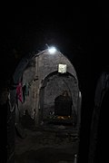
Gokulchand Temple is a 17th-century stone built pancharatna temple in Gokulnagar village in the Joypur CD block in the Bishnupur subdivision of the Bankura district in the state of West Bengal, India.

Ajodhya is a village in the Bishnupur CD block in the Bishnupur subdivision of the Bankura district in the state of West Bengal, India.

Balsi Purbapara is a village in the Patrasayer CD block in the Bishnupur subdivision of the Bankura district in the state of West Bengal, India.

Jagannathpur is a village in the Barjora CD block in the Bankura Sadar subdivision of the Bankura district in the state of West Bengal, India.

Patit Dommahal is a village in the Patrasayer CD block in the Bishnupur subdivision of the Bankura district in the state of West Bengal, India.

Maynapur is a village and a gram panchayat in the Joypur CD block in the Bishnupur subdivision of the Bankura district in the state of West Bengal, India.

Madanmohanpur is a village in the Sonamukhi CD block in the Bishnupur subdivision of the Bankura district in the state of West Bengal, India.

References

  1. "CD block Wise Primary Census Abstract Data(PCA)". West Bengal – District-wise CD blocks. Registrar General and Census Commissioner, India. Retrieved 17 April 2020.
  2. "Baital G.P. Vidyapith". Schools.org.in. Retrieved 4 May 2020.
  3. "Baital Girls' High School". Schools.org.in. Retrieved 4 May 2020.
  4. "Chatra Ramai Pandit Mahavidyalaya". CRPM. Retrieved 14 April 2020.
  5. McCutchion, David J., Late Mediaeval Temples of Bengal, first published 1972, reprinted 2017, pages 20,46, . The Asiatic Society, Kolkata, ISBN   978-93-81574-65-2
  6. "Health & Family Welfare Department" (PDF). Health Statistics – Rural Hospitals. Government of West Bengal. Archived from the original (PDF) on 8 October 2022. Retrieved 10 April 2020.