Gonpur

Last updated

Gonpur
Ganpur
Village
Ganpur temples (Birbhum) - Rameswar Shiva temple complex (10). Temples and the terracotta panels of Gangpur Rameswar temple complex (10).jpg
Rameswar Shiva temple complex - terracota carving
West Bengal location map.svg
Red pog.svg
Gonpur
Location in West Bengal, India
India location map.svg
Red pog.svg
Gonpur
Gonpur (India)
Coordinates: 24°04′03″N87°40′27″E / 24.0676°N 87.6742°E / 24.0676; 87.6742 Coordinates: 24°04′03″N87°40′27″E / 24.0676°N 87.6742°E / 24.0676; 87.6742
CountryFlag of India.svg  India
State West Bengal
District Birbhum
Population
 (2011)
  Total2,706
Official Languages
  Languages Bengali, English, Santali
Time zone UTC+5:30 (IST)
PIN
731216
Lok Sabha constituency Birbhum
Vidhan Sabha constituency Rampurhat
Website birbhum.nic.in

Gonpur (also spelled Ganpur) is an old village in Mohammad Bazar CD Block in Suri Sadar subdivision of Birbhum district, West Bengal, India.

Contents

Geography

It is situated beside NH 14 (old numbering NH 60). This village is surrounded on four sides with "Ganpur reserved forests". [1] A narrow canal passes through south of the village.

Ganpur is mainly covered with moram soil, and this sal forest is on moram soil. The villagers, living in villages (Ulpahari, Ghaga, Choubata, Shabla etc.) located inside the forest, have realised that they can make a living by selling plates (thalis/"tharis") made of sal leaves. [2]

Demographics

As per the 2011 Census of India, Ganpur had a total population of 2,706 of which 1,347 (50%) were males and 1,359 (50%) were females. Population below 6 years was 257. The total number of literates in Ganpur was 2,059 (84.08% of the population over 6 years). [3]

Education

Basantika Institute of Engineering and Technology (Polytechnic) at Gonpur offers diploma courses in engineering. [4]

There are two primary schools and a high school(H.S) in the village. This schools are well maintained and well equipped with modern facilities. There are about 800 students in the high school offering two streams, arts and science in higher secondary level.

Culture

Rameswar Shiva temple complex Ganpur temples (Birbhum) - Rameswar Shiva temple complex (03).jpg
Rameswar Shiva temple complex

David J. McCutchion mentions the many small char chala temples of the 18th and 19th centuries built of brick with facades richly carved, at Ganpur. He also mentions a Visnu temple of the Mondal family, built around 1769. It is an at chala temple built of brick with phulpathar facades richly carved. [5]

Ganpur Sabuj Sansad Gramin Pathagar, a government-sponsored library, was established in 1980. It has its own pucca building. [6]

Related Research Articles

Ghatal is a city and a municipality in Paschim Medinipur district, West Bengal, India. It is the headquarters of the Ghatal subdivision.

Khirpai City in West Bengal, India

Khirpai, also known as Kshirpai, is a city and a municipality in the Ghatal subdivision of the Paschim Medinipur district in the state of West Bengal, India. The city is situated between Ghatal and Chandrakona, near the banks of the rivers Shilabati and Kethai, and is one of the oldest municipalities in India. Khirpai is also famous for its ‘Babarsha’, a special type of sweetmeat, which is not available elsewhere.

Nanoor Village in West Bengal, India

Nanoor, is a village in Nanoor CD block in Bolpur subdivision of Birbhum district in West Bengal. Nanoor is the birthplace of 14th century lyric poet Chandidas of Vaishnava Padavali fame. It is developing as a craft centre with NGO support. With the massacres in 2000, Nanoor was in intense media focus.

Ilambazar is a census town, with a police station, in Ilambazar CD block in Bolpur subdivision of Birbhum district in the Indian state of West Bengal. A traditional weaving and trading centre it serves as a gateway to Birbhum district.

Mallarpur Census Town in West Bengal, India

Mallarpur is a census town in Mayureswar I CD Block in Rampurhat subdivision of Birbhum district in the Indian state of West Bengal.

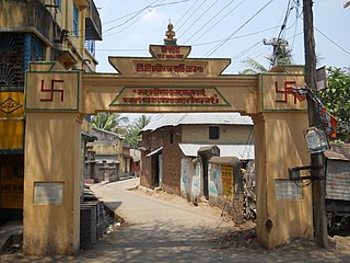
Daspur is a village, with a police station, in Daspur I CD Block in Ghatal subdivision of Paschim Medinipur district in the state of West Bengal, India.

Bhagabanpur is a village, in Bhagabanpur I CD block in Egra subdivision of Purba Medinipur district in the state of West Bengal, India.

Suri, Birbhum City in West Bengal, India

Suri is a city and a municipality in the Indian state of West Bengal. It is the headquarters of the Birbhum district.

Patrasayer is a village in the Patrasayer CD block in the Bishnupur subdivision of the Bankura district in the state of West Bengal, India.

Mankar is a village in Galsi I CD Block in Bardhaman Sadar North subdivision of Purba Bardhaman district in the state of West Bengal, India.

Fatehpur is a census town in Mayureswar I CD block in Rampurhat subdivision of Birbhum district.

Balsi Purbapara is a village in the Patrasayer CD block in the Bishnupur subdivision of the Bankura district in the state of West Bengal, India.

Patit Dommahal is a village in the Patrasayer CD block in the Bishnupur subdivision of the Bankura district in the state of West Bengal, India.

Pathra is a village and a gram panchayat in the Midnapore Sadar CD block in the Medinipur Sadar subdivision of the Paschim Medinipur district in the state of West Bengal, India.

Dihi Baliharpur is a village in the Daspur I CD block in the Ghatal subdivision of the Paschim Medinipur district in the state of West Bengal, India.

Jalshara is a village in the Ghatal CD block in the Ghatal subdivision of the Paschim Medinipur district in the state of West Bengal, India.

Dihi Bayara is a village in the Arambagh CD block in the Arambagh subdivision of Hooghly district in the Indian state of West Bengal.

Kayapat is a village in the Goghat II CD block in the Arambagh subdivision of Hooghly district in the Indian state of West Bengal.

Parul, Hooghly Village in West Bengal, India

Parul is a village in the Pursurah CD block in the Arambagh subdivision of Hooghly district in the Indian state of West Bengal.

Kotalpur is a village and a gram panchayat in the Jangipara CD block in the Srirampore subdivision of Hooghly district in the Indian state of West Bengal.

References

  1. http://wikimapia.org/22953593/Ganpur-forest [ user-generated source ]
  2. Ghosh, Kanailal, Birbhumer Bon Udbhidjo O Banyapran, Paschim Banga, Birbhum Special Issue, February 2006, (in Bengali),
  3. "2011 Census – Primary Census Abstract Data Tables". West Bengal – District-wise. Registrar General and Census Commissioner, India. Retrieved 6 February 2018.
  4. "Basantika Institute of Engineering and Technology (Polytechnic)". BIETP. Retrieved 9 February 2018.
  5. McCutchion, David J., Late Mediaeval Temples of Bengal, first published 1972, reprinted 2017, page 31. The Asiatic Society, Kolkata, ISBN   978-93-81574-65-2
  6. "List of Govt. Sponsored Libraries in the district of BIRBHUM" (PDF). Government of West Bengal. Archived from the original (PDF) on 4 February 2018. Retrieved 7 February 2018.