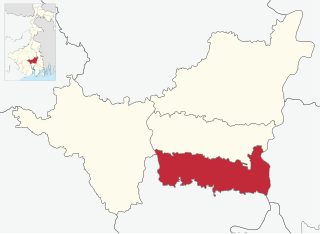
Kharsarai is a census town in Chanditala II CD Block in Srirampore subdivision of Hooghly district in the Indian state of West Bengal.
Purba Tajpur is a census town in Chanditala II CD Block in Srirampore subdivision of Hooghly district in the Indian state of West Bengal.

Antpur is a village in the Jangipara community development block of the Srirampore subdivision in the Hooghly District in the Indian state of West Bengal. It is around 20 km from Tarakeswar. Haripal is nearest railway station from Antpur.

Rajbalhat is a census town in Jangipara CD Block of Srirampore subdivision in Hooghly district in the Indian state of West Bengal. Rajbalhat can be reached conveniently by Bus from Kolkata, Haripal or Tarakeswar.
Masat is a census town in Chanditala I CD block in Srirampore subdivision of Hooghly district in the state of West Bengal, India.

Manirampur is a census town in Chanditala I CD Block in Srirampore subdivision of Hooghly district in the state of West Bengal, India.
Nababpur is a census town in Chanditala I CD Block in Srirampore subdivision of Hooghly district in the state of West Bengal, India.
Kumirmora is a census town in Chanditala I CD Block in Srirampore subdivision of Hooghly district in the state of West Bengal, India.
Bhagabatipur is a census town in Chanditala I CD Block in Srirampore subdivision of Hooghly district in the state of West Bengal, India.
Ramanathpur is a census town in Chanditala I CD Block in Srirampore subdivision of Hooghly district in the state of West Bengal, India.
Dudhkalmi is a census town in Chanditala I CD Block in Srirampore subdivision of Hooghly district in the state of West Bengal, India.
Naity is a census town in Chanditala II Block in Srirampore subdivision of Hooghly district in the state of West Bengal, India. Naity lies between Janai and Chanditala― two historical villages of Bengal and the village is in the eastern bank of the river Saraswati. The village Naity has two parts― North Naity and South Naity. North Naity's nearest railway station is Janai Road and South Naity's nearest railway station is Gobra. The school in Naity was founded in 1942.
Baksa is a census town in Chanditala II CD Block in Srirampore subdivision of Hooghly district in the state of West Bengal, India.
Jaykrishnapur is a census town in Chanditala II CD Block in Srirampore subdivision of Hooghly district in the state of West Bengal, India.
Panchghara is a census town in Chanditala II CD Block in Srirampore subdivision of Hooghly district in the state of West Bengal, India.
Kapashanria is a census town in Chanditala II CD Block in Srirampore subdivision of Hooghly district in the state of West Bengal, India.
Tisa is a census town in Chanditala II CD Block in Srirampore subdivision of Hooghly district in the state of West Bengal, India.

Chanditala is a town in Chanditala II community development block of Srirampore subdivision in Hooghly District in the Indian state of West Bengal.

Srirampore subdivision is an administrative subdivision of the Hooghly district in the state of West Bengal, India.
Kotalpur is a village and a gram panchayat in the Jangipara CD block in the Srirampore subdivision of Hooghly district in the Indian state of West Bengal.


