Goghat

Last updated

Goghat
Village
West Bengal location map.svg
Red pog.svg
Goghat
Location in West Bengal, India
India location map.svg
Red pog.svg
Goghat
Goghat (India)
Coordinates: 22°53′16″N87°42′7″E / 22.88778°N 87.70194°E / 22.88778; 87.70194
CountryFlag of India.svg  India
State West Bengal
District Hooghly
Government
  Type Panchayati raj (India)
  Body Gram panchayat
Population
 (2011)
  Total5,495
Languages
  Official Bengali, English
Time zone UTC+5:30 (IST)
ISO 3166 code IN-WB
Vehicle registration WB
Website wb.gov.in

Goghat is a village in the Goghat I CD block in the Arambag subdivision of the Hooghly district in the Indian state of West Bengal.

Contents

Geography

Invisible Square.svg
Mapscaleline.svg
8km
5miles
Red pog.svg
Damodar
River
Rupnarayan
River
Mundeswari
River
Dwarakeswar
River
Shyambazar
H
Invisible Square.svg
Satberia
H
Invisible Square.svg
Parul
H
Invisible Square.svg
Memanpur
H
Invisible Square.svg
Mamudpur
H
Invisible Square.svg
Madhabpur
H
Invisible Square.svg
Kanpur
HV
Invisible Square.svg
Kayapat
H
Invisible Square.svg
Hat Basantapur
H
Invisible Square.svg
Hamirbati
H
Invisible Square.svg
Gourhati
H
Invisible Square.svg
Fului
H
Invisible Square.svg
Dihi
Bayara
H
Invisible Square.svg
Bhalia
H
Invisible Square.svg
Bali Dewanganj
H
Invisible Square.svg
Badanganj
H
Invisible Square.svg
Gar Mandaran
H
Invisible Square.svg
Arambag
M
Invisible Square.svg
Dakshin Narayanpur
R
Invisible Square.svg
Natibpur
R
Invisible Square.svg
Shrirampur
R
Invisible Square.svg
Radhanagore
R
Invisible Square.svg
Keshabpur
R
Invisible Square.svg
Bengai
R
Invisible Square.svg
Pursurah
R
Invisible Square.svg
Kamarpukur
R
Invisible Square.svg
Cities and towns in Arambagh subdivision in Hooghly district
M: municipal city/ town, R: rural/ urban centre, H: historical/ religious centre
Owing to space constraints in the small map, the actual locations in a larger map may vary slightly

Location

Goghat is located at 22°53′16″N87°42′7″E / 22.88778°N 87.70194°E / 22.88778; 87.70194 . [1]

Area overview

The Arambagh subdivision, presented in the map alongside, is divided into two physiographic parts – the Dwarakeswar River being the dividing line. The western part is upland and rocky – it is the extension of the terrain of neighbouring Bankura district. The eastern part is flat alluvial plain area. The railways, the roads and flood-control measures have had an impact on the area. [2] The area is overwhelmingly rural with 94.77% of the population living in rural areas and 5.23% of the population living in urban areas. [3]

Note: The map alongside presents some of the notable locations in the subdivision. All places marked in the map are linked in the larger full screen map.

Demographics

According to the 2011 Census of India, Goghat had a total population of 5,495 of which 2,798 (51%) were males and 2,699 (49%) were females. Population in the age range 0–6 years was 580. The total number of literate persons in Goghat was 4,135 (84.13% of the population over 6 years). [4]

Civic administration

Police station

Goghat police station has jurisdiction over Goghat I and Goghat II CD blocks. [5] [6]

CD block HQ

The headquarters of Goghat I CD block are located at Goghat. [7]

Transport

EMU services, earlier operating from Howrah to Arambag, was extended to Goghat railway station, after completion of the electrified broad gauge Tarakewar-Goghat sector of the Tarakeswar-Bishnupur extension of the Sheoraphuli–Bishnupur branch line. [8]

Related Research Articles

Arambagh also known as Arambag is a town and a municipality in Hooghly district in the state of West Bengal, India. It is the headquarters of Arambagh subdivision.

Kamarpukur is a village in the Goghat II CD block in the Arambag subdivision of the Hooghly District in West Bengal state of India. It is the birthplace of Sri Ramakrishna. It is the block headquarters of the Goghat –II community development block.

Radhanagore in the khanakul Town Arambagh subdivision of the Hooghly District of West Bengal, India. It is the birthplace of Raja Rammohan Roy. Located near Khanakul, it is approachable from Tarakeswar or Arambag. Mundeswari river flows nearby.

<span class="mw-page-title-main">Arambag subdivision</span> Subdivision in West Bengal, India

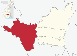
Arambag subdivision is an administrative subdivision of the Hooghly district in the Indian state of West Bengal.

Bengai is a village in the Goghat II CD block in the Arambagh subdivision of the Hooghly district in the Indian state of West Bengal.

Khanakul is a town in Hooghly District in the state of West Bengal, India. Khanakul is the birthplace of Raja Ramohon Roy. The town is famous for Ratnavali Temple, Gopinath Temple, Radhavallabh Temple, Ghontashor Temple. Khanakul can be reached conveniently by Bus from Kolkata or Tarakeswar. Tarakeswar Station is the nearest railway station from Khanakul.

Pursurah is a village in the Pursurah CD block in the Arambag subdivision of Hooghly district in the Indian state of West Bengal.

Gar Mandaran is a village and a gram panchayat in the Goghat II CD block in the Arambag subdivision of the Hooghly district in the state of West Bengal, India.

Keshabpur is a village in the Aramgah CD block in the Arambag subdivision of the Hooghly district in the state of West Bengal, India.

Badanganj is a village in the Goghat II CD block in the Arambagh subdivision of Hooghly district in the Indian state of West Bengal.

Bhalia is a village in the Arambagh CD block in the Arambagh subdivision of Hooghly district in the Indian state of West Bengal.

Hamirbati is a village in the Arambagh CD block in the Arambagh subdivision of Hooghly district in the Indian state of West Bengal.

Fului is a village in the Goghat II CD block in the Arambagh subdivision of Hooghly district in the Indian state of West Bengal.

Mamudpur is a village in the Goghat II CD block in the Arambagh subdivision of Hooghly district in the Indian state of West Bengal.

Memanpur is an inhabited place in the Goghat II CD block in the Arambagh subdivision of Hooghly district in the Indian state of West Bengal.

Satberia is a village in the Goghat II CD block in the Arambagh subdivision of Hooghly district in the Indian state of West Bengal.

Hat Basantapur is a village in the Arambagh CD block in the Arambagh subdivision of Hooghly district in the Indian state of West Bengal.

Madhabpur is a village and gram panchayat in the Arambagh CD block in the Arambagh subdivision of Hooghly district in the Indian state of West Bengal.

Natibpur is a village in the Khanakul II CD block in the Arambagh subdivision of Hooghly district in the Indian state of West Bengal.

Dakshin Narayanpur is a village in the Arambagh CD block in the Arambagh subdivision of Hooghly district in the Indian state of West Bengal.

References

  1. "Goghat Police Station". Hooghly district. Wikimapia. Retrieved 10 June 2016.
  2. "District Census Handbook: Hugli, Series-20, Part XIIA" (PDF). Physiography, Page 17-19. Directorate of Census Operations, West Bengal, 2011. Retrieved 25 September 2020.
  3. "District Statistical Handbook 2014 Hooghly". Table 2.2, 2.4(a). Department of Planning and Statistics, Government of West Bengal. Retrieved 25 September 2020.
  4. "C.D. Block Wise Primary Census Abstract Data(PCA)". 2011 census: West Bengal – District-wise CD Blocks. Registrar General and Census Commissioner, India. Retrieved 10 June 2016.
  5. "District Statistical Handbook 2014 Hooghly". Tables 2.1, 2.2. Department of Statistics and Programme Implementation, Government of West Bengal. Retrieved 15 October 2018.
  6. "Hooghly District Police". West Bengal Police. Retrieved 20 June 2017.
  7. "District Census Handbook: Hugli, Series-20, Part XIIA" (PDF). Map of Hooghly district with CD Block HQs and Police Stations (on the fifth page). Directorate of Census Operations, West Bengal, 2011. Retrieved 20 June 2017.
  8. "37365 Howrah Goghat Local". indiarailinfo. Retrieved 6 September 2016.