Anandanagar

Last updated

Anandanagar
Village
West Bengal location map.svg
Red pog.svg
Anandanagar
Location in West Bengal, India
India location map.svg
Red pog.svg
Anandanagar
Anandanagar (India)
Coordinates: 22°51′22″N88°13′00″E / 22.8562456°N 88.2167816°E / 22.8562456; 88.2167816
CountryFlag of India.svg  India
State West Bengal
District Hooghly
Government
  Type Panchayati raj (India)
  Body Gram panchayat
Area
  Total249.63 km2 (96.38 sq mi)
Elevation
10 m (30 ft)
Population
 (2001)
  Total3,963
  Density16/km2 (41/sq mi)
Languages
  Official Bengali, English
Time zone UTC+5:30 (IST)
Telephone code03213
ISO 3166 code IN-WB
Lok Sabha constituency Hooghly
Vidhan Sabha constituency Singur

Anandanagar is a village (village code 01920300, JL no 38) in Anandanagar gram panchayat in Singur CD block in Chandannagore subdivision of Hooghly district in the Indian state of West Bengal.

Contents

Geography

Anandanagar is at 22°51′22″N88°13′00″E / 22.8562456°N 88.2167816°E / 22.8562456; 88.2167816 .

Demographics

As per 2011 Census of India Anandanagar had a total population of 3,915 of which 1,916 (49%) were males and 1,999 (51%) were females. Population below 6 years was 288. The total number of literates in Anandanagar was 3,117 (85.94% of the population over 6 years). [1]

Anandanagar had a population of 3,963 in the 2001 census. [2]

Education

High schools

English Medium Schools

There are two english medium schools in Anandanagar:

Primary schools

There are five primary schools in Anandanagar:

Health

There is a central government hospital 'Anandanagar Union Health Center & Rural Training Unit' under Singur unit. It has all necessary primary facilities, six-bed capacity (maternity ward), outdoor facilities for general patients.

Roads and transportation

The main road is 'Anandanagar Link Road' (length 2.7 km, width 5 m). It is the main artery of the village and it is connected to the SH 2 via Chandannagar-Nasibpur road. Another road renovated under 'Pradhan Mantri Gram Sadak Yojana' connects between Kaliwada and Singur via Rajarbathan, Boinchipota, Anandanagar, Ratanpur.

There is Auto & Trecker service to Singur, Chandannagar and Kamarkundu. The nearest railway stations are Singur railway station and Nasibpur railway station on the Howrah-Tarakeshwar section.

Clubs

Business

Sonar Harin has nine sub store 1) Apur Sangsar - (Grocery, home Kitchen Item)

2) Haridaser Bulbul Vaja - (Snacks, Biscuit, Papad, Achar)

3) Bancharamer Bagan - (Agricultural & Nursery item)

4) Padmaparer Hat - (Fruit, Vegetable Dairy Hatchery Item)

5) Malatibala Balika Vidyalay -( Rxcercise Book, Pen, Pencil & Office Stationary item)

6) Naksi Kantha - Cloth Store

7) The Manu The Saint - Flower & Worship

8) Kumor Parar Gorur Gari - Clay Item

9) Natorer Banalata Sen - Cosmetis & Women Hygiene.

10) Nutubabu Ebong Damodor Sether Zugol Bandi - Sweet Dishes

Their Home delivery service is bounded in Pincode -712409

Politics

The current Panchayat Prodhan from Anandanagar Panchayat is Amar Pore of AITC, who won the seat in Panchayat elections of 2013. Profulla Pore of AITC won this seat in 2003 and Prem Prasad Adhikari of AITC won this seat in 1998. [3]

Related Research Articles

<span class="mw-page-title-main">Hooghly district</span> District in West Bengal, India

Hooghly district is one of the districts of the Indian state of West Bengal. It can alternatively be spelt Hoogli or Hugli. The district is named after the Hooghly River.

Baidyabati is a city and a municipality of Hooghly district in the State of West Bengal in India. It is under Serampore police station of Srirampore subdivision. It is a part of the area covered by Kolkata Metropolitan Development Authority (KMDA).

<span class="mw-page-title-main">Bhadreswar, Hooghly</span> City in West Bengal, India

Bhadreswar is a city and a municipality of Hooghly district in the Indian state of West Bengal. It is a part of the area covered by Kolkata Metropolitan Development Authority (KMDA).

<span class="mw-page-title-main">Singur</span> Census Town in West Bengal, India

Singur is a census town in Singur CD Block in Chandannagore subdivision of Hooghly district in the Indian state of West Bengal.

Bishnupur is a census town within the jurisdiction of the Bishnupur police station in the Bishnupur I CD block in the Alipore Sadar subdivision of the South 24 Parganas district in the Indian state of West Bengal.

<span class="mw-page-title-main">Chandannagar subdivision</span> Subdivision in West Bengal, India

Chandannagore subdivision is an administrative subdivision of the Hooghly district in the state of West Bengal, India.

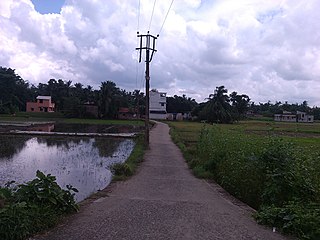
Jejur is a gram panchayat under Haripal block in Chandannagar subdivision of Hooghly district in the Indian state of West Bengal.

<span class="mw-page-title-main">Dhaniakhali (community development block)</span> Community development block in West Bengal, India

Dhaniakhali is a community development block that forms an administrative division in Chinsurah subdivision of Hooghly district in the Indian state of West Bengal. The place has lent its name to the tant (handloom) sari it produces.

<span class="mw-page-title-main">Chanditala II</span> Community development block in West Bengal, India

Chanditala II is a community development block that forms an administrative division in Srirampore subdivision of Hooghly district in the Indian state of West Bengal.

<span class="mw-page-title-main">Polba Dadpur</span> Community development block in West Bengal, India

Polba Dadpur is a community development block that forms an administrative division in Chinsurah subdivision of Hooghly district in the Indian state of West Bengal.

<span class="mw-page-title-main">Singur (community development block)</span> Community development block in West Bengal, India

Singur is a community development block that forms an administrative division in Chandannagore subdivision of Hooghly district in the Indian state of West Bengal.

<span class="mw-page-title-main">Sreerampur Uttarpara</span> Community development block in West Bengal, India

Sreerampur Uttarpara is a community development block that forms an administrative division in Srirampore subdivision of Hooghly district in the Indian state of West Bengal.

<span class="mw-page-title-main">Bally Jagachha</span> Community development block in West Bengal, India

Bally Jagachha is a community development block that forms an administrative division in Howrah Sadar subdivision of Howrah district in the Indian state of West Bengal.

<span class="mw-page-title-main">Jagatnagar</span> Census Town in West Bengal, India

Jagatnagar is a census town in Singur CD Block in Chandannagore subdivision of Hooghly district in the state of West Bengal, India.

Bajemelia is a village in Singur CD Block in Chandannagore subdivision of Hooghly district in the Indian state of West Bengal.

Gopalnagar is a village in Singur CD Block in Hooghly district in the state West Bengal, India.

Chhota Jagulia is a village and a gram panchayat in the Barasat I Block - 1 in the Barasat Sadar subdivision of the North 24 Parganas district in the state of West Bengal, India. It is around 7 km from Barasat.

Bargachhia is a census town of Nalikul Purba Gram Panchayat in Haripal CD Block in Chandannagore subdivision of Hooghly district in the Indian state of West Bengal.

Nasibpur is a census town in Singur CD Block in Chandannagore subdivision of Hooghly district in the Indian state of West Bengal.

Hanspukuria is a census town within the jurisdiction of the Maheshtala police station in the Thakurpukur Maheshtala CD block in the Alipore Sadar subdivision of the South 24 Parganas district in the Indian state of West Bengal.

References

  1. "C.D. Block Wise Primary Census Abstract Data(PCA)". 2011 census: West Bengal – District-wise CD Blocks. Registrar General and Census Commissioner, India. Retrieved 13 June 2016.
  2. "CENSUS DATA District Name: HUGLI(12) Block Name: Singur(0012)". West Bengal Govt. Retrieved 26 January 2009.[ permanent dead link ]
  3. "Untitled Page". Archived from the original on 11 December 2008. Retrieved 29 June 2009.