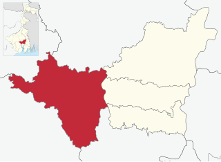
Khanakul I

Last updated
Khanakul I
Community development block
Khanakul-I in Hooghly (West Bengal).svg
Coordinates: 22°41′32″N87°51′23″E / 22.6921903°N 87.8564644°E / 22.6921903; 87.8564644
CountryFlag of India.svg  India
State West Bengal
District Hooghly
Government
  Type Representative democracy
Area
  Total171.92 km2 (66.38 sq mi)
Elevation
15 m (49 ft)
Population
 (2011)
  Total254,434
  Density1,500/km2 (3,800/sq mi)
Languages
  Official Bengali, English
Time zone UTC+5:30 (IST)
PIN
712406 (Khanakul)
712412 (Helan)
STD 03225
Vehicle registration WB-15, WB-16, WB-18
Literacy77.73%
Lok Sabha constituency Arambagh
Vidhan Sabha constituency Khanakul, Pursurah
Website hooghly.gov.in

Khanakul I is a community development block that forms an administrative division in Arambag subdivision of Hooghly district in the Indian state of West Bengal.

Contents

Overview

The Khanakul I CD Block is part of the Dwarakeswar-Damodar inter-riverine plain with alluvial soil. The Mundeswari flows through the region, carrying water from the Damodar and joins the Rupnarayan at the tri-junction of the Hooghly, Howrah and Purba Medinipur districts. [1] It is a flood prone area. [2] [3]

Geography

Map of Hooghly district showing CD blocks and municipal areas Map of hooghly district .jpg
Map of Hooghly district showing CD blocks and municipal areas

Khanakul I is located at 22°41′32″N87°51′23″E / 22.6921903°N 87.8564644°E / 22.6921903; 87.8564644 .

Khanakul-I CD block map sowing GP areas Khanakul-I CD Block.svg
Khanakul-I CD block map sowing GP areas

Khanakul I CD Block is bounded by Arambagh and Pursurah CD Blocks in the north, Udaynarayanpur CD Block, in Howrah district, in the east, Khanakul II CD Block in the south, Ghatal CD Block, in Paschim Medinipur district, in the west.

It is located 66 km from Chinsurah, the district headquarters.

Khanakul I CD Block has an area of 171.92 km2. It has 1 panchayat samity, 13 gram panchayats, 192 gram sansads (village councils), 94 mouzas and 93 inhabited villages. Khanakul police station serves this block. [4] Headquarters of this CD Block is at Khanakul. [5]

Raja Rammohan Roy, the great reformer, was born at Radhanagore on 14 August 1774. [6]

Gram panchayats of Khanakul I block/ panchayat samiti are: Arunda, Balipur, Khanakul I, Khanakul II, Kishorpur I, Kishorpur II, Pole I, Pole II, Rammohan I, Rammohan II, Tantisal, Thakuranichak, and Ghoshpur. [7]

Demographics

Population

As per the 2011 Census of India, Khanakul I CD Block had a total population of 254,434, all of which were rural. There were 130,712 (51%) males and 123,722 (49%) females. Population below 6 years was 29,925. Scheduled Castes numbered 73,310 (28.81%) and Scheduled Tribes numbered 764 (0.30%). [8]

As per the 2001 census, Khanakul I block had a total population of 221,832, out of which 112,183 were males and 109,649 were females. Khanakul I block registered a population growth of 13.00 per cent during the 1991-2001 decade. Decadal growth for Hooghly district was 15.72 per cent. [9] Decadal growth in West Bengal was 17.84 per cent. [10]

Large villages (with 4,000+ population) in Khanakul I CD Block are (2011 census figures in brackets): Mahisgot (4,414), Pilkhana (4,176), Ghoshpur (19,014), Paschim Thakurani Chak (5,514), Purbba Thakurani Chak (7,076), Kanchra (4,068), Mainan (5,623), Pol (11,038), Patul (5,474), Radhaballabhpur (5,168), Krishnanagar (4,767), Dainan Anantanagar (4,840), Tantisal (4,759), Balipur (8,254), Purbba Radhanagar (Radhanagore) (5,582) and Arunda (5,291). [8]

Other villages in Khanakul I CD Block include (2011 census figures in brackets): Khanakul (3,489), Paschim Radhanagar (2,417) and Langulpara (1,989). [8]

Literacy

As per the 2011 census the total number of literates in Khanakul I CD Block was 174,505 (77.73% of the population over 6 years) out of which males numbered 97,387 (84.41% of the male population over 6 years) and females numbered 77,118 (70.66% of the female population over 6 years). The gender disparity (the difference between female and male literacy rates) was 13.76%. [8]

As per the 2001 census, Khanakul I block had a total literacy of 51 per cent. While male literacy was 74.52 per cent, female literacy was 40.10 per cent. [11]

See also – List of West Bengal districts ranked by literacy rate

Literacy in CD Blocks of
Hooghly district
Arambagh subdivision
Arambagh – 79.10
Khanakul I – 77.73
Khanakul II – 79.16
Goghat I – 78.70
Goghat II – 77.24
Pursurah – 82.12
Chandannagar subdivision
Haripal – 78.59
Singur – 84.01
Tarakeswar – 79.96
Chinsurah subdivision
Balagarh – 76.94
Chinsurah Mogra – 83.01
Dhaniakhali – 75.66
Pandua – 75.86
Polba Dadpur – 75.14
Srirampore subdivision
Chanditala I – 83.76
Chanditala II – 84.78
Jangipara – 75.34
Sreerampur Uttarpara – 87.33
Source: 2011 Census: CD Block Wise
Primary Census Abstract Data

Language and religion

Religion in Khanakul I CD block (2011) [12]
Hinduism
75.96%
Islam
23.90%
Other or not stated
0.14%

As per the 2011 census, majority of the population of the district belong to the Hindu community with a population share of 82.9% followed by Muslims at 15.8%. The percentage of the Hindu population of the district has followed a decreasing trend from 87.1% in 1961 to 82.9% in the latest census 2011. On the other hand, the percentage of Muslim population has increased from 12.7% in 1961 to 15.8% in 2011 census. [13]

In 2011 census Hindus numbered 254,434 and formed 75.96% of the population in Khanakul I CD Block. Muslims numbered 60,813 and formed 23.90% of the population. Others numbered 352 and formed 0.14% of the population. [12]

Bengali is the predominant language, spoken by 99.94% of the population. [14]

Rural poverty

As per poverty estimates obtained from household survey for families living below poverty line in 2005, rural poverty in Khanakul I CD Block was 11.10%. [15]

Economy

Livelihood

Livelihood
in Khanakul I CD Block

  Cultivators (19.61%)
  Agricultural labourers (34.83%)
  Household industries (9.43%)
  Other Workers (36.14%)

In Khanakul I CD Block in 2011, amongst the class of total workers, cultivators formed 19.61%, agricultural labourers 34.83%, household industry workers 9.43% and other workers 36.14%. [16]

Infrastructure

There are 93 inhabited villages in Khanakul I CD Block. 100% villages have power supply. 54 villages have more than one source of drinking water (tap, well, tube well, hand pump), 24 villages have only tube well/ borewell and 12 villages have only hand pump. 13 villages have post offices, 11 villages have sub post offices and 1 villages has a post and telegraph office. 63 villages have landlines, 61 villages have public call offices and 74 villages have mobile phone coverage. 16 villages have pucca roads and 31 villages have bus service (public/ private). 24 villages have agricultural credit societies, 18 villages have commercial/ co-operative banks and 1 village has bank ATM. [17]

Important Handicrafts of Hooghly District
  • Zari Work on Sari - Pandua, Pursurah, Jangipara, Tarakeswar and other blocks - 3,000 families involved
  • Chikon Embroidery – Babnan, Pandua, Singur - 2,500 families involved
  • Silk and Cotton Printing – Serampore (Chanditala) - 300 families involved
  • Brass and Bell Metal – Manikpat, Goghat, Arambagh - 150 families involved
  • Conch Shell – Pandua, Khanakul, Makla, Chandannagar
  • Jute Diversified Product – Baidyabati, Mogra
  • Terracota – Chinsurah, Chandannagar, Baidyabati, Mogra

Source:District Human Development Report 2010: Hooghly P. 67

Agriculture

Some of the primary and other hats or markets in the Khanakul I CD Block are: Balpai, Bandipur hat, Dharampur market, Ghoshpara hat, Helan hat, Mayal hat, Polhat and Radhaballavpur hat. [18]

The Tebhaga movement launched in 1946, in 24 Parganas district, aimed at securing for the share-croppers a better position within the existing land relation structure. Although the subsequent Bargadari Act of 1950 recognised the rights of bargadars to a higher share of crops from the land that they tilled, it was not implemented fully. Large tracts, beyond the prescribed limit of land ceiling, remained with the rich landlords. From 1977 onwards major land reforms took place in West Bengal. Land in excess of land ceiling was acquired and distributed amongst the peasants. [19] Following land reforms land ownership pattern has undergone transformation. In 2013–14, persons engaged in agriculture in Khanakul CD Block could be classified as follows: bargadars 16.68%, patta (document) holders 2.75%, small farmers (possessing land between 1 and 2 hectares) 3.06%, marginal farmers (possessing land up to 1 hectare) 36.94% and agricultural labourers 40.57%. [16]

Khanakul I CD Block had 89 fertiliser depots, 33 seed stores and 70 fair price shops in 2013–14. [16]

In 2013–14, Khanakul I CD Block produced 3,263 tonnes of Aman paddy, the main winter crop from 1,513 hectares, 17,805 tonnes of Boro paddy (spring crop) from 6,389 hectares, 6,025 tonnes of Aus paddy (summer crop) from 2,544 hectares, 24 tonnes wheat from 10 hectares, 55,380 tonnes of jute from 2,600 hectares and 187,352 tonnes of potatoes from 11,426 hectares. It also produced oilseeds. [16]

In 2013–14, the total area irrigated in Khanakul I CD Block was 12,283 hectares, out of which 2,500 hectares were irrigated by canal water, 1,500 hectares by tank water, 2,210 hectares by river lift irrigation, 1,290 hectares by deep tube wells and 4,783 hectares by shallow tube wells. [16]

Banking

In 2013–14, Khanakul I CD Block had offices of 10 commercial banks and 1 gramin bank. [16]

Transport

Khanakul I CD Block has 14 ferry services and 7 originating/ terminating bus routes. The nearest railway station is 20 km from CD Block headquarters. [16]

Education

In 2013–14, Khanakul I CD Block had 175 primary schools with 16,735 students, 17 middle schools with 2,655 students, 13 high schools with 7,988 students and 14 higher secondary schools with 18,570 students. Khanakul I CD Block had 1 general colleges with 2,485 students, 1 technical/ professional institution with 91 students and 358 institutions for special and non-formal education with 11,498 students [16]

Raja Rammohan Roy Mahavidyalaya, a general degree college, was established at Radhanagore in 1964. [20]

In Khanakul I CD Block, amongst the 93 inhabited villages, only 1 village had no school, 65 villages had more than 1 primary school, 47 villages had at least 1 primary school, 45 villages had at least 1 primary and 1 middle school and 28 villages had at least 1 middle and 1 secondary school. [17]

Healthcare

In 2014, Khanakul I CD Block had 1 rural hospital, 3 primary health centre and 4 private nursing homes with total 95 beds and 5 doctors (excluding private bodies). It had 40 family welfare subcentres. 25,279 patients were treated indoor and 251,364 patients were treated outdoor in the hospitals, health centres and subcentres of the CD Block. [16]

Khanakul I CD Block has Khanakul Rural Hospital (with 60 beds) at Khanakul, Ghoshpur Primary Health Centre at PO Pilkhan (with 10 beds), Tantisal PHC (with 10 beds) and Harimohan Golap Sundari PHC at PO Raghunathpur (with 4 beds). [21]

Khanakul I CD Block is one of the areas of Hooghly district where ground water is affected by high level of arsenic contamination. The WHO guideline for arsenic in drinking water is 10 mg/ litre, and the Indian Standard value is 50 mg/ litre. In Hooghly district, 16 blocks have arsenic levels above WHO guidelines and 11 blocks above Indian standard value. The maximum concentration in Khanakul I CD Block is 390 mg/litre. [22]

External videos
Nuvola apps kaboodle.svg Wooden bridge across the Mundeswari
Nuvola apps kaboodle.svg Floods in Khanakul I CD Block

Related Research Articles

Arambagh also known as Arambag is a town and a municipality in Hooghly district in the state of West Bengal, India. It is the headquarters of Arambagh subdivision.

Radhanagore in the khanakul Town Arambagh subdivision of the Hooghly District of West Bengal, India. It is the birthplace of Raja Rammohun Roy. Located near Khanakul, it is approachable from Tarakeswar or Arambag. Mundeswari river flows nearby.

<span class="mw-page-title-main">Balagarh (community development block)</span> Community Development Block in West Bengal, India

Balagarh is a Community Development Block, located in Jirat, West Bengal, India, that forms an administrative division in Chinsurah Subdivision of Hooghly in the Indian state of West Bengal

<span class="mw-page-title-main">Arambag subdivision</span> Subdivision in West Bengal, India

Arambag subdivision is an administrative subdivision of the Hooghly district in the Indian state of West Bengal.

<span class="mw-page-title-main">Haripal (community development block)</span> Community development block in West Bengal, India

Haripal is a community development block that forms an administrative division in Chandannagore subdivision of Hooghly district in the Indian state of West Bengal.

<span class="mw-page-title-main">Goghat I</span> Community development block in West Bengal, India

Goghat I is a community development block that forms an administrative division in Arambag subdivision of Hooghly district in the Indian state of West Bengal.

<span class="mw-page-title-main">Pursurah (community development block)</span> Community development block in West Bengal, India

Pursurah is a community development block that forms an administrative division in Arambag subdivision of Hooghly district in the Indian state of West Bengal.

<span class="mw-page-title-main">Dhaniakhali (community development block)</span> Community development block in West Bengal, India

Dhaniakhali is a community development block that forms an administrative division in Chinsurah subdivision of Hooghly district in the Indian state of West Bengal. The place has lent its name to the tant (handloom) sari it produces.

<span class="mw-page-title-main">Chanditala II</span> Community development block in West Bengal, India

Chanditala II is a community development block that forms an administrative division in Srirampore subdivision of Hooghly district in the Indian state of West Bengal.

<span class="mw-page-title-main">Jangipara (community development block)</span> Community development block in West Bengal, India

Jangipara is a community development block that forms an administrative division in Srirampore subdivision of Hooghly district in the Indian state of West Bengal.

<span class="mw-page-title-main">Polba Dadpur</span> Community development block in West Bengal, India

Polba Dadpur is a community development block that forms an administrative division in Chinsurah subdivision of Hooghly district in the Indian state of West Bengal.

<span class="mw-page-title-main">Arambagh (community development block)</span> Community development block in West Bengal, India

Arambagh is a community development block that forms an administrative division in Arambag subdivision of Hooghly district in the Indian state of West Bengal.

<span class="mw-page-title-main">Khanakul II</span> Community development block in West Bengal, India

Khanakul II is a community development block that forms an administrative division in Arambag subdivision of Hooghly district in the Indian state of West Bengal.

<span class="mw-page-title-main">Goghat II</span> Community development block in West Bengal, India

Goghat II is a community development block that forms an administrative division in Arambag subdivision of Hooghly district in the Indian state of West Bengal.

<span class="mw-page-title-main">Singur (community development block)</span> Community development block in West Bengal, India

Singur is a community development block that forms an administrative division in Chandannagore subdivision of Hooghly district in the Indian state of West Bengal.

<span class="mw-page-title-main">Tarakeswar (community development block)</span> Community development block in West Bengal, India

Tarakeshwar is a panchayat samiti in Chandannagore subdivision of Hooghly district in the Indian state of West Bengal.

<span class="mw-page-title-main">Chinsurah Mogra</span> Community development block in West Bengal, India

Chinsurah Mogra is a community development block that forms an administrative division in Chinsurah subdivision of Hooghly district in the Indian state of West Bengal.

<span class="mw-page-title-main">Pandua (community development block)</span> Community development block in West Bengal, India

Pandua is a community development block that forms an administrative division in Chinsurah subdivision of Hooghly district in the Indian state of West Bengal.

<span class="mw-page-title-main">Chanditala I</span> Community development block in West Bengal, India

Chanditala I is a community development block that forms an administrative division in Srirampore subdivision of Hooghly district in the Indian state of West Bengal.

<span class="mw-page-title-main">Sreerampur Uttarpara</span> Community development block in West Bengal, India

Sreerampur Uttarpara is a community development block that forms an administrative division in Srirampore subdivision of Hooghly district in the Indian state of West Bengal.

References

  1. "District Census Handbook: Hugli, Series-20, Part XIIA" (PDF). Physiography, Page 17-24. Directorate of Census Operations, West Bengal, 2011. Retrieved 15 June 2017.
  2. "Identification of areas vulnerable to floods and water logging". Hooghly district administration. Retrieved 15 June 2017.
  3. "Bengal floods: 50 killed, lakhs left homeless". Kolkata. The Times of India, 3 August 2015. Retrieved 15 June 2017.
  4. "District Statistical Handbook 2014 Hooghly". Tables 2.1, 2.2. Department of Statistics and Programme Implementation, Government of West Bengal. Retrieved 15 October 2018.
  5. "District Census Handbook: Hugli, Series-20, Part XIIA" (PDF). Map of Hooghly district with CD Block HQs and Police Stations (on the fifth page). Directorate of Census Operations, West Bengal, 2011. Retrieved 1 June 2017.
  6. "Raja Ram Mohan Roy". Cultural India. Retrieved 15 June 2017.
  7. "Directory of District, Subdivision, Panchayat Samiti/ Block and Gram Panchayats in West Bengal". Hooghly – Revised in March 2008. Panchayats and Rural Development Department, Government of West Bengal. Retrieved 16 May 2016.
  8. 1 2 3 4 "C.D. Block Wise Primary Census Abstract Data(PCA)". 2011 census: West Bengal – District-wise CD Blocks. Registrar General and Census Commissioner, India. Retrieved 26 May 2016.
  9. "Provisional Population Totals, West Bengal. Table 4". Census of India 2001 – Hooghly district. Census Commission of India. Archived from the original on September 28, 2011. Retrieved 2011-01-20.
  10. "Provisional Population Totals, West Bengal. Table 4". Census of India 2001. Census Commission of India. Archived from the original on September 27, 2007. Retrieved 2011-01-20.
  11. "Khanakul I". Local Self-government. Hooghly Zilla Parishad. Retrieved 2011-08-04.
  12. 1 2 "Table C-01 Population by Religion: West Bengal". censusindia.gov.in. Registrar General and Census Commissioner of India. 2011.
  13. "District Census Handbook: Hugli, Series-20, Part XIIA" (PDF). Religion, Mother-tongue Pages 50-51. Directorate of Census Operations, West Bengal, 2011. Retrieved 1 June 2017.
  14. "Table C-16 Population by Mother Tongue: West Bengal". www.censusindia.gov.in. Registrar General and Census Commissioner of India.
  15. "District Human Development Report: Hooghly" (PDF). Table 2.38: Empirical Measurement of Rural Poverty in Hooghly 2005, page 89. Development and Planning Department, Government of West Bengal, 2011. Archived from the original (PDF) on 7 August 2017. Retrieved 14 June 2017.
  16. 1 2 3 4 5 6 7 8 9 "District Statistical Handbook 2014 Hooghly". Tables 2.7, 17.2, 16.1, 18.1, 18.2, 20.1, 21.2, 4.4, 3.1, 3.3 – arranged as per use. Department of Statistics and Programme Implementation, Government of West Bengal. Retrieved 15 October 2018.
  17. 1 2 "District Census Handbook: Hugli, Series-20, Part XIIA" (PDF). Appendices to Village Directory, 2009, Pages 775-779. Directorate of Census Operations, West Bengal, 2011. Retrieved 1 June 2017.
  18. "Primary Hats/Markets of District". Hooghly. West Bengal State Marketing Board. Archived from the original on 2009-07-07. Retrieved 2009-01-29.
  19. "District Human Development Report: South 24 Parganas". (1) Chapter 1.2, South 24 Parganas in Historical Perspective, pages 7-9 (2) Chapter 3.4, Land reforms, pages 32-33. Development & Planning Department, Government of West Bengal, 2009. Archived from the original on 5 October 2016. Retrieved 7 August 2016.
  20. "Raja Rammohan Roy Mahavidyalaya". RRRM. Retrieved 30 June 2017.
  21. "Health & Family Welfare Department". Health Statistics. Government of West Bengal. Retrieved 15 July 2017.
  22. "Groundwater Arsenic contamination in West Bengal-India (20 years study )". Hugli. SOES. Archived from the original on 24 May 2017. Retrieved 13 June 2017.