Nadia district is mostly alluvial plains lying to the east of Hooghly River, locally known as Bhagirathi. The alluvial plains are cut across by such distributaries as Jalangi, Churni and Ichhamati. With these rivers getting silted up, floods are a recurring feature.[2]
Chakdaha CD Block has an area of 288.80km2. It has 1 panchayat samity, 10 gram panchayats, 307 gram sansads (village councils), 158 mouzas and 137 inhabited villages. Chakdaha police station serves this block.[3] Headquarters of this CD Block is at Chakdaha.[4]
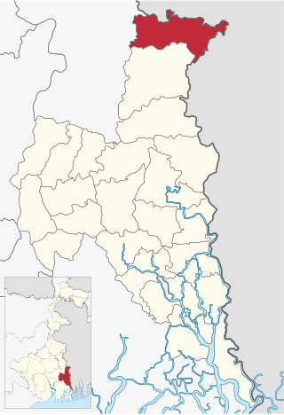
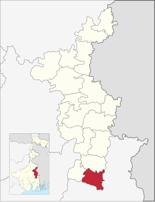
Map of Chakdah block before 2018
Gram panchayats of Chakdaha block/ panchayat samiti are: Chanduria I, Dewli, Dubra, Ghetugachhi, Hingnara, Silinda I, Silinda II, Tatla I, Tatla II and Rautari.[5]
Demographics
Population
As per the 2011 Census of India, Chakdaha CD Block had a total population of 405,719, of which 314,383 were rural and 91,336 were urban. There were 209,513 (52%) males and 196,206 (48%) females. Population below 6 years was 38,434. Scheduled Castes numbered 185,933 (45.83%) and Scheduled Tribes numbered 21,609 (5.33%).[6]
As per the 2001 census, Chakdaha block had a total population 362,739, out of which 187,025 were males and 175,714 were females. Chakdaha block registered a population growth of 19.52 per cent during the 1991-2001 decade. Decadal growth for the district was 19.51 per cent. Decadal growth in West Bengal was 17.84 per cent.[7][8]
Large villages (with 4,000+ population) in Chakdaha CD Block are (2011 census figures in brackets): Balagari Char (5,305), Manaspota (4,544), Sikarpur (4,770), Alaipur (13,754), Rautari (6,563), Chaugachha (8,603), Purba Bishnupur (5,191), Dubra (5,285), Balia (6,014), Balarampur (4,606), Hariankha (6,585), Srinagar (10,483), Muratipur (P) (5,208), Char Kachrapara (4,491), Silinda (7,741) and Chand Mari (P), (8,475).[6]
Other villages in Chakdaha CD Block include (2011 census figures in brackets): Ghetugachhi (2,230), Chuadanga (1,764), Hingnara (1,687) and Sarati (3,284).[6]
Literacy
As per the 2011 census, the total number of literates in Chakdah CD Block was 293,946 (80.03% of the population over 6 years) out of which males numbered 161,564 (85.14% of the male population over 6 years) and females numbered 132,382 (74.57% of the female population over 6 years). The gender disparity (the difference between female and male literacy rates) was 10.57%.[6]
In the 2011 census, Hindus numbered 339,415 and formed 83.66% of the population in Chakdaha CD Block. Muslims numbered 59,451 and formed 14.65% of the population. Christians numbered 1,657 and formed 0.41% of the population. Others numbered 5,196 and formed 1.28% of the population.[9]
In the 2001 census, Hindus numbered 306,028 and formed 84.31% of the population of Chakdaha CD Block. Muslims numbered 51,790 and formed 14.27% of the population. In the 1991 census, Hindus numbered 257,794 and formed 84.94% of the population of Chakdaha CD Block. Muslims numbered 44,514 and formed 14.67% of the population.[10]
At the time of the 2011 census, 95.59% of the population spoke Bengali, 1.41% Sadri and 1.20% Hindi as their first language.[11]
Rural poverty
The District Human Development Report for Nadia has provided a CD Block-wise data table for Modified Human Vulnerability Index of the district. Chakdaha CD Block registered 32.60 on the MHPI scale. The CD Block-wise mean MHVI was estimated at 33.92. A total of 8 out of the 17 CD Blocks in Nadia district were found to be severely deprived when measured against the CD Block mean MHVI - Karimpur I and Karimpur II (under Tehatta subdivision), Kaliganj, Nakashipara, Chapra, Krishnanagar I and Nabadwip (under Krishnanagar Sadar subdivision) and Santipur (under Ranaghat subdivision) appear to be backward.[12]
As per the Human Development Report 2004 for West Bengal, the rural poverty ratio in Nadia district was 28.35%. The estimate was based on Central Sample data of NSS 55th round 1999–2000.[13]
Economy
Livelihood
In Chakdaha CD Block in 2011, amongst the class of total workers, cultivators formed 16.64%, agricultural labourers 29.49, household industry workers 4.24% and other workers 49.63%.[14]
The southern part of Nadia district starting from Krishnanagar I down to Chakdaha and Haringhata has some urban pockets specialising in either manufacturing or service related economic activity and has reflected a comparatively higher concentration of population but the urban population has generally stagnated. Nadia district still has a large chunk of people living in the rural areas.[15]
Infrastructure
There are 137 inhabited villages in Chakdaha CD Block. 100% villages have power supply and 136 villages (99.27%) have drinking water supply. 26 Villages (18.98%) have post offices. 119 villages (86.86%) have telephones (including landlines, public call offices and mobile phones). 67 villages (48.91%) have a pucca approach road and 53 villages (38.69%) have transport communication (includes bus service, rail facility and navigable waterways). 19 villages (13.87%) have agricultural credit societies and 16 villages (11.68%) have banks.[16] It should, however, be noted that although 100% villages in Nadia district had power supply in 2011, a survey in 2007-08 revealed that less than 50% of households had electricity connection. In rural areas of the country, the tube well was for many years considered to be the provider of safe drinking water, but with arsenic contamination of ground water claiming public attention it is no longer so. Piped water supply is still a distant dream. In 2007–08, the availability of piped drinking water in Nadia district was as low as 8.6%, well below the state average of around 20%.[17]
Agriculture
Persons engaged in agriculture in Chakdaha CD Block
Bargadars (2.70%)
Patta holders (10.54%)
Small farmers (5.64%)
Marginal farmers (26.68%)
Agricultural labourers (54.44%)
Although the Bargadari Act of 1950 recognised the rights of bargadars to a higher share of crops from the land that they tilled, it was not implemented fully. Large tracts, beyond the prescribed limit of land ceiling, remained with the rich landlords. From 1977 onwards major land reforms took place in West Bengal. Land in excess of land ceiling was acquired and distributed amongst the peasants.[18] Following land reforms land ownership pattern has undergone transformation. In 2013–14, persons engaged in agriculture in Chakdaha CD Block could be classified as follows: bargadars 2.70%, patta (document) holders 10.54%, small farmers (possessing land between 1 and 2 hectares) 5.64%, marginal farmers (possessing land up to 1 hectare) 26.68% and agricultural labourers 54.44%.[14] As the proportion of agricultural labourers is very high, the real wage in the agricultural sector has been a matter of concern.[19]
Chakdaha CD Block had 220 fertiliser depots and 87 fair price shops in 2013–14.[14]
In 2013–14, Chakdaha CD Block produced 3,181 tonnes of Aman paddy, the main winter crop from 1,297 hectares, 51,745 tonnes of Boro paddy (spring crop) from 12,934 hectares, 2,226 tonnes of Aus paddy (summer crop) from 811 hectares, 789 tonnes of wheat from 316 hectares, 121,652 tonnes of jute from 6,644 hectares, 1,155 tonnes of potatoes from 42 hectares and 301 tonnes of sugar cane from 3 hectares. It also produced pulses and oilseeds.[14]
In 2013–14, the total area irrigated in Chakdaha CD Block was 1,745 hectares, out of which 102 hectares were irrigated by river lift irrigation and 643 hectares by deep tube wells.[14]
Banking
In 2013–14, Chakdaha CD Block had offices of 7 commercial banks and 5 gramin banks.[14]
Transport
Chakdaha CD Block has 2 ferry services and 5 originating/ terminating bus services.[14]
NH 12 (old number NH 34) passes through this block.[20]
SH 1, running from Bangaon (in North 24 Parganas district) to Kulpi (in South 24 Parganas district) passes through this CD Block.[21]
Education
In 2013–14, Chakdaha CD Block had 222 primary schools with 16,609 students, 14 middle schools with 1,407 students, 9 high schools with 4,495 students and 39 higher secondary schools with 39,805 students. Chakdaha CD Block had 6 technical/ professional institutions with 754 students and 705 institutions for special and non-formal education with 11,316 students[14]
In Chakdaha CD Block, amongst the 170 inhabited villages, 5 villages did not have any school, 62 had more than 1 primary school, 46 had at least 1 primary and one middle school and 30 had 1 middle school and 1 secondary school.[22]
Healthcare
In 2014, Chakdaha CD Block had 4 primary health centres and with total 10 beds and 16 doctors (excluding private bodies, but including Chakdaha municipal area). It had 40 family welfare subcentres. 210,669 patients were treated outdoor in the hospitals, health centres and subcentres of the CD Block.[14]
Chaugacha Block Primary Health Centre, with 10 beds at Chaugacha, is the major government medical facility in the Chakdaha CD block. There are primary health centres at Moshra (with 6 beds) and Srinagar (with 10 beds), Sutargachhi (6 beds).[23][24]
Chakdah State General Hospital at Chakdaha functions with 100 beds.,[25]
Chakdaha CD Block is one of the areas of Nadia district where ground water is affected by high level of arsenic contamination. The WHO guideline for arsenic in drinking water is 10mg/ litre, and the Indian Standard value is 50mg/ litre. All the 17 blocks of Nadia district have arsenic contamination above this level. The maximum concentration in Chakdaha CD Block is 890mg/litre.[26]
Related Research Articles
Hanskhali is a community development block that forms an administrative division in Ranaghat subdivision of Nadia district in the Indian state of West Bengal.
Bagdah is a community development block that forms an administrative division in Bangaon subdivision of North 24 Parganas district in the Indian state of West Bengal.
Gaighata is a community development block that forms an administrative division in Bangaon subdivision of North 24 Parganas district in the Indian state of West Bengal.
Chapra is a community development block that forms an administrative division in Krishnanagar Sadar subdivision of Nadia district in the Indian state of West Bengal.
Nakashipara is a community development block that forms an administrative division in Krishnanagar Sadar subdivision of Nadia district in the Indian state of West Bengal.
Tehatta II is a community development block that forms an administrative division in Tehatta subdivision of Nadia district in the Indian state of West Bengal.
Krishnaganj is a community development block that forms an administrative division in Krishnanagar Sadar subdivision of Nadia district in the Indian state of West Bengal.
Kaliganj is a community development block that forms an administrative division in Krishnanagar Sadar subdivision of Nadia district in the Indian state of West Bengal.
Habra II is a community development block that forms an administrative division in Barasat Sadar subdivision of North 24 Parganas district in the Indian state of West Bengal.
Bangaon is a community development block that forms an administrative division in Bangaon subdivision of North 24 Parganas district in the Indian state of West Bengal.
Krishnanagar I is a community development block that forms an administrative division in Krishnanagar Sadar subdivision of Nadia district in the Indian state of West Bengal.
Krishnanagar II is a community development block that forms an administrative division in Krishnanagar Sadar subdivision of Nadia district in the Indian state of West Bengal.
Nabadwip is a community development block that forms an administrative division in Krishnanagar Sadar subdivision of Nadia district in the Indian state of West Bengal.
Santipur is a community development block that forms an administrative division in Ranaghat subdivision of Nadia district in the Indian state of West Bengal.
Ranaghat I is a community development block that forms an administrative division in Ranaghat subdivision of Nadia district in the Indian state of West Bengal.
Ranaghat II is a community development block that forms an administrative division in Ranaghat subdivision of Nadia district in the Indian state of West Bengal.
Karimpur I is a community development block that forms an administrative division in Tehatta subdivision of Nadia district in the Indian state of West Bengal.
Karimpur II is a community development block that forms an administrative division in Tehatta subdivision of Nadia district in the Indian state of West Bengal.
Tehatta I is a community development block that forms an administrative division in Tehatta subdivision of Nadia district in the Indian state of West Bengal.
Haringhata is a community development block that forms an administrative division in Kalyani subdivision of Nadia district in the Indian state of West Bengal.
↑ "District Statistical Handbook 2014 Nadia". Table 17.1. Department of Statistics and Programme Implementation, Government of West Bengal. Archived from the original on 2017-03-02. Retrieved 2 May 2017.{{cite web}}: CS1 maint: unfit URL (link)
↑ "West Bengal Human Development Report 2004"(PDF). Page 80: Table 4.5 Per capita consumption in rural and urban areas by district. Development and Planning Department, Government of West Bengal. Archived from the original(PDF) on 1 May 2012. Retrieved 20 November 2018.
↑ "District Human Development Report: Nadia"(PDF). Chapter IV: Livelihood and occupational structure, pages 63-73. Development and Planning Department, Government of West Bengal, 2011. Archived from the original(PDF) on 16 March 2016. Retrieved 6 May 2017.
↑ "District Human Development Report, Nadia"(PDF). Pages 54-55, published in 2012, Infrastructure development across the district. Department of Planning, Government of West Bengal. Archived from the original(PDF) on 16 March 2016. Retrieved 4 May 2017.
↑ "District Human Development Report: South 24 Parganas". (1) Chapter 1.2, South 24 Parganas in Historical Perspective, pages 7-9 (2) Chapter 3.4, Land reforms, pages 32-33. Development & Planning Department, Government of West Bengal, 2009. Archived from the original on 2016-10-05. Retrieved 7 August 2016.
↑ "District Human Development Report, Nadia"(PDF). Pages 71-72, published in 2012, Infrastructure development across the district. Department of Planning, Government of West Bengal. Archived from the original(PDF) on 16 March 2016. Retrieved 4 May 2017.
↑ "District Census Handbook, Nadia, 2011, Series 20, Part XII A"(PDF). Page 591, Appendix I A: Villages by number of Primary Schools and Appendix I B: Villages by Primary, Middle and Secondary Schools, 2011. Directorate of Census Operations, West Bengal. Retrieved 4 May 2017.
This page is based on this Wikipedia article Text is available under the CC BY-SA 4.0 license; additional terms may apply. Images, videos and audio are available under their respective licenses.